Search the Special Collections and Archives Portal
Search Results
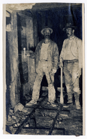
Photograph of two men standing on ore car rails inside a mine, Goldfield (Nev.), 1907
Date
1907
Archival Collection
Description
Photograph of two men standing on ore car rails inside a mine, Goldfield (Nev.), 1907
Image
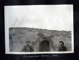
Photograph of Sam Bradburn and J. O'Brien standing at the opening of the Yellowjacket tunnel, Pioneer (Nev.), 1909
Date
1909
Archival Collection
Description
Annotated "Sam. H. Bradbury" [left] and "J. D. O'Brien" [right]
Caption: Yellowjacket Tunnel. 1909.
Caption: Yellowjacket Tunnel. 1909.
Image
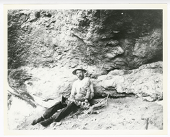
Photograph of O. K. Reed and his son Little O. K. near his claim at Gold Reed, Tonopah (Nev.), 1920
Date
1920
Archival Collection
Description
Photograph of O. K. Reed and his son Little O. K. near his claim at Gold Reed, Tonopah (Nev.), 1920
Image
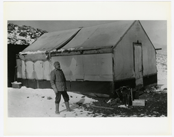
Photograph of Don Finley at Josiah Crowel's Chloride Cliff camp in winter, Beatty (Nev.), 1915
Date
1915
Archival Collection
Description
Photograph of Don Finley at Josiah Crowel's Chloride Cliff camp in winter, Beatty (Nev.), 1915
Image
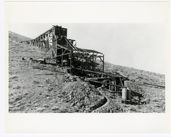
Photograph of Josiah Irving Crowell's mill at the Chloride Cliff Mine (Nev.), 1915
Date
1915
Archival Collection
Description
Photograph of Josiah Irving Crowell's mill at the Chloride Cliff Mine (Nev.), 1915
Image

Photograph of a man working outside the Dividend Mining Company mill, Tonopah Dividend Mine (Nev.), 1916
Date
1916
Archival Collection
Description
Inscription on back reads: "This picture shows the head of our 2V-HP engine which operated the mill and compressor"
Image

Photograph of a double handed drilling contest, Tonopah (Nev.), July 26, 1904
Date
1906-07-26
Archival Collection
Description
Caption: Drilling contest. Tonopah R.R. Carnival. Tonopah July 26 1904
Image
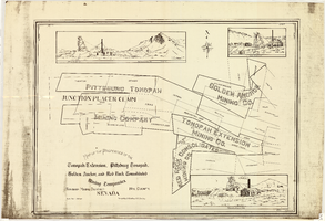
Map of the properties of the Tonopah Extension, Pittsburg Tonopah, Golden Anchor, and Red Rock Consolidated Mining Companies : Tonopah Mining District, Nye County (Nev.), 1901
Date
1901
Description
Scale [ca. 1:2,400] 1 in. to 200 feet ; 1 map ; 75 x 102 cm; Includes locations of mines and their main shafts and drawings of the hoists of the Tonopah Extension, Golden Anchor and the Red Rock Consolidated ; Photocopy. [United States : s.n., 198-?]
Image
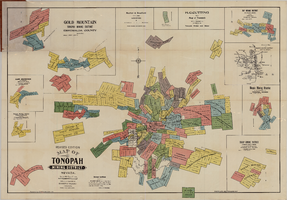
Map of the Tonopah Mining District, Tonopah (Nev.), 1903
Date
1903
Description
Rev. ed. ; Scale [ca. 1:10,800]. 1 inch to 900 feet ; 1 map : col. ; 76 x 102 cm., folded in cover to 21 x 11 cm ; Relief shown by hachures ; Cover title: Map of Tonopah, Gold Mountain and other adjacent mining districts, Nye and Esmeralda Counties ; Insets: Ray Mining District, vicinity map of Tonopah Mining District, Utopia Mining District, Tokop Mining District, Weepah Mining District, East Klondike Mining District, Gold Mountain, Tonopah Mining District and Red Mountain ; "Photo-lith. Britton & Rey, S.F." ; Includes advertisements
Image
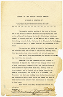
Minutes of the regular monthly meeting of the Board of Directors of Goldfield Belmont Extension Mining Company, August 12, 1912
Date
1912-08-12
Archival Collection
Description
Minutes of the regular monthly meeting of the Board of Directors of Goldfield Belmont Extension Mining Company, August 12, 1912
Text
Pagination
Refine my results
Content Type
Creator or Contributor
Subject
Archival Collection
Digital Project
Resource Type
Material Type
Place
Language
Records Classification
