Search Results
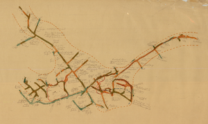
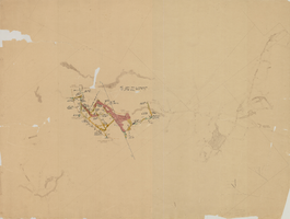
Map of the Combination Mine, 328 ft., Nye County (Nev.), 1900-1925
Date
1900 to 1925
Description
Sectional mining map; hand-drawn and annotated in colored pencil
Image
Map of the Combination Mine, 130 ft., Nye County (Nev.), 1900-1925
Date
1900 to 1925
Description
Sectional mining map; hand-drawn and annotated in colored pencil
Image
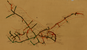
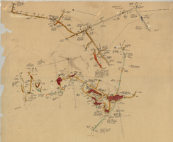
Map of the Combination Mine, 330 ft., Nye County (Nev.), 1900-1925
Date
1900 to 1925
Description
Sectional mining map; hand-drawn and annotated in colored pencil
Image
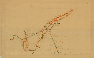
Map of the Locke Mine, 380 ft., Nye County (Nev.), 1900-1925
Date
1900 to 1925
Description
Sectional mining map; hand-drawn and annotated in colored pencil
Image
Map of the Combination Mine, 280 ft., Esmeralda County (Nev.), 1900-1925
Date
1900 to 1925
Description
Sectional mining map; hand-drawn and annotated in colored pencil
Image
Map of the Clermont Mine, 600 ft., Nye County (Nev.), 1900-1925
Date
1900 to 1925
Description
Sectional mining map; hand-drawn and annotated in colored pencil
Image
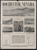
Newspaper clipping, Rochester Hills Mining Company Advertisement, Rohester (Nev.), 1900-1925
Date
1900 to 1925
Description
Caption: Rochester, Nevada
Text
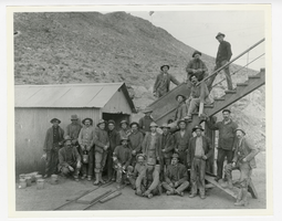
Photograph of mine workers at the Indian Mine, Round Mountain (Nev.), 1900-1925
Archival Collection
Description
Group of men pose at the Indian Mine
Image
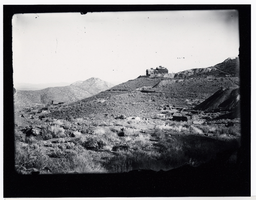
Photograph of the Burke Mine tunnel area and store atop a hill, Pioche (Nev.), 1900-1925
Date
1900 to 1925
Archival Collection
Description
View of Burke Tunnel area-building at top of hill was store for Burke tunnel. #93 on left, some buildings on left remain, 1982. Photo 1900-1910. Pioche, Nev. ID by Vic Cottino/Jerome Sears July 1982
Image
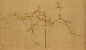
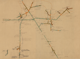
Map of the Mohawk Mine, 3rd level, Esmeralda County (Nev.), 1900-1925
Date
1900 to 1925
Description
Sectional mining map; hand-drawn and annotated in colored pencil
Image