Search Results
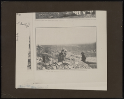
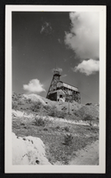
Top of the original Bullfrog Mine in Sunset Magazine: ephemera
Date
1905-08
Description
From the Nan Doughty Photograph Collection (PH-00240). Amargosa visible in the distance.
Image
Photograph of mining in Arizona, circa 1930s
Date
1930 to 1939
Archival Collection
Description
Mining in Arizona.
Image
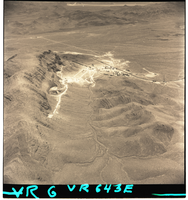
Film negatives of aerial views of a strip mining operation in the Las Vegas region, August 21, 1956
Date
1956-08-21
Description
Series of two black and white negative aerial views of a strip mining operation in the Las Vegas region, dated August 21, 1956.
Image
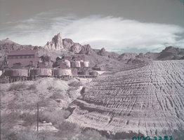
Film transparency of buildings at mines in Kingman, Arizona, circa late 1940s
Date
1945 to 1949
Archival Collection
Description
An image of buildings next to mines in Kingman.
Image
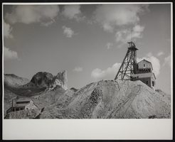
Photograph of mining building and headframe, Kingman, Arizona circa 1940s-1950s
Date
1940 to 1959
Archival Collection
Description
An image of a mining operation in Kingman.
Image
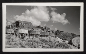
Photograph of mining buildings and headframe, Kingman, Arizona, circa 1940s-1950s
Date
1940 to 1959
Archival Collection
Description
An image of a mining operation in Kingman.
Image
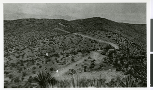
Picture of a mining operation at an unidentified location, circa mid 1900s
Date
1930 to 1959
Archival Collection
Description
An image of a mining operation at an unidentified location, possibly within the southwestern region of the United States.
Image

Mine entrance with rock face, image 002 of 002: photographic film
Date
1878 to 1954
Archival Collection
Description
Entrance to a mine, location unknown. Close-up view of rock that looks like the profile of a face.
Image
Giles and miners holding pickaxes: photographic film
Date
1878 to 1954
Archival Collection
Description
Edwin S. Giles stands with two unidentified miners. They hold pickaxes and what appears to be rocks or mineral deposits.
Image
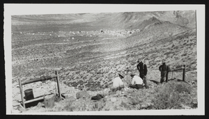
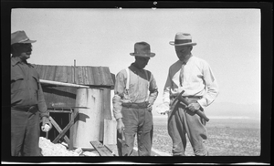
Four men outside a mine: photographic print
Date
1905 (year uncertain)
Archival Collection
Description
On a Rhyolite trip, the Jackson party inspects a prospect on Bonanza Mountain, early 1905. The Bullfrog Mine can be seen in the distance.
Image