Search Results
Minutes of the regular monthly meeting of the Board of Directors of Goldfield Belmont Extension Mining Company, April 8, 1912
Date
1912-04-08
Archival Collection
Description
Minutes of the regular monthly meeting of the Board of Directors of Goldfield Belmont Extension Mining Company, April 8, 1912
Text
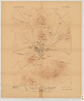
Map of the Tonopah Mining District, Tonopah (Nev.), 1910
Date
1910
Description
Ed. of Mar. 1904, reprinted Apr. 1910 ; Scale 1:12,000 (W 117 14'--W 117 12'/N 38 05'--N 38 03') ; 1 map : col. ; 41 x 31 cm ; Oriented with north toward the upper left ; Relief shown by contours and hachures ; Topography by W.J. Peters ; "Surveyed in 1902-1903." ; "Triangulation by U.S. Coast and Geodetic Survey." ;
Image
Report of the Diamond Valley Gold Mining Company, January 14, 1915
Date
1915-01-14
Archival Collection
Description
Report of the Diamond Valley Gold Mining Company, January 14, 1915
Text
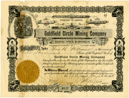
Certificate, Goldfield Circle Mining Company, March 17, 1906
Date
1906-03-17
Archival Collection
Description
Certificate, Goldfield Circle Mining Company, March 17, 1906
Image

Certificate, Goldfield American Mining Company, November 27, 1906
Date
1906-11-27
Archival Collection
Description
Certificate, Goldfield American Mining Company, November 27, 1906
Image
Mallory H. Ferrell Photograph Collection
Identifier
PH-00305
Abstract
The Mallory H. Ferrell Photograph Collection (approximately 1900-1935) is comprised of nine black-and-white photographic prints depicting railroads, locomotives, and mines in Tonopah, Nevada and Tecopa, California.
Archival Collection

Report on the property of Goldfield Belmont Extension Mining Company, January 28, 1915
Date
1915-01-28
Archival Collection
Description
Report on the property of Goldfield Belmont Extension Mining Company, January 28, 1915
Text
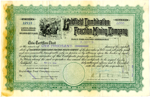
Certificate, Goldfield Combination Fraction Mining Company, November 24, 1914
Date
1914-11-24
Archival Collection
Description
Certificate, Goldfield Combination Fraction Mining Company, November 24, 1914
Image

Certificate, Manhattan Gold Mining and Milling Company, November 16, 1907
Date
1907-11-16
Archival Collection
Description
Certificate, Manhattan Gold Mining and Milling Company, November 16, 1907
Image