Search the Special Collections and Archives Portal
Search Results
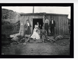
Photograph of people posing in front of miner's cabin, Pioche (Nev.), 1900-1925
Date
1900 to 1925
Archival Collection
Description
Photograph of people posing in front of miner's cabin, Pioche (Nev.), 1900-1925
Image
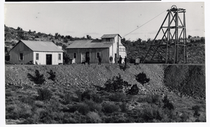
Photograph of men outside at mining operation, Pioche (Nev.), 1900-1925
Date
1900 to 1925
Archival Collection
Description
Photograph of men outside at mining operation, Pioche (Nev.), 1900-1925
Image
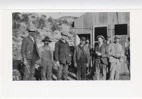
Photograph of miners and workers outside a mine, Pioche (Nev.), 1900-1925
Date
1900 to 1925
Archival Collection
Description
Photograph of miners and workers outside a mine, Pioche (Nev.), 1900-1925
Image
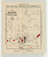
Map of the Bullfrog Mining District, Nye County (Nev.), 1905
Date
1905
Description
Scale [ca. 1:39,000. 1 in. to approx. 3,250 feet] ; 1 map : col. ; 45 x 38 cm ; Relief shown by hachures ; "Compliments of the Forward Mining Development Co." ; Properties owned by Patrick Investment Company are marked in red ; Shows railroads, roads, and pipelines ;
Image
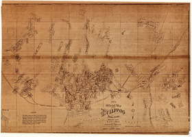
New official map of the Bullfrog Mining District, Nye County (Nev.), 1905
Date
1905
Description
Scale [ca. 1:16,800. 1 inch to approximately 1,400 feet] ; 1 map ; 74 x 109 cm ; Blueline print ; Scale almost illegible ; "Photo. lith. Britton & Rey." ; Photocopy? [United States : s.n., 199-?] ;
Image
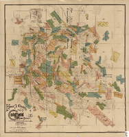
Elmer J. Chute's Map of Goldfield Mining District, Esmeralda and Nye Counties (Nev.), 1905
Date
1905
Description
Scale [ca. 1:20, 400. 1 in.=aprrox. 1,700 feet] ; 1 map : col. ; 60 x 58 cm ; Includes inset location map ; Includes township and range grid ;
Image
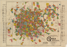
Elmer J. Chute's map of U.S. patent and location surveys in the Goldfield Mining District, Esmeralda and Nye Counties (Nev.), 1907
Date
1907
Description
Scale [ca. 1:22,800. 1 in. to approx. 1900 feet] ; 1 map : col. ; 66 x 82 cm., folded to 18 x 9 cm ; Includes index Includes township and range grid ;
Image
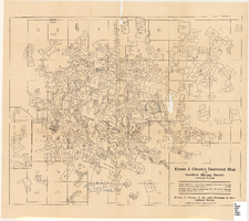
Elmer J. Chute's Diamond Map of the Goldfield Mining District, Esmeralda and Nye Counties (Nev.), 1907
Date
1907
Description
Elmer J. Chute's Diamond Map of the Goldfield Mining District, Esmeralda and Nye Counties (Nev.), 1907
Image
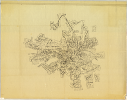
Map of the Tonopah Mining District, Nye County (Nev.), 1905
Date
1905
Description
Scale [ca.1:12,804. 1 in. to approx. 1,067 ft.] ; 1 map ; on sheet 92 x 106 cm ; Relief shown by hachures ; Title supplied by cataloger ; Probably a preliminary black and white edition of the colored map copyrighted by Bradford and Bradford in 1905
Image
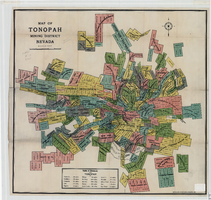
Map of the Tonopah Mining District, Nye County (Nev.), 1905
Date
1905
Description
Scale [ca. 1:15,600. 1 in. to approx. 1300 feet] ; 1 map : col. ; 60 x 64 cm ; Relief shown by hachures ; Copyright held by Bradford & Bradford ; Includes table of distances ; Library's copy has one section outlined in red pencil and Tonopah Victor printed on it in red pencil. Red pencil dots are on two other sections. 1905 printed in pencil and some unreadable words written in pencil near title of map ;
Image
Pagination
Refine my results
Content Type
Creator or Contributor
Subject
Archival Collection
Digital Project
Resource Type
Material Type
Place
Language
