Search the Special Collections and Archives Portal
Search Results
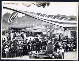
Photograph of a double handed drilling contest,Tonopah (Nev.), early 1900s
Archival Collection
Description
Caption: Drilling Contest
Image
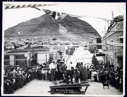
Photograph of a double handed drilling contest in downtown Tonopah (Nev.), early 1900s
Archival Collection
Description
Drilling Contest Tonopah Railroad Carnival
Image
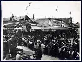
Photograph of Tonopah Railroad Carnival, Tonopah (Nev.), early 1900s
Archival Collection
Description
Caption: Drilling Contest. R.R. Carnival
Image
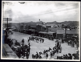
Photograph of a Fourth of July Parade, Tonopah (Nev.), July 04, 1903
Date
1903-07-04
Archival Collection
Description
Caption: 1281
Image
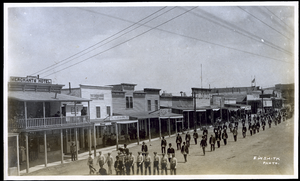
Photograph of Fraternal Order of Eagles marching in parade, Tonopah (Nev.), early 1900s
Date
Unknown year in the decade of the 1900s
Archival Collection
Description
Photograph of Fraternal Order of Eagles marching in parade, Tonopah (Nev.), early 1900s
Image

Photograph of packtrain on Main Street, Tonopah (Nev.), early 1900s
Date
Unknown year in the decade of the 1900s
Archival Collection
Description
Photograph of packtrain on Main Street, Tonopah (Nev.), early 1900s
Image
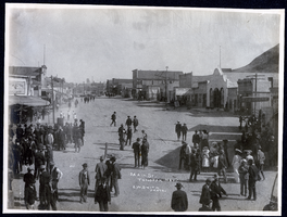
Photograph of people and buildings on Main Street, Tonopah (Nev.), early 1900s
Archival Collection
Description
Caption: Main St. Tonopah Nev.
Image
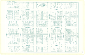
Map of downtown Las Vegas, Nevada, circa 1952-1955
Date
1952 to 1955
Description
Title in upper left and right margins: Las Vegas, Nevada. Identifies business tenants in the downtown area and includes property valuations, measurements, addresses, etc. Cadastral map. Oriented with north to the lower right.Text, illustrations, aerial photos, and ancillary map of the Las Vegas Strip on verso. Cataloger has determined date of map to be between 1952 and 1955 because the Sahara and the Sands Casinos are shown on the verso of the map, and they both opened in 1952, but the Riviera and the Dunes opened in 1955, and they are not shown on the map. Also, the Hotel Last Frontier is shown on the verso of the map, and its name was changed to New Frontier in 1955. Note: Many of the property names and addresses are erroneous when compared to Las Vegas business directories from the same period.
Image
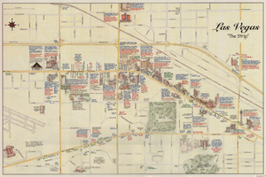
Maps of the Las Vegas Strip, downtown and metropolitan Las Vegas area, the Grand Canyon and southern Nevada, circa 1997
Date
1995 to 1999
Description
'Detail maps for downtown, neighborhoods, out of town, Grand Canyon' -- front panel. Maps on verso: Downtown -- Out of town and short adventures -- Greater Las Vegas -- Grand Canyon, South Rim Village. Major buildings and points of interest on the Las Vegas Strip shown pictorially. Includes text and notes. Originally published by MapEasy, Inc. Scale [ca. 1:10,560. 1 inch to approximately 1/6 mile].
Text
Photograph album 1, Leon Rockwell Collection, circa 1900s-1910s
Date
1900 to 1910
1905 to 1919
Archival Collection
Description
Photographs taken circa 1907-1914 in the Las Vegas, Nevada area, including Fort Callville, and during travels in California; Washington State; Idaho; Montana; and Oregon, with emphasis on Yosemite National Park and Yellowstone National Park. Album also features photographs taken at the 1911 Yakima (Washington) State Fair and in Salt Lake City, Utah, and Goodsprings, Nevada during the same period.
Image
Pagination
Refine my results
Content Type
Creator or Contributor
Subject
Archival Collection
Digital Project
Resource Type
Material Type
Place
Language
