Search Results
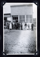
Photograph of men in front of store, Round Mountain (Nev.), early 1900s
Date
1900 to 1925
Archival Collection
Description
Photograph of men in front of store, Round Mountain (Nev.), early 1900s
Image
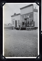
Photograph of Round Mountain storefronts and merchants (Nev.), early 1900s
Date
1900 to 1925
Archival Collection
Description
Photograph of Round Mountain storefronts and merchants (Nev.), early 1900s
Image
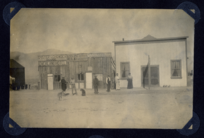
Photograph of street scene outside Chowder House and Overland Hotel, Round Mountain (Nev.), early 1900s
Date
1900 to 1925
Archival Collection
Description
Site Name: Overland Hotel (Round Mountain, Nev.)
Oyster and Chowder House (Round Mountain, Nev.)
Oyster and Chowder House (Round Mountain, Nev.)
Image
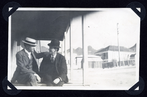
Photograph of two men seated on a porch in town, Round Mountain (Nev.), early 1900s
Date
1900 to 1925
Archival Collection
Description
Photograph of two men seated on a porch in town, Round Mountain (Nev.), early 1900s
Image
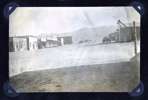
Photograph of main street in Round Mountain (Nev.), early 1900s
Date
1900 to 1925
Archival Collection
Description
Photograph of main street in Round Mountain (Nev.), early 1900s
Image
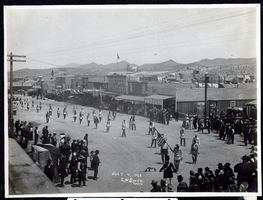
Photograph of an Independence Day parade, Tonopah (Nev.), July 4, 1903
Date
1903-07-04
Archival Collection
Description
Caption: F.O.E. [Fraternal Order of Eagles]
Image
Photograph of Upper Main Street, Tonopah (Nev.), early 1900s
Archival Collection
Description
Caption: Upper Main St.
Image
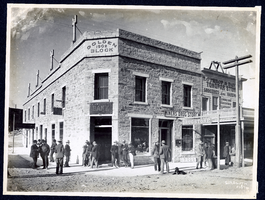
Photograph of street scene and Golden Block Building, Tonopah (Nev.), early 1900s
Archival Collection
Description
Site Name: Miners' Drug Store (Tonopah, Nev.)
Lathrop & Davis Tonopah Store (Tonopah, Nev.)
Lathrop & Davis Tonopah Store (Tonopah, Nev.)
Image
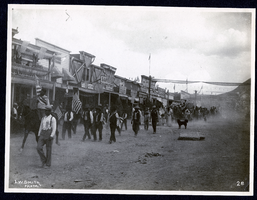
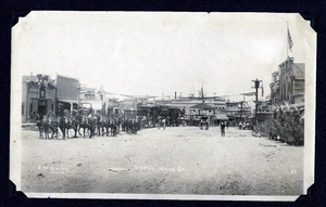
Photograph of a parade on Main Street, Tonopah (Nev.), early 1900s
Archival Collection
Description
Caption: 28
Image
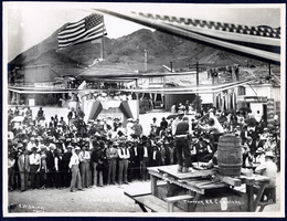
Photograph of a double handed drilling contest, Tonopah (Nev.), July 26, 1904
Date
1906-07-26
Archival Collection
Description
Caption: Drilling contest. Tonopah R.R. Carnival. Tonopah July 26 1904
Image