Search Results
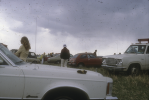
People gathered at Rocky Flats: photographic slide
Date
Archival Collection
Description
From the Sister Klaryta Antoszewska Photograph Collection (PH-00352).
Image
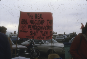
Protestors at Rocky Flats with sign: photographic slide
Date
Archival Collection
Description
From the Sister Klaryta Antoszewska Photograph Collection (PH-00352). The sign in the image is not fully legible as some words are hidden. Part of it says, "PEOPLE BEFORE PROFITS! NO NUKES!" with a symbol.
Image
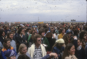
Protestors at Rocky Flats, Jefferson County, Colorado: photographic slide
Date
Archival Collection
Description
From the Sister Klaryta Antoszewska Photograph Collection (PH-00352).
Image

People seated in a car.: photographic slide
Date
Archival Collection
Description
From the Sister Klaryta Antoszewska Photograph Collection (PH-00352). Lenten Desert Experience.
Image

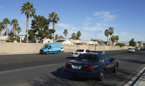
Traffic on Eastern Avenue north of Warm Springs Road, looking west in Las Vegas, Nevada: digital photograph
Date
Archival Collection
Description
From the UNLV University Libraries Photographs of the Development of the Las Vegas Valley, Nevada (PH-00394). Part of the collection documents the entire 19 mile length of the north/south Eastern Avenue / Civic Center Drive alignment. This photograph was captured in the section of Eastern Avenue between Sunset and Warm Springs Roads.
Image

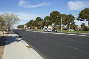
Traffic flows on Eastern Avenue as seen from north of Warm Springs Road, looking south in Las Vegas, Nevada: digital photograph
Date
Archival Collection
Description
From the UNLV University Libraries Photographs of the Development of the Las Vegas Valley, Nevada (PH-00394). Part of the collection documents the entire 19 mile length of the north/south Eastern Avenue / Civic Center Drive alignment. This photograph was captured in the section of Eastern Avenue between Sunset and Warm Springs Roads.
Image

An airplane flies over Eastern Avenue near Sunset Park, looking north-northwest in Las Vegas, Nevada: digital photograph
Date
Archival Collection
Description
From the UNLV University Libraries Photographs of the Development of the Las Vegas Valley, Nevada (PH-00394). Part of the collection documents the entire 19 mile length of the north/south Eastern Avenue / Civic Center Drive alignment. This photograph was captured in the section of Eastern Avenue between Sunset and Warm Springs Roads.
Image
Traffic flows next to a single family home neighborhood on Eastern Avenue next to Sunset Park, looking west-northwest in Las Vegas, Nevada: digital photograph
Date
Archival Collection
Description
From the UNLV University Libraries Photographs of the Development of the Las Vegas Valley, Nevada (PH-00394). Part of the collection documents the entire 19 mile length of the north/south Eastern Avenue / Civic Center Drive alignment. This photograph was captured in the section of Eastern Avenue between Sunset and Warm Springs Roads.
Image
Traffic flows on Sunset Road east of Eastern Avenue, looking west in Las Vegas, Nevada: digital photograph
Date
Archival Collection
Description
From the UNLV University Libraries Photographs of the Development of the Las Vegas Valley, Nevada (PH-00394). Part of the collection documents the entire 19 mile length of the north/south Eastern Avenue / Civic Center Drive alignment. This photograph was captured in the section of Eastern Avenue between Sunset and Warm Springs Roads.
Image
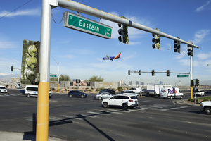
A Southwest Airline plane lands at McCarran International Airport as traffic navigates the intersection of Sunset Road and Eastern Avenue, looking west-northwest in Las Vegas, Nevada: digital photograph
Date
Archival Collection
Description
From the UNLV University Libraries Photographs of the Development of the Las Vegas Valley, Nevada (PH-00394). Part of the collection documents the entire 19 mile length of the north/south Eastern Avenue / Civic Center Drive alignment. This photograph was captured in the section of Eastern Avenue between Sunset and Warm Springs Roads.
Image