Search Results
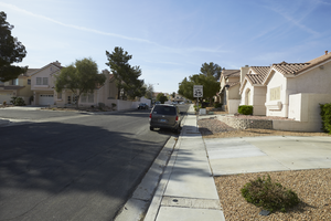
A single family neighborhood on La Alba Street off Windmill Lane near Eastern Avenue, looking south in Las Vegas, Nevada: digital photograph
Date
Archival Collection
Description
From the UNLV University Libraries Photographs of the Development of the Las Vegas Valley, Nevada (PH-00394). Part of the collection documents the entire 19 mile length of the north/south Eastern Avenue / Civic Center Drive alignment. This photograph was captured in the section of Eastern Avenue between Windmill Parkway and Pebble Road.
Image
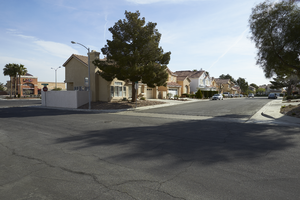
A single family neighborhood on La Alba Street and Calamada Avenue with commercial development behind off Windmill Lane near Eastern Avenue, looking northeast in Las Vegas, Nevada: digital photograph
Date
Archival Collection
Description
From the UNLV University Libraries Photographs of the Development of the Las Vegas Valley, Nevada (PH-00394). Part of the collection documents the entire 19 mile length of the north/south Eastern Avenue / Civic Center Drive alignment. This photograph was captured in the section of Eastern Avenue between Windmill Parkway and Pebble Road.
Image
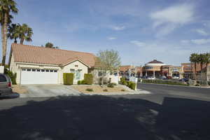
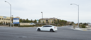
A single family neighborhood on La Alba Street with commercial development off Windmill Lane near Eastern Avenue, looking west-northwest in Las Vegas, Nevada: digital photograph
Date
Archival Collection
Description
From the UNLV University Libraries Photographs of the Development of the Las Vegas Valley, Nevada (PH-00394). Part of the collection documents the entire 19 mile length of the north/south Eastern Avenue / Civic Center Drive alignment. This photograph was captured in the section of Eastern Avenue between Windmill Parkway and Pebble Road.
Image
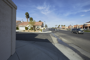
A single family neighborhood with commercial development on La Alba Street off Windmill Lane near Eastern Avenue, looking west-southwest in Las Vegas, Nevada: digital photograph
Date
Archival Collection
Description
From the UNLV University Libraries Photographs of the Development of the Las Vegas Valley, Nevada (PH-00394). Part of the collection documents the entire 19 mile length of the north/south Eastern Avenue / Civic Center Drive alignment. This photograph was captured in the section of Eastern Avenue between Windmill Parkway and Pebble Road.
Image
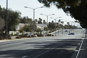
Looking east up Windmill Lane east of Eastern Avenue, in Henderson, Nevada: digital photograph
Date
Archival Collection
Description
From the UNLV University Libraries Photographs of the Development of the Las Vegas Valley, Nevada (PH-00394). Part of the collection documents the entire 19 mile length of the north/south Eastern Avenue / Civic Center Drive alignment. This photograph was captured in the section of Eastern Avenue between Windmill Parkway and Pebble Road.
Image
Cars travel on Windmill Lane near Eastern Avenue, looking west-southwest in Las Vegas, Nevada: digital photograph
Date
Archival Collection
Description
From the UNLV University Libraries Photographs of the Development of the Las Vegas Valley, Nevada (PH-00394). Part of the collection documents the entire 19 mile length of the north/south Eastern Avenue / Civic Center Drive alignment. This photograph was captured in the section of Eastern Avenue between Windmill Parkway and Pebble Road.
Image
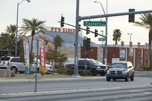
A car travels on Pebble Road passing Jefferys Street west of Eastern Avenue with commercial and multi-family development, looking north-west in Las Vegas, Nevada: digital photograph
Date
Archival Collection
Description
From the UNLV University Libraries Photographs of the Development of the Las Vegas Valley, Nevada (PH-00394). Part of the collection documents the entire 19 mile length of the north/south Eastern Avenue / Civic Center Drive alignment. This photograph was captured in the section of Eastern Avenue between Pebble Road and Silverado Ranch Boulevard.
Image
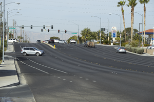
Cars turn up Pebble Road at Eastern Avenue, looking east-northeast in Las Vegas, Nevada: digital photograph
Date
Archival Collection
Description
From the UNLV University Libraries Photographs of the Development of the Las Vegas Valley, Nevada (PH-00394). Part of the collection documents the entire 19 mile length of the north/south Eastern Avenue / Civic Center Drive alignment. This photograph was captured in the section of Eastern Avenue between Pebble Road and Silverado Ranch Boulevard.
Image
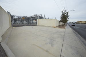
The entrance to the NV Energy power transfer station at Pebble Road and Eastern Avenue, looking southwest in Las Vegas, Nevada: digital photograph
Date
Archival Collection
Description
From the UNLV University Libraries Photographs of the Development of the Las Vegas Valley, Nevada (PH-00394). Part of the collection documents the entire 19 mile length of the north/south Eastern Avenue / Civic Center Drive alignment. This photograph was captured in the section of Eastern Avenue between Pebble Road and Silverado Ranch Boulevard.
Image
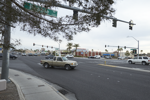
The intersection of Pebble Road and Eastern Avenue, looking north-northeast in Las Vegas, Nevada: digital photograph
Date
Archival Collection
Description
From the UNLV University Libraries Photographs of the Development of the Las Vegas Valley, Nevada (PH-00394). Part of the collection documents the entire 19 mile length of the north/south Eastern Avenue / Civic Center Drive alignment. This photograph was captured in the section of Eastern Avenue between Pebble Road and Silverado Ranch Boulevard.
Image