Search Results
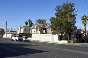
Graffiti on block wall in North Las Vegas, Nevada: digital photograph
Date
Archival Collection
Description
From the UNLV University Libraries Photographs of the Development of the Las Vegas Valley, Nevada (PH-00394). Part of the collection documents the entire 19 mile length of the north/south Eastern Avenue / Civic Center Drive alignment. This photograph was captured in the section of Civic Center Drive between Alexander Road and Cheyenne Avenue.
Image
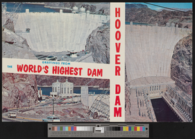
Postcard with three photographs of Hoover Dam, Nevada, 1960s
Date
Archival Collection
Description
Image
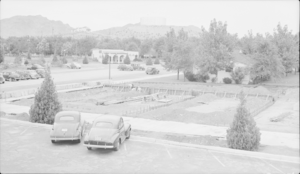
Film transparency of construction in Boulder City, Nevada, circa 1942-1940s
Date
Archival Collection
Description
Image
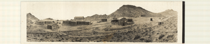
Panoramic photograph of mining buildings in Gilbert, Nevada, circa 1910s-1920s
Date
Archival Collection
Description
Image
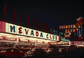
Slide of the Nevada Club, Las Vegas, circa late 1950s-1960s
Date
Archival Collection
Description
Image
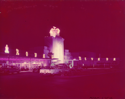
Film transparency of the entrance of the Royal Nevada (Las Vegas), between 1955-1959
Date
Archival Collection
Description
nighttime view of the front exterior and entrance of the Royal Nevada resort and casino. The Royal Nevada was eventually incorporated into the Stardust Resort and Casino.
Site Name: Royal Nevada
Address: 3000 Las Vegas Boulevard South
Image
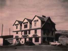
Slide of Tom's Drive Inn, Elko, Nevada, circa 1950
Date
Archival Collection
Description
Image
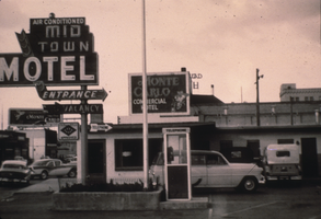
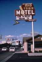
Slide of the Mid-Town Motel, Elko, Nevada, circa 1950
Date
Archival Collection
Description
Image
Slide of the Mid-Town Motel, Elko, Nevada, circa 1986
Date
Archival Collection
Description
Image
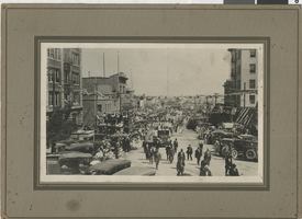
Photograph of crowds of people watching a parade, Tonopah, Nevada, circa 1910s
Date
Archival Collection
Description
Image