Search the Special Collections and Archives Portal
Search Results

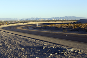
Traffic on 215 the Beltway in the Nortwest, Las Vegas, Nevada: digital photograph
Date
2016-10-04
Archival Collection
Description
Traffic along 215 the Beltway in the northwest section of the Las Vegas Valley.
Image
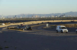
Traffic on 215 the Beltway in the Nortwest, Las Vegas, Nevada: digital photograph
Date
2016-10-04
Archival Collection
Description
Traffic along 215 the Beltway in the northwest section of the Las Vegas Valley.
Image
Traffic on 215 the Beltway in the Nortwest, Las Vegas, Nevada: digital photograph
Date
2016-10-04
Archival Collection
Description
Traffic along 215 the Beltway in the northwest section of the Las Vegas Valley as a fire briefly burns closer to the Las Vegas Strip.
Image
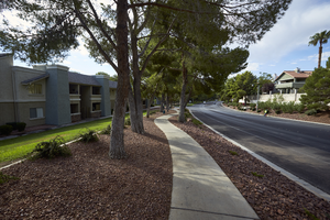
Lake Town Center in The Lakes, Las Vegas, Nevada: digital photograph
Date
2017-08-29
Archival Collection
Description
Desert landscaping has replaced grass in this portion of Lake East Drive in The Lakes master planned development. Built in the 1980s, The Lakes is one of the last development's with a manmade lake as its feature. This area is just south of West Sahara Avenue near South Durango Drive. August 29, 2017 UNLV Libraries Special Collections / Aaron Mayes N36 °08.302' x W115 °16.973')
Image
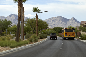
Cars on Desert Foothills Drive, Las Vegas, Nevada: digital photograph
Date
2017-08-23
Archival Collection
Description
A bus and truck travel on Desert Foothills Drive near West Sahara Avenue. The road tracks northwest as it changes names from West Sahara Avenue to Desert Foothills Drive in the Red Rock Country Club area.
Image
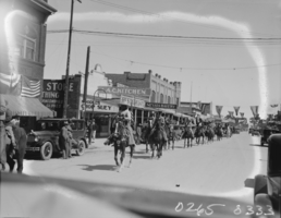
Film transparency of horses in the Labor Day Parade, Las Vegas, Nevada, circa 1930
Date
1928 to 1932
Archival Collection
Description
The Labor Day Parade in Las Vegas, Nevada, circa 1930. The following buildings are visible: Noodles Chop Suey, A. C. Kitchen, Nevada Bakery, Blandings Meat Market, a drugstore, and a hardware store. The original image has been damaged.
Image
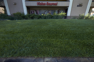
Grass use at The Lakes Busines Park off West Sahara Avenue near South Durango Drive, Las Vegas, Nevada: digital photograph
Date
2017-08-29
Archival Collection
Description
Grass areas like this in front of Vision Source! are common in The Lakes Business Park off of West Sahara Avenue. Built in the 1980, water requirements for developments have changed dramatically over the years. August 29, 2017 UNLV Libraries Special Collections / Aaron Mayes N36 °08.643' x W115 °17.502')
Image
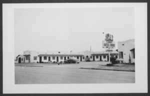
Photograph of the Chief Autel Court motel, Las Vegas, Nevada, circa 1938-1940s
Date
1938 to 1949
Archival Collection
Description
Chief Autel Court Motel in Las Vegas, Nevada. The motel was owned by Harold Stocker.
Image
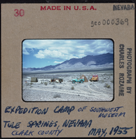
Photographic slide of Southwest Museum expedition camp at Tule Springs, Nevada, May 1955
Date
1955-05
Archival Collection
Description
Written on the slide: "Expedition camp of Southwest Museum. Tule Springs, Nevada. Clark County. May 1955."
Image
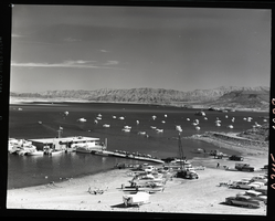
Film transparency of Las Vegas Bay, Lake Mead, Nevada, 1961
Date
1961
Archival Collection
Description
Boats are moored at the marina, as well as offshore. Some boats are on the beach, waiting to launch. A few small islands are visible in the background. Las Vegas Bay is a bay at the western edge of Lake Mead, to the northeast of the city of Henderson, Nevada, near the junction of Lake Mead Drive and Lake Mead Boulevard. A public campground and boat access are available in Las Vegas Bay. Low water levels of Lake Mead have rendered the marina there inoperable, and it relocated to the Hemenway Boat Harbor, in the south end of the Boulder Basin in 2002. The launch ramp there has also been closed due to the water levels. The Lake Mead Marina was relocated to the Hemenway Boat Harbor in 2008. The bay is the natural discharge point for the Las Vegas Wash. Las Vegas Wash is in the southeastern portion of the Las Vegas Valley and is approximately 12 miles long, from its headwaters northwest of Las Vegas to its mouth at Las Vegas Bay on the western portion of Lake Mead. The bridge across the Wash on Northshore Road is approximately 1.2 miles north of the intersection of Lakeshore and Northshore Roads.
Image
Pagination
Refine my results
Content Type
Creator or Contributor
Subject
Archival Collection
Digital Project
Resource Type
Year
Material Type
Place
Language
