Search the Special Collections and Archives Portal
Search Results
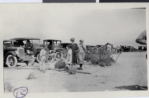
Photograph of the Lost City Pageant, Nevada, circa late 1920s
Date
1925 to 1929
Archival Collection
Description
Description given with photograph: "A Lost City Pageant (old St. Thomas)." Some of the people identified in photo as Leon Rockwell, Jr.; Margie (Marjorie); Bessie; Lottie.
Image
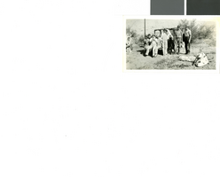
Photograph of people camping in Moapa, Nevada, circa 1920s to 1940s
Date
1920 to 1949
Archival Collection
Description
Early Las Vegas on camping trip at Moapa, NV. Campers are identified as Jim and Lotty Adams's and daughter, Harry Jameson, Ray and Gilda Mosbach and daughters, Earl Rockwell and Charlotte Amanda "Lottie" Rockwell (mother).
Image
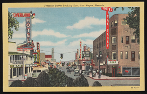
Artistic rendition of Fremont Street in Las Vegas, Nevada: postcards
Date
1940 (year approximate) to 1990 (year approximate)
Archival Collection
Description
From Harvey's Hotel and Casino Postcard Collection (PH-00367)
Image
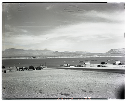
Film transparency of Overton Beach at Lake Mead, Nevada, 1947
Date
1947
Archival Collection
Description
Several boats are moored close to shore, and a few tents have been pitched close to the water's edge. Three small buildings are visible. Overton Beach is located on the northern end of the Overton Arm, a long extension of the lake that follows the former channel of the Virgin River. In 1939, shortly after Lake Mead was impounded, Overton Beach was one of only three sites on the reservoir to have facilities for the public. Overton Beach offered access to a public launch ramp, restrooms, fish cleaning station and ranger station. A concessioner operated a RV park, store, fuel station, dry boat storage, long-term trailer village, and a marina with 125 slips. In the spring of 2007, the marina facilities were divided into two smaller sections and moved to other concessioner operations on the lake at Temple Bar and Callville Bay. Shortly after that, the store was boarded up and the trailer village was dismantled. What remained are the boat launch and the ranger station. On Sunday, April 25, 2010, the National Park Service locked the gate leading to Overton Beach at its intersection with Northshore Road, although the area will still be open to visitors who choose to enter on foot or by boat. Only vehicle access is restricted, making the area in effect a backcountry site. The move was considered temporary, but it could prove permanent depending on how long it takes Lake Mead to recover from over a decade of drought on the overdrawn Colorado River. The Overton Beach water treatment facility was also shut down on April 25, 2010. Without water and sewage services, the park wasn't able to operate restrooms, the fish cleaning station or RV pump-out stations. These services are now available at Echo Bay, which is located ten miles south of Overton Beach.
Image
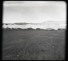
Film transparency of Overton Beach at Lake Mead, Nevada, 1961
Date
1961
Archival Collection
Description
Several trucks and automobiles are parked near the water's edge, and several boats are visible in the background, moored close to shore. Overton Beach is located on the northern end of the Overton Arm, a long extension of the lake that follows the former channel of the Virgin River. In 1939, shortly after Lake Mead was impounded, Overton Beach was one of only three sites on the reservoir to have facilities for the public. Overton Beach offered access to a public launch ramp, restrooms, fish cleaning station and ranger station. A concessioner operated a RV park, store, fuel station, dry boat storage, long-term trailer village, and a marina with 125 slips. In the spring of 2007, the marina facilities were divided into two smaller sections and moved to other concessioner operations on the lake at Temple Bar and Callville Bay. Shortly after that, the store was boarded up and the trailer village was dismantled. What remained are the boat launch and the ranger station. On Sunday, April 25, 2010, the National Park Service locked the gate leading to Overton Beach at its intersection with Northshore Road, although the area will still be open to visitors who choose to enter on foot or by boat. Only vehicle access is restricted, making the area in effect a backcountry site. The move was considered temporary, but it could prove permanent depending on how long it takes Lake Mead to recover from over a decade of drought on the overdrawn Colorado River. The Overton Beach water treatment facility was also shut down on April 25, 2010. Without water and sewage services, the park wasn't able to operate restrooms, the fish cleaning station or RV pump-out stations. These services are now available at Echo Bay, which is located ten miles south of Overton Beach.
Image
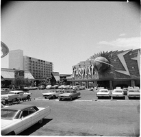
Stardust Resort and Casino exterior, Las Vegas, Nevada: photographs
Date
1962 (year approximate) to 1967
Archival Collection
Description
Photographs from the Stardust Hotel and Desert Inn Hotel Photographic Negatives -- Stardust Hotel and Desert Inn Hotel photographic negatives file.
Image
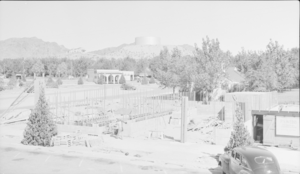
Film transparency showing construction in Boulder City, Nevada, circa 1942-1940s
Date
1942 to 1949
Archival Collection
Description
The view of an unidentified building being constructed in Boulder City. In the background of the photo the Shell Station can be seen on the corner of Nevada Way and Arizona Street. The sign reads, "P. S. Webb General Contractor."
Image
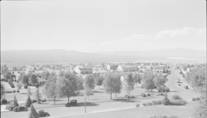
Film transparency showing streets of Boulder City, Nevada, circa 1933-1940s
Date
1933 to 1949
Archival Collection
Description
A grayscale view of Boulder City, Nevada; Boulder Dam Hotel, located at 1305 Arizona Street, and a building sign advertising "free Boulder Dam motion pictures" can be seen in the background.
Image
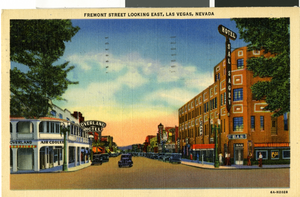
Postcard of Fremont Street, Las Vegas, Nevada, circa 1940
Date
1940-09-24
Archival Collection
Description
A view of Fremont Street, looking southeast from Main Street. The Overland Hotel and Hotel Sal Sagev are seen on the corners. Postcard is addressed to Mr. Garfield Voget Hubbard in Arizona. Handwritten message on card reads: "Las Vegas Nev. 9-24-40. Dear, G. today we saw Boulder Dam. How interesting. We are spending the night in Las Vegas and am thinking of you. Tomorrow expect to see Grand Canyon. Just mt a 3 day from me and my friends. Love, Julie. Greetings and may God bless you, Arma."
Image
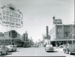
Film transparency of Fremont Street, Las Vegas, Nevada, circa 1940s
Date
1940 to 1949
Archival Collection
Description
Fremont Street looking northwest from Second Street towards the Union Pacific Railroad station, Las Vegas, Nevada. The Golden Nugget, Frontier Arcade, White Spot Café, Pioneer Club and Monte Carlo Club are seen on the south side of the street. The El Dorado and Hotel Apache, the Boulder Club, and Overland Hotel are seen on the north side of the street, along with a neon sign featuring an early version of Vegas Vic. Site Name: Golden Nugget Hotel and Casino (Las Vegas, Nev.); Boulder Club (Las Vegas, Nev.); Hotel Apache (Las Vegas, Nev.)
Image
Pagination
Refine my results
Content Type
Creator or Contributor
Subject
Archival Collection
Digital Project
Resource Type
Year
Material Type
Place
Language
