Search Results
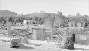
Film transparency showing building construction in Boulder City, Nevada, circa 1930s-1940s
Date
Archival Collection
Description
Image
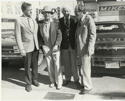
Photograph of John Cahlan and others, Las Vegas, Nevada, October 16, 1980
Date
Archival Collection
Description
Image
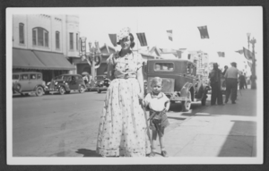
Photograph of Stocker family members in costume at the Helldorado Parade, Las Vegas, Nevada, 1934
Date
Archival Collection
Description
Image
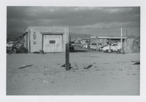
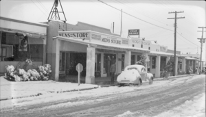
Photograph of an atuomobile repair garage and scrap yard, Las Vegas, Nevada, circa 1960s
Date
Archival Collection
Description
Image
Film transparency of a general view of Boulder City, Nevada, circa 1930s-1940s
Date
Archival Collection
Description
Image
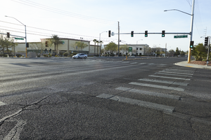
The intersection of Eastern and Wigwam Avenues, looking southeast in Las Vegas, Nevada: digital photograph
Date
Archival Collection
Description
From the UNLV University Libraries Photographs of the Development of the Las Vegas Valley, Nevada (PH-00394). Part of the collection documents the entire 19 mile length of the north/south Eastern Avenue / Civic Center Drive alignment. This photograph was captured in the section of Eastern Avenue between Windmill Parkway and Pebble Road.
Image
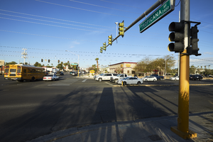
Looking west on Tropicana Avenue at Eastern Avenue, in Las Vegas, Nevada: digital photograph
Date
Archival Collection
Description
From the UNLV University Libraries Photographs of the Development of the Las Vegas Valley, Nevada (PH-00394). Part of the collection documents the entire 19 mile length of the north/south Eastern Avenue / Civic Center Drive alignment. This photograph was captured in the section of Eastern Avenue between Flamingo Road and Tropicana Avenue.
Image
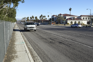
Looking north-northeast up Eastern Avenue in Las Vegas, Nevada: digital photograph
Date
Archival Collection
Description
From the UNLV University Libraries Photographs of the Development of the Las Vegas Valley, Nevada (PH-00394). Part of the collection documents the entire 19 mile length of the north/south Eastern Avenue / Civic Center Drive alignment. This photograph was captured in the section of Eastern Avenue between Desert Inn and Flamingo Roads.
Image
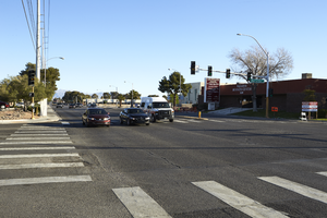
Intersection of Hacienda and Eastern Avenues, looking north in Las Vegas, Nevada: digital photograph
Date
Archival Collection
Description
From the UNLV University Libraries Photographs of the Development of the Las Vegas Valley, Nevada (PH-00394). Part of the collection documents the entire 19 mile length of the north/south Eastern Avenue / Civic Center Drive alignment. This photograph was captured in the section of Eastern Avenue between Tropicana Avenue and Russell Road.
Image
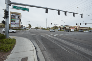
The intersection of Eastern and Richmar Avenues, looking south-southwest in Henderson, Nevada: digital photograph
Date
Archival Collection
Description
From the UNLV University Libraries Photographs of the Development of the Las Vegas Valley, Nevada (PH-00394). Part of the collection documents the entire 19 mile length of the north/south Eastern Avenue / Civic Center Drive alignment. This photograph was captured in the section of Eastern Avenue between Pebble Road and Silverado Ranch Boulevard.
Image