Search the Special Collections and Archives Portal
Search Results

Photograph of I. ''Pat'' Head, Oran Gragson, and Leonard Fayle at reservoir construction site, May 1, 1969
Date
Archival Collection
Description
Oran Gragson, Leonard Fayle, and I. ''Pat'' Head at the Leonard R. Fayle reservoir construction site. Left to Right: I. 'Pat' Head, Mayor Oran Gragson, and Leonard R. Fayle.
Image

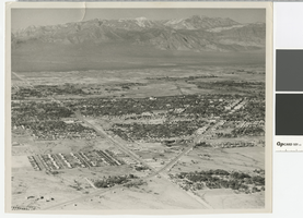
Aerial photograph of the Las Vegas Valley looking northwest towards Mount Charleston, 1945
Date
Archival Collection
Description
Aerial view of the Las Vegas Valley looking northwest towards Mount Charleston.
Transcribed Notes: Handwritten inscription on back: Las Vegas about 1945 looking toward Charleston Mountains (North West). Road intersection in immediate foreground is that of Fremont Street from the right, Charleston Blvd from the left (Charleston Blvd runs due West); Stamped on back: Las Vegas News Bureau, Las Vegas - Nevada, Photographers Don English - Joe Buck - Jerry Abbott
Image

Aerial photograph of Las Vegas looking northwest, late 1950s
Date
Archival Collection
Description
Aerial view of Las Vegas looking northwest. Fremont Street in center, running west.
Transcribed Notes: Notes on photo sleeve: Aerial view of Las Vegas looking west. Fremont Street in center, running west.
Image

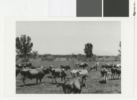
Photograph of George Ullom, Senior at his dairy ranch, circa 1925
Date
Archival Collection
Description
George Ullom, Sr. at his dairy ranch, Charleston Boulevard area
Image

Photograph of water clarifier tank at gravel plant in Hoover Dam construction, March 19, 1932
Date
Archival Collection
Description
Water clarifier tank at the gravel plant by the Colorado River for Hoover Dam construction.
Transcribed Notes: Handwritten on back: [1038], 3-19-32; Notes on photo sleeve: Water clarifier tank at the gravel plant. The water is pumped from the river two miles away and is distilled in this tank. March 19, 1932.
Image

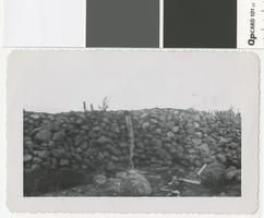
Photograph of pondwater overflow at Whitney Ranch, circa 1950
Date
Archival Collection
Description
Overflow from a pond that was constructed to catch rain water on the Whitney Ranch.
Transcribed Notes: Handwritten collection note on back: overflow from pond handmade; Notes on photo sleeve: 'Overflow from pond (handmade) at Whitney Ranch. Pond was constructed to catch rainwater.'
Image

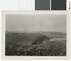
Photograph looking west over the Colorado River and Hemenway Wash from Fortification Hill, before 1931
Date
Archival Collection
Description
Looking west over the Colorado River and Hemenway Wash from Fortification Hill.
Transcribed Notes: Handwritten collection note on back of photo: [Las Vegas Wash and area under water now(?)]; Notes on photo sleeve: [Las Vegas Wash area] from top of Fortification Mountain. (Credit: W.A. Davis); 'Wint made a fire at night on top then kicked it off into space. Lacey hired Wint to do it for some tourists.' - James J. Hester, son-in-law of W.A. ('Wint') Davis, 1992
Image

Aerial photograph of Las Vegas, partial view of high school, southwest direction, 1930
Date
Archival Collection
Description
Aerial view of Las Vegas in 1930
Transcribed Notes: Handwritten collection note on back of photo: Aerial view of Las Vegas showing Fifth St. and Main St., c. 1933; Notes on photo sleeve: Aerial view of Las Vegas 'taken in a clip wing Jenny. Date is winter of 1930. Plane had a wooden propeller open cockpit. Pilot had a contract with Bureau of Reclamation to fly aerial photos in a grid. Took Wint (up in) the plane this day because it was too windy (for the pilot) to take his regular aerials.' (James J. Hester, son-in-law of W.A. Davis ('Wint'), the photographer who took this. Note added 4-92.
Image

Aerial photograph of Las Vegas, full view of high school, southwest direction, 1930
Date
Archival Collection
Description
Aerial view of Las Vegas in 1930
Transcribed Notes: Notes on back of duplicate photo: Aerial view of Las Vegas w/ new high school on bottom left, c. 1933; Notes on photo sleeve: Aerial view of Las Vegas taken in the winter of 1930 (same day as #0123 002) in clip wing Jenny. Shows railroad and main street - essentially shows the whole city. (Credit: W.A. Davis)
Image

Aerial photograph of Las Vegas looking south, 1930
Date
Archival Collection
Description
Aerial view of Las Vegas in 1930.
Transcribed Notes: Notes on photo sleeve: 'Shows stockyards and car shops. Creek is overflow from UP artesian well. Site of earliest ranch in area. Creek had mosquito minnows in it - a native species. Only source of water for Las Vegas. Water carried in a 20-24'' wooden pipe.' (James J. Hester, from W.A. Davis, photographer. April 1992)
Image
