Search Results
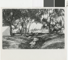
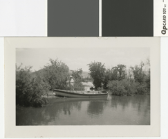
Photograph of riders near the Vegas Creek at the Stewart Ranch camp in Las Vegas, circa 1905-1906
Date
Archival Collection
Description
Las Vegas Creek running through the old Las Vegas Ranch with tents on the side
Image
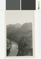
Photograph of the Colorado River from Observation Point, Boulder Canyon, April 3, 1932
Date
Archival Collection
Description
Looking down the Colorado River from Observation Point, April 3, 1932, view of the beginning of construction of the Hoover Dam.
Transcribed Notes: Transcribed from back of photo: "Looking down the river from Observation Point"
Image
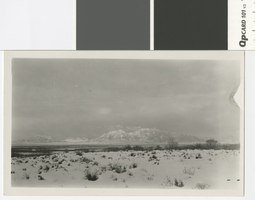
Panoramic photograph of snow-covered Sunrise Mountain, Las Vegas Valley, circa 1930
Date
Archival Collection
Description
Looking east over the Las Valley towards Sunrise Mountain; the mountain and valley are covered with snow
Transcribed Notes: Transcribed from back of photo: "Sun. Jan 12th - Snow over Sunrise Mountain"
Image
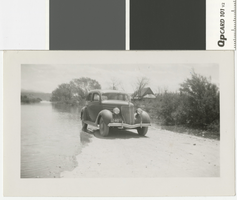
Photograph of a car driving on a flooded dirt road, St. Thomas (Nevada), 1938
Date
Archival Collection
Description
A view of the old Chadburn Place in St. Thomas and a car on a road that is being covered by water from Lake Mead
Transcribed Notes: Transcribed from back of photo: "St. Thomas - The old Chadburn place - 1938"
Image
Photograph of two women and a rowboat, St. Thomas, 1938
Date
Archival Collection
Description
Two women standing near a row boat in the middle of St. Thomas as it is being covered by Lake Mead
Image
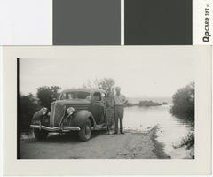
Photograph of a couple standing next to a car on a flooded road, St. Thomas, 1938
Date
Archival Collection
Description
A man and woman standing near a car on a road that is being covered by the waters of Lake Mead
Image
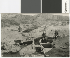
Photograph of excavations in process at the Lost City near St. Thomas, Nevada, circa 1925
Date
Archival Collection
Description
Transcribed Notes: Transcribed from handwritten inscription by D. Hancock on back of postcard: "This shows some of the excavators at work at the Buried City or 'Lost City' as it is sometimes called. This is near St. Thomas if you wish to look up its approximate location on the map. It was here I went last Spring on one of my trips."
Image
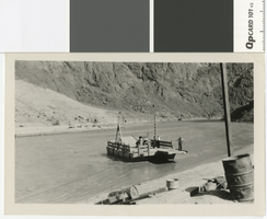
Photograph of a car ferry crossing the Colorado River to the Arizona highway, circa 1926-1928
Date
Archival Collection
Description
Ferry that carried cars and people across the Colorado River to the Arizona highway
Transcribed Notes: Transcribed from back of photo: "The ferry which takes cars across to the Arizona highway. It is run by cables. This was taken about 1926 - or maybe 1928. I'm not sure which. The motor was a Jim Cashman truck motor."
Image
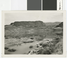
Panoramic photograph of Fortification Hill across the Colorado River, circa 1924
Date
Archival Collection
Description
Fortification Hill near the Colorado River
Transcribed Notes: Transcribed from back of photo: "About 1924. The Colorado River before the Dam, above where Hoover Dam is now (1963)"
Image
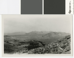
Photograph of the McFarland Ranch with the Pintwater Mountains in the distance
Date
Archival Collection
Description
View of McFarland Ranch from nearby mountains looking towards Pintwater Mountains.
Transcribed Notes: Transcribed from back of photo: "Pintwater Mountains in distance. The dark mass of growth are huge cottonwood and willow trees on ranch. House is hidden by trees. Taken from foothills behind ranch. McFarland Ranch - Indian Springs."
Image