Search Results
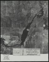
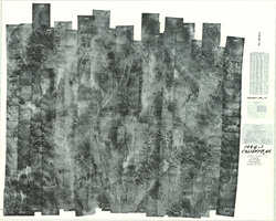
Aerial view of the Bonelli quadrant in Arizona-Nevada: photographic print
Date
1950
Archival Collection
Description
From the Army Mapping Service Aerial Photographs of Southern and Western Nevada (PH-00285). Aerial photographs, composites, and indices. Aerial photographs, Quad. Bonelli 4, U.S. Department of the Interior Geological Survey, Army Map Service. State: Arizona - Nevada. Flight Scale I-47200Project-GS-LJ. Index copied -8-26-50. Flying Comp. -7-26-50
Image
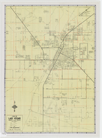
Index to aerial photographs of Caliente, Nevada: photographic print
Date
1952 to 1954
Archival Collection
Description
From the Army Mapping Service Aerial Photographs of Southern and Western Nevada (PH-00285). Aerial photographs, composites, and indices. Geological Survey, Army Map Service.
Image

Index to aerial photographs of Goldfield, Nevada: photographic print
Date
1952
Archival Collection
Description
From the Army Mapping Service Aerial Photographs of Southern and Western Nevada (PH-00285). Aerial photographs, composites, and indices. Geological Survey, Army Map Service.
Image
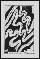
View of folding, ore, and shale: photographic print
Date
1910 (year approximate) to 1930 (year approximate)
Archival Collection
Description
From the Chester R. Longwell Photograph Collection (PH-00311)
Image
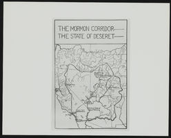
The Mormon Corridor: map
Date
1900 (year approximate) to 2000 (year approximate)
Archival Collection
Description
From the UNLV Special Collections Photograph Collection on Book Illustrations (PH-00170) -- "Hunter, Milton R. Brigham Young the Colonizer. the Mormon Corridor, the state of Deseret map, p. 69."
Image
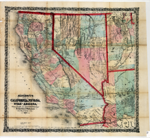
Bancroft's map of California, Nevada, Utah and Arizona, 1873
Date
1873
Description
Hand colored ; Relief shown by hachures and spot heights ; Prime meridian: Washington, D.C ; Shows railroads, proposed railroads and wagon roads, etc. Published by A.L. Bancroft & Company. Scale [ca. 1:1,520,640]. 1 in. to 24 miles (W 124°--W 111°/N 42°--N 32°).
Image