Search the Special Collections and Archives Portal
Search Results
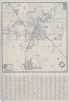
Street map of Las Vegas and vicinity, 1960
Date
1960
Description
43 x 40 cm., folded to 18 x 9 cm. Panel title: Las Vegas and vicinity map. Includes index. Text with facts about Las Vegas, photographs of Las Vegas and nearby tourist attractions and maps of Henderson, Boulder City and downtown Las Vegas on verso. Library's copy 2 has notes handwritten in black ink. Original publisher: Thomas Bros. Maps.
Image

Street map of the Las Vegas area, circa 1960
Date
1959 to 1960
Description
53 x 65 cm., folded to 22 x 9 cm. Panel title: Welcome map & established guide to the greater Las Vegas area and scenic routes to and from there. Includes index and advertisements for local businesses. Las Vegas Motel Association map on verso along with advertisements, information on the Las Vegas Convention Center, and sightseeing information. Map was probably distributed by the Las Vegas Chamber of Commerce. Library's copy has freeway, service road, and streets connecting to the freeway marked with different colors of crayon and includes notes. 1960 ed. Map is irregularly shaped. Original publisher: Las Vegas Motel Association.
Image
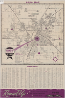
Street map of Las Vegas and North Las Vegas, circa 1963
Date
1961 to 1965
Description
36 x 37 cm. Panel title: Las Vegas area map. Includes index. Advertisements for Round-up Real Estate on verso. Original publisher: Round.
Image
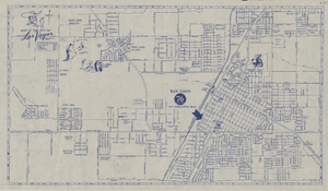
Street map of the city of Las Vegas, 1955
Date
1955
Description
20 x 35 cm., folded to 22 x 11 cm. Copyright held by Redwood Pub. Co. "Compliments of 'Buck' Evans 76 Union"--Panel. Index on verso. Includes table of mileages to Las Vegas from other cities in the Southwest. Original publisher: Redwood Publishing Co., Scale: .
Image

Street map of the city of Las Vegas & vicinity, showing streets, main roads and recreation areas, 1954
Date
1954
Description
7 maps on 3 sheets, 2 leaves ; 21 x 31 cm. or smaller on sheets 22 x 35 cm. folded to 22 x 13 cm. in paper cover. Title from cover. Copyright held by James E. Stringer. 1st ed. Includes maps of North Las Vegas, the Strip and Vegas Heights and Meadow Acres. Includes key to map coordinates. Includes index. "Map of Las Vegas & Vicinity showing streets, main roads, and recreation areas." Original publisher: R.W. Baldwin.
Image

Surficial geologic map of the Specter Range NW quadrangle, Nye County, Nevada, 1989
Date
1989
Description
58 x 47 cm., on sheet 74 x 81 cm., folded in envelope 30 x 24 cm. Relief shown by contours and spot heights. "Geology mapped in 1984-85." Includes text, bibliography, and location maps. "Prepared in cooperation with the U. S. Deparment of Energy." "Base from U. S. Geological Survey, 1961. Photorevised 1983. 10,0000-foot grid ticks based on Nevada coordinate system, central zone. 1000-meter Universal Transverse Mercator grid ticks, zone 11, shown in blue." Original publisher: U. S. Geological Survey, Series: Miscellaneous investigations series map I, Scale: 1:24 000.
Image
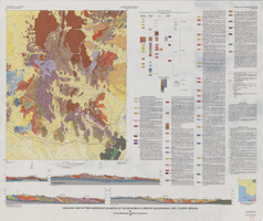
Geologic map of the northeast quarter of the Bullfrog 15-minute quadrangle, Nye County, Nevada, 1990
Date
1990
Description
58 x 46 cm., on sheet 87 x 102 cm., folded in envelope 30 x 24 cm. Relief shown by contours and spot heights. "Contour interval 40 feet." "Base from U.S. Geological Survey 1:62,500. 1954." "Geology mapped in 1985 and 1988." Includes text, bibliography, 4 col. cross sections, and location and index maps. "Prepared in cooperation with the U. S. Atomic Commission." Original publisher: U. S. Geological Survey, Series: Miscellaneous investigations series, map I, Scale: 1:24 000.
Image
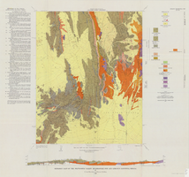
Geologic map of the Plutonium Valley quadrangle, Nye and Lincoln counties, Nevada, 1965
Date
1965
Description
58 x 46 cm., on sheet 77 x 83 cm., folded in envelope 30 x 24 cm. Relief shown by contours and spot heights. "Geology mapped in 1961." Includes description of map units, col. cross section, and quadrangle location map. "Prepared in cooperation with the U. S. Atomic Commission." Original publisher: Interior, Geological Survey, Series: Geologic quadrangle map GQ, Scale: 1:24 000.
Image
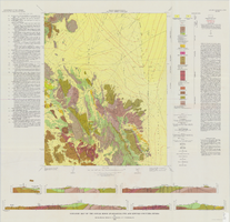
Geologic map of the Jangle Ridge quadrangle, Nye and Lincoln Counties, Nevada, 1965
Date
1965
Description
58 x 46 cm., on sheet 84 x 87 cm., folded in envelope 30 x 24 cm. Relief shown by contours and spot heights. "Contour interval 20 feet." "Prepared in cooperation with the U.S. Atomic Energy Commission." "Geology mapped in 1961. Limit of pluvial Groom Lake and faults from photographs mapped by R. B. Colton, 1962." Includes text, bibliography, location map, and 5 col. cross sections. Original publisher: Interior, U.S. Geological Survey, Series: Geologic quadrangle map GQ, Scale: 1:24 000.
Image
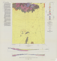
Geology of the Jackass Flats quadrangle, Nye County, Nevada, 1964
Date
1964
Description
58 x 47 cm., on sheet 86 x 81 cm., folded in envelope 30 x 24 cm. Relief shown by contours and spot heights. "Geology mapped in 1961." Includes description of map units, 2 col. cross sections, and quadrangle location map. "Prepared in cooperation with the U. S. Atomic Commission." Original publisher: Interior, Geological Survey, Series: Geologic quadrangle map GQ, Scale: 1:24 000.
Image
Pagination
Refine my results
Content Type
Creator or Contributor
Subject
Archival Collection
Digital Project
Resource Type
Year
Material Type
Place
Language
