Search Results
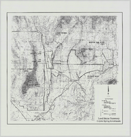
Land Status Summary, Coyote Spring Investments: map
Date
Archival Collection
Description
From the Jeff Van Ee Papers (MS-00470) -- Coyote Springs development -- Maps file.
Image
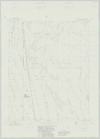
Wildcat Wash NW, Nev. (Fish & Wildlife #1 WSA): map
Date
Archival Collection
Description
From the Jeff Van Ee Papers (MS-00470) -- Coyote Springs development -- Maps file.
Image
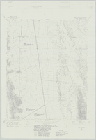
Wildcat Wash SW, Nev. (Fish & Wildlife #1 and #2 WSA): map
Date
Archival Collection
Description
From the Jeff Van Ee Papers (MS-00470) -- Coyote Springs development -- Maps file.
Image
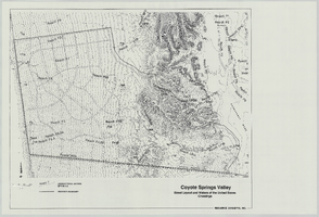
Coyote Springs Valley Street Layout & Waters of the United States Crossings: map
Date
Archival Collection
Description
From the Jeff Van Ee Papers (MS-00470) -- Coyote Springs development -- Maps file.
Image
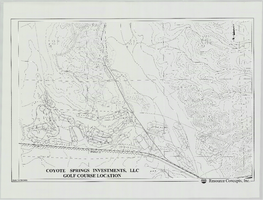
Coyote Springs Investments, LLC Golf Course Location: map
Date
Archival Collection
Description
From the Jeff Van Ee Papers (MS-00470) -- Coyote Springs development -- Maps file.
Image
Coyote Springs Investments, Soils Series: map
Date
Archival Collection
Description
From the Jeff Van Ee Papers (MS-00470) -- Coyote Springs development -- Maps file.
Image
Coyote Springs Investments, LLC Golf Course Location: map
Date
Archival Collection
Description
From the Jeff Van Ee Papers (MS-00470) -- Coyote Springs development -- Maps file.
Image
Coyote Springs Project Area – Waters of the United States: map
Date
Archival Collection
Description
From the Jeff Van Ee Papers (MS-00470) -- Coyote Springs development -- Maps file.
Image
Coyote Springs Project Area: map
Date
Archival Collection
Description
From the Jeff Van Ee Papers (MS-00470) -- Coyote Springs development -- Maps file.
Image
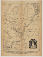
"Las Vegas & Tonopah Railroad - The Goldfield Route" map
Date
Description
Map showing "Las Vegas & Tonopah Railroad 'The Goldfield Route.'" On the back it lists a timetable, railroad employees and executives, and descriptions of districts and towns: Johnnie, Beatty, Rhyolite, Bonnie Clare, Goldfield, Tonopah, Manhattan, Round Mountain, and Hornsilver.
Image