Search the Special Collections and Archives Portal
Search Results

Map of a portion of the Eldorado Mining District (brochure), Clark County (Nev.), 1900-1925
Date
1900 to 1925
Description
Map of a portion of the Eldorado Mining District (brochure), Clark County (Nev.), 1900-1925
Image

Sectional maps for the Combination and Florence Mines, Goldfield (Nev.), 1900-1925
Date
1900 to 1925
Description
Sectional mining map, vertical orientation
Image
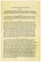
Report of the Diamond Valley Gold Mining Company, January 14, 1915
Date
1915-01-14
Archival Collection
Description
Report of the Diamond Valley Gold Mining Company, January 14, 1915
Text
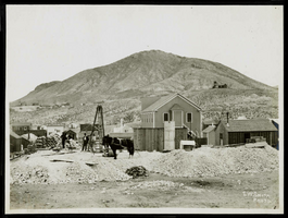
Photograph of mining operations, Goldfield (Nev.), 1900-1925
Date
1900 to 1925
Archival Collection
Description
Photograph of mining operations, Goldfield (Nev.), 1900-1925
Image
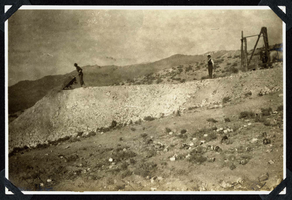
Photograph of a man dumping excavated rock, Round Mountain (Nev.), 1900-1925
Date
1900 to 1925
Archival Collection
Description
Photograph of a man dumping excavated rock, Round Mountain (Nev.), 1900-1925
Image
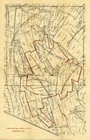
Map of the Goldfield Deep Mines Company of Nevada, Goldfield (Nev.), 1900-1925
Date
1900 to 1925
Description
Caption: Boundary drawn in red, surrounding mines named
Image

Plat of the Texas and Lone Star Lodes, Goldfield (Nev.), November 11, 1905
Date
1905-11-11
Description
Caption: U.S. Surveyor General for Nevada plat for mining claim
Image

Map of the Rawhide Mining District, Rawhide (Nev.), 1900-1925
Description
Caption: Proven zone, Rawhide Mining District, Nevada
Image
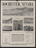
Newspaper clipping, Rochester Hills Mining Company Advertisement, Rohester (Nev.), 1900-1925
Date
1900 to 1925
Description
Caption: Rochester, Nevada
Text
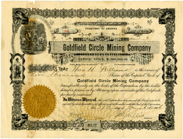
Certificate, Goldfield Circle Mining Company, March 17, 1906
Date
1906-03-17
Archival Collection
Description
Certificate, Goldfield Circle Mining Company, March 17, 1906
Image
Pagination
Refine my results
Content Type
Creator or Contributor
Subject
Archival Collection
Digital Project
Resource Type
Year
Material Type
Place
Language
Records Classification
