Search Results
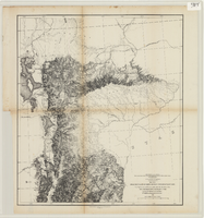
From the valley of Green River to the Great Salt Lake
Date
Description
Image
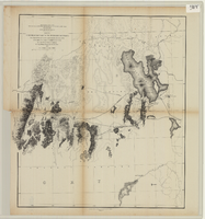
From the Great Salt Lake to the Humboldt Mountains
Date
Description
Image
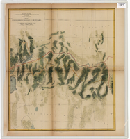
From the Humboldt Mountains to the Mud Lakes
Date
Description
Image
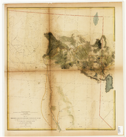
From the valley of the Mud Lakes to the Pacific Ocean
Date
Description
Image
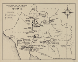
Map of Bureau of Reclamation Region III, August 1, 1945
Date
Description
Image
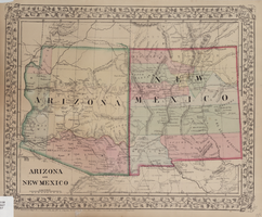
Map of Arizona and New Mexico, 1867
Date
Description
Image

Map of California, Utah, Nevada, Colorado, New Mexico and Arizona, circa 1867
Date
Description
Image

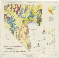
General geologic map of Las Vegas, Pahrump, and Indian Spring Valleys, Clark and Nye Counties, Nevada, 1948
Date
Description
At top of map: 'United States Department of the Interior, Geological Survey. State Engineer of Nevada. Water resources bulletin No. 5, Plate 1.' Relief shown by spot heights. Includes 3 inset maps of wells and springs in the vicinity of Pahrump, Manse Ranch and Indian Springs, Nevada. Scale [ca. 1:126,720. 1 inch to approx. 2 miles] (W 116°--W 115°/N 40°--N 36°). Originally published as plate 1 in Geology and water resources of Las Vegas, Pahrump, and Indian Spring Valleys, Clark and Nye Counties, Nevada by George B. Maxey and C.H. Jameson (1948), which is number 5 of the Water resources bulletin published by the Nevada Office of the State Engineer.
Image
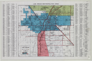
General map of Las Vegas, Nevada, June 1962
Date
Description
Text
Geologic map of Clark County, Nevada, 1964
Date
Description
62. Relief shown by contours and spot heights. Includes two index maps and eight cross-sections.
Image