Skip to main content
Main navigation
Finding Aids
Digital Projects
African American Experience in Las Vegas
Charles Saladino Landscape Architecture Collection
Culinary Union Photograph Collection
Dino at the Sands
Dreaming the Skyline
Entertainment
Historic Landscape of Nevada
Hoover Dam
Jamey Stillings
Menus: The Art of Dining
Nevada Test Site Oral History Project
Newspapers
Oral Histories Collection
Photograph Collections
Rebel Yell Newspaper
Showgirls
Southern Nevada: The Boomtown Years 1900-1925
Southern Nevada History in Maps
Southern Nevada Jewish Heritage Project
UNLV CSUN Records
Union Pacific Railroad Water Documents
Walking Box Ranch Collection
Welcome Home Howard
About
Request Images
Help
Provide Feedback
Special Collections Home
Search the Special Collections and Archives Portal
Search
Search
Breadcrumb
Home
Search Results
Display
List
Grid
Results Per Page
10
25
50
100
250
maps (documents)
Displaying results 181 - 190 of 253
Map showing railroads in Nevada, 1911, side 2
Image
View
Tonopah, Nevada mining map, March 1904, side 1
Image
View
Tonopah, Nevada mining map, March 1904, side 2
Image
View
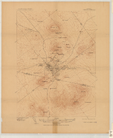
Map of Kawich Quadrangle, Nye County, Nevada, June 1908, side 1
Image
View
Map of Kawich Quadrangle, Nye County, Nevada, June 1908, side 2
Image
View
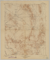
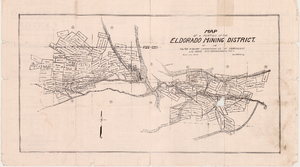
Map of a portion of the Eldorado Mining District, November 1916, side 1
Image
View
Map of a portion of the Eldorado Mining District, November 1916, side 2
Image
View
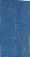
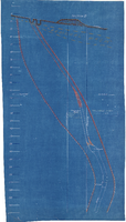
Cross-section maps of Combination and Florence Mines, Goldfield, Nevada, circa 1902-1908, section A
Image
View
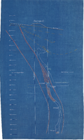
Cross-section maps of Combination and Florence Mines, Goldfield, Nevada, circa 1902-1908, section B
Image
View
Cross-section maps of Combination and Florence Mines, Goldfield, Nevada, circa 1902-1908, section C
Image
View
Pagination
First page
« First
Previous page
‹ Previous
…
Page
15
Page
16
Page
17
Page
18
Current page
19
Page
20
Page
21
Page
22
Page
23
…
Next page
Next ›
Last page
Last »
Go
Refine my results
Content Type
Digital Object (253)
Creator or Contributor
United States. War Department (6)
Beckwith, E. G. (Edward Griffin), 1818-1881 (5)
Davis, Jefferson, 1808-1889 (5)
Siebert, Selmar (5)
Chute, Elmer J. (3)
United States. Army Map Service (3)
Welsh, John Elliott (3)
Charles Desilver (Firm) (2)
Geological Survey (U.S.) (2)
Hazzard, J. L. (2)
J. & C. Walker (Firm) (2)
Society for the Diffusion of Useful Knowledge (Great Britain) (2)
Welch and Tune (2)
Yeager, E. (Edward) (2)
Young, J. H. (James Hamilton) (2)
A.L. Bancroft & Company (1)
Abert, John James, 1788-1863 (1)
Allen Photographers, Inc. (1)
Baker, C. D. (Charles Duncan), 1901-1972 (1)
Barber, V. S. (1)
Barnes, A. J. (1)
Bateman, C. A. (1)
Bien, Julius, 1826-1909 (1)
Bradford, S. K. (1)
Burke, Howard (1)
Candrian, H. A. (Herman Anton) (1)
Cella Barr Associates (1)
Chambers, Frank M. (1)
Civilian Conservation Corps (U.S.). (1)
Cram, George Franklin, 1841-1928 (1)
Curtis, Joseph Story (1)
Davis and Byler (1)
Egloffstein, F. W., 1824-1885 (1)
Freudenthal, Herman E. (1)
General Washington Mining Company (1)
Geographical Surveys West of the 100th Meridian (U.S.) (1)
Gilbert, G. K. (1)
Goldfield Belmont Extension Mining Company (1)
Goldfield Review (1)
Griswold, R. W. (1)
Hardman, George (1)
Hornsilver Herald (1)
Howell, Edwin E. (Edwin Eugene), 1845-1911 (1)
Hummel Brothers Employment Agency (1)
J.H. Colton & Co. (1)
Johnson, A. J. (Alvin Jewett), 1827-1884 (1)
Kern, M. H. (1)
Kern, Richard H., 1821-1853 (1)
Las Vegas and Tonopah Railroad (1)
Las Vegas Valley Water District (Nev.) (1)
Liddell, C. A. (1)
Los Angeles & Salt Lake Railroad Company. Los Angeles Division (1)
Marvine, A. R. (Archibald Robertson), 1848-1876 (1)
Miller, C. F. (1)
Montgomery, J. M. (James M.) (1)
Overton, Ed (1)
Parke, John G. (1)
Parker, John W. (1)
Reinhardt, William (1)
Roeser, C. (Charles) (1)
Sherer, George E. (1)
Sitgreaves, Lorenzo, 1811-1888 (1)
United States. Army. Corps of Topographical Engineers (1)
United States. Bureau of Reclamation (1)
United States. Department of the Interior (1)
United States. Forest Service (1)
United States. General Land Office (1)
United States. Surveyor General of Nevada (1)
Walker, John, 1786-1873 (1)
Wheeler, George M. (George Montague), 1842-1905 (1)
Subject
maps (documents) (46)
Mines and mineral resources (42)
Records and correspondence (38)
Las Vegas Land and Water Company (33)
Water utilities (19)
Reinhardt, William, 1884-1969 (14)
Water-pipes (14)
Water-supply (14)
Bracken, Walter R., 1870-1950 (13)
Water resources development (12)
Nevada--Las Vegas Valley Water District (11)
Coyote Springs (10)
Railroads (10)
Real property (9)
Union Pacific Railroad Company (9)
Water-supply--Management (9)
Bennett, E. E. (Lawyer) (8)
Discoveries in geography (8)
Nevada (8)
Southwest, New (8)
Water utilities--Rates (7)
Cartography (5)
Clark, J. Ross (James Ross), 1850-1927 (5)
Deserts (5)
Pacific railroads (5)
Pacific railroads--Explorations and surveys (5)
West United States (5)
Bettis, H. I. (3)
California (3)
Flood control (3)
Maag, L. R., 1889-1978 (3)
McNamee, Leo A., 1888-1958 (3)
San Pedro, Los Angeles & Salt Lake Railroad Company (3)
Wells (3)
Advertising (2)
Agriculture (2)
Arizona (2)
California--Sacramento Valley (2)
California--San Joaquin Valley --http://id.worldcat.org/fast/1270333 (2)
Charts, diagrams, etc. (2)
Cities and towns (2)
Flood damage (2)
Flood damage prevention--Planning (2)
Folger, Al M. (2)
Knickerbocker, F. H., 1875-1955 (2)
McNamee, F. R. (Frank R.), 1865 or 1866-1933 (2)
Mining districts (2)
Moapa River Reservation (Nev.) (2)
Municipal water supply--Planning (2)
Nevada. Public Service Commission (2)
Pipelines (2)
Railroads--Maps (2)
Springs (2)
United States (2)
Utah (2)
Washington (D.C.) (2)
Water--Prices (2)
Water-supply--Maps (2)
Aerial views (1)
Arden, Nevada (1)
Artesian wells (1)
Bancroft, W. H. (1)
Bodies of water (1)
Boundaries (1)
Building sites--Planning (1)
Casinos (1)
Colorado (1)
Comstock, W. H. (1)
Desert pupfish (1)
Elks (Fraternal order) (1)
Farms (1)
Festivals (1)
Floods (1)
Folds (Geology) (1)
Geology (1)
George, Sadie Kiel (1)
Goldfield Belmont Extension Mining Company (1)
Goldfield Consolidated Mines Company (1)
Goldfield Deep Mines Company of Nevada (1)
Helldorado Days (1)
Hotels (1)
Hughes, Howard, 1905-1976 (1)
Hydrology (1)
Indian country (United States law) (1)
Indians of North America (1)
Irrigation (1)
Jeffers, William Martin (1)
Johnson, W. H. (Executive) (1)
Las Vegas and Tonopah Railroad (1)
Las Vegas Valley Water District (Nev.) (1)
Latter Day Saints (1)
Lone Star Consolidated Mining Company (1)
Mann, Howard C. (1)
Mexico (1)
Mexico, North (1)
Military reconnaissance (1)
Montana-Tonopah Mine (1)
Mormon cities and towns (1)
Municipal buildings--Planning (1)
Municipal water supply (1)
Nevada--Moapa Valley (1)
Nevada Rapid Transit Company (1)
Prospecting (1)
Reclamation of land (1)
Resorts (1)
Roads--Design and construction (1)
Rodeos (1)
Southwestern States (1)
Strong, Frank, 1879- (1)
Surveys (1)
Technical reports (1)
Telegraph lines (1)
Views (1)
Water--Waste (1)
Water-meters (1)
Water-pipes--Design and construction (1)
Water-supply--Planning (1)
Water-supply--Sources (1)
Water-supply--U.S. states (1)
Water conservation (1)
Water rights--Law and legislation (1)
Watershed hydrology (1)
Watersheds (1)
Water use (1)
Water utilities--Costs (1)
Water well drilling (1)
Wells--Design and construction (1)
Whittemore, C. O. (1)
Zoning (1)
Archival Collection
Union Pacific Railroad Collection (39)
Jeff Van Ee Papers (10)
UNLV Libraries Single Item Accession Photograph Collection (5)
John Wittwer Collection on Agriculture in Nevada (4)
Army Mapping Service Aerial Photographs of Southern and Western Nevada (3)
Las Vegas Land & Water Company Records from the Las Vegas Valley Water District (2)
Sadie and Hampton George Papers (2)
Chester Longwell Photograph Collection (1)
Edith Giles Barcus Family Papers (1)
Howard Hughes Public Relations Photograph Collection (1)
James E. Deacon Pupfish Research Files (1)
Jay Sarno Papers (1)
Union Pacific Railroad Photographs (1)
UNLV Special Collections Photograph Collection of Book Illustrations (1)
Digital Project
Southern Nevada and Las Vegas, History in Maps (131)
Southern Nevada The Boomtown Years 1900-1925 (48)
Historic Landscape of Nevada (9)
The Historic Landscape of Nevada: Development, Water and Natural Environment (7)
Southern Nevada Jewish Heritage Project (1)
Welcome Home, Howard (1)
Resource Type
Still Image (242)
Text (49)
Year
We are sorry, but this facet only works with JavaScript enabled. Please check your browser's settings.
Material Type
maps (documents) (253)
blueprints (reprographic copies) (11)
historical maps (10)
correspondence (4)
aerial photographs (3)
black-and-white photographs (3)
photographic prints (3)
photographs (3)
documents (object genre) (2)
pamphlets (2)
reports (2)
brochures (1)
charts (graphic documents) (1)
clippings (information artifacts) (1)
contracts (1)
family papers (1)
notes (documents) (1)
petitions (1)
zoning maps (1)
Place
Las Vegas (43)
Goldfield Consolidated Mines (19)
Nevada (19)
California (11)
Coyote Springs (10)
Utah (9)
Arizona (7)
New Mexico (6)
Tonopah (6)
Clark County (5)
Goldfield (4)
Esmeralda County (3)
Lincoln County (3)
Moapa Valley (3)
Red Top Mine (3)
Bullfrog Hills (2)
Death Valley (2)
Los Angeles (2)
Moapa River Indian Reservation (2)
North Las Vegas (2)
Riverside (2)
Texas (2)
United States (2)
Arden (1)
Bullfrog Mining District (1)
Caliente (1)
Colorado (1)
Eldorado Canyon (1)
Eureka Consolidated Mine (1)
Florence Mine (1)
Golden Anchor (1)
Henderson (1)
Las Vegas Springs (1)
Las Vegas Valley (1)
Locke Mine (1)
Logandale (1)
Manse Ranch Springs (1)
Mohawk Mine (1)
Montana Tonopah (1)
Ontario (1)
Oregon (1)
Pioche Hills (1)
Potosi Mine (1)
Rawhide (1)
Red Mountain (1)
Searchlight (1)
Tonopah Extension (1)
West (1)
Language
English (124)