Search Results
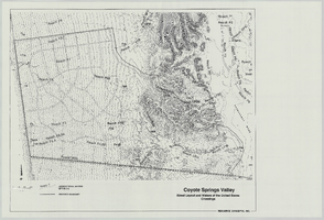
Coyote Springs Valley Street Layout & Waters of the United States Crossings: map
Date
Archival Collection
Description
From the Jeff Van Ee Papers (MS-00470) -- Coyote Springs development -- Maps file.
Image
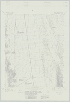
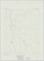
Wildcat Wash SW, Nev. (Fish & Wildlife #1 and #2 WSA): map
Date
Archival Collection
Description
From the Jeff Van Ee Papers (MS-00470) -- Coyote Springs development -- Maps file.
Image

Coyote Springs development: maps
Date
Archival Collection
Description
Materials document issues surrounding the master-planned community of Coyote Springs in Lincoln County and Clark County, Nevada from 1988 to 2005. From the Jeff Van Ee Papers (MS-00470) -- Coyote Springs development -- Maps file.
Image
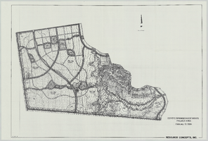
Coyote Springs Investments Project Area: map
Date
Archival Collection
Description
From the Jeff Van Ee Papers (MS-00470) -- Coyote Springs development -- Maps file.
Image
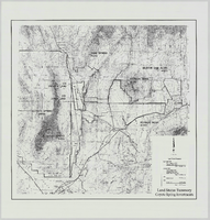
Land Status Summary, Coyote Spring Investments: map
Date
Archival Collection
Description
From the Jeff Van Ee Papers (MS-00470) -- Coyote Springs development -- Maps file.
Image
Wildcat Wash NW, Nev. (Fish & Wildlife #1 WSA): map
Date
Archival Collection
Description
From the Jeff Van Ee Papers (MS-00470) -- Coyote Springs development -- Maps file.
Image
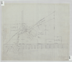
Elks Helldorado Grounds, Las Vegas, Nevada: map
Date
Description
Map of Elks Helldorado Grounds in Las Vegas, Nevada. Map is from the Library's Union Pacific Collection, maps/drawings, Las Vegas Ranch folder 5A, drawing no. F-403. Scale approximately 1:2,400.
Image
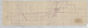
Map showing contemplated improvements to develop the Las Vegas Ranch at Las Vegas, Nevada
Date
Description
Shows springs, Clark's Las Vegas Townsite, Buck's Addition, cemetery, and State Experimental Farm. Shows township and range lines. From the Union Pacific Collection. Written on the map: "Union Pacific System, Los Angeles & Salt Lake Railroad Co., Map showing contemplated improvements to develop the Las Vegas Ranch at Las Vegas, Nev. Scale 1" - 800" Dwg. No. 31171. Office of Asst. Chief Engr., L.A.&S.L.R.R. Los Angeles, Calif., March 9, 1926. Approved: "
Image
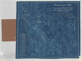
Prospectors map of Tonopah, Goldfield, Bull Frog, & principal mining districts
Date
Description
Showing towns, roads, trails & watering places, in southern Nevada & Death Valley region, California. 1 map ; 44 x 49 cm, folded in cover 18 x 11 cm. Scale [1:950,400]. 15 mi. to an inch. (W 119⁰--W 114⁰/N 39⁰--36⁰). Relief shown by hachures. Blueprint. "Jan. 1905." Includes list of distances. Goldfield, Nev. : Booker, Philbrick & Fenner.
Image
Coyote Springs Investments, Soils Series: map
Date
Archival Collection
Description
From the Jeff Van Ee Papers (MS-00470) -- Coyote Springs development -- Maps file.
Image