Search Results
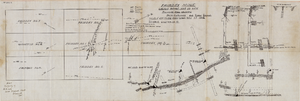
Fairday Mine property map, May 25, 1916
Date
1916-05-25
Description
'Fairday Mine, Cactus Range, Nye Co., Nev. property map showing vein outcrops and underground surface, May 25, 1916.' Handwritten in lower left corner: 'Map property of A.H. Lee, care [of] Tonopah Club, Tonopah, Nev.' 'Scale 200' to the inch.' 'Silver oz. Gold value 1/9.'
Image

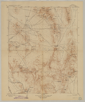
Longitudinal section map, Montana Tonopah Mine, circa 1900s-1910s
Date
1900 to 1919
Description
'Longitudinal Section, Montana Tonopah Mine showing workings projected on east-west vertical plane.' In lower right corner: 'E.D. North E.M.' 'Photo-litho. Britton & Rey, S.F.'
Image
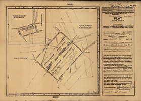
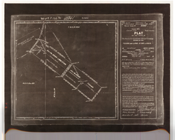
Plat of the claim of George Wingfield, June, 1907
Date
1907-06
Description
'Plat of the claim of George Wingfield, known as the Yankee Doodle and Desert Rose Lodes and Desert Rose Mill Site, in Goldfield Mining District, Esmeralda County, Nevada. Containing an area of 41.318 + 4.841 acres. Scale of 300 feet to the inch. Variation 17° east. Surveyed June 22-25, 1907.' 'Mineral Survey No. 3202 A and B.' 'Pat. # 132432, May 26, 1910.' Certification signed by Matthew Kyle, U.S. General Surveyor's Office, Reno, Nev., December 7, 1907.
Text
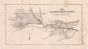
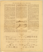
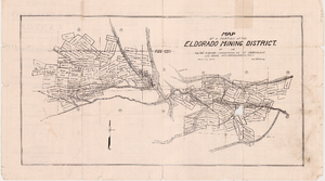
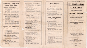
Map of a portion of the Eldorado Mining District, November 1916
Date
1916-11
Description
'Edition No. 2. November 1916.' Map is one side of a folded flyer advertising mines and mining in the Eldorado Canyon district. Transporation options to the area are listed. Scale: 1" = 1000'.
Text
Map of mines owned and operated by Goldfield Deep Mines Company of Nevada, circa 1904-1908
Date
1904 to 1908
Description
Printed on map: 'Boundary in red.'
Image
Plat of the Texas and Lone Star Lodes, May, 1905
Date
1905-05
Description
'Plat of the claim of the Rochester Goldfield Mining Company known as the Texas and Lone Star Lodes, in Goldfield Mining District, Nye County, Nevada containing an area of 36.121 acres. Scale of 300 feet to the inch. Variation 17° east. Surveyed May 6-18, 1905, by H. F. Bruce, U.S. Deputy Mineral Surveyor.' Certification signed by Matthew Kyle, U.S. General Surveyor's Office, Reno, Nevada, November 11, 1905. 'Claim located February 3, 1904; amended December 28, 1904.' 'Mineral Survey No. 2330.' At top of plat: 'Vol 459, P 133, No 45841.'
Text