Search Results
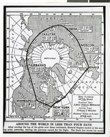
Photograph of a map showing the course of Howard Hughes' Round the World flight, circa 1938
Date
1938
Archival Collection
Description
The black and white view of a map showing the path Howard Hughes took on his Round the World trip.
Image
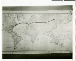
Photograph of a flight path map, July 1938
Date
1938-07
Archival Collection
Description
Description printed on back of photograph: "Close up of map and miniature plane attached showing Hughes' flight to date. 7/38"
Image
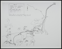
Map of Southen Nevada Geography: map
Date
1900 (year approximate) to 1999 (year approximate)
Archival Collection
Description
From the UNLV Libraries Single Item Accession Photograph Collection (PH-00171). Photo of map-Southern Nevada Geography and Landmark of Armijo's Trace.
Image
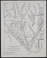
The San Pedro, Los Angeles and Salt Lake Railroad in Southern Nevada: map
Date
1906
Archival Collection
Description
From the UNLV Libraries Single Item Accession Photograph Collection (PH-00171). Plat showing country tributary to S.P.L.A. and S.L. Railroad in Southern Nevada. Compiled by J.T. McWilliams.
Image
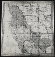
Map of Texas, Oregon, and California: map
Date
1846
Archival Collection
Description
From the UNLV Libraries Single Item Accession Photograph Collection (PH-00171). Published by S. Augustus Mitchell, Philadelphia.
Image
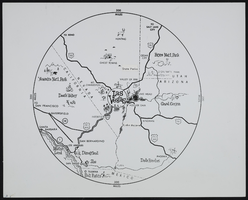
The Magic 300-Mile Circle Map: map
Date
1900 (year approximate) to 1999 (year approximate)
Archival Collection
Description
From the UNLV Libraries Single Item Accession Photograph Collection (PH-00171). The Magic 300-Mile Circle. A map showing Las Vegas as the hub of a 300-mile circle containing the most significant tourist attractions in the southwestern United States.
Image
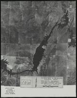
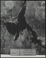
Aerial view of the Bonelli quadrant in Arizona-Nevada: photographic print
Date
1950
Archival Collection
Description
From the Army Mapping Service Aerial Photographs of Southern and Western Nevada (PH-00285). Aerial photographs, composites, and indices. Aerial photographs, Quad. Bonelli 4, U.S. Department of the Interior Geological Survey, Army Map Service. State: Arizona - Nevada. Flight Scale I-47200Project-GS-LJ. Index copied -8-26-50. Flying Comp. -7-26-50
Image
Aerial view of the Bonelli quadrant in Arizona-Nevada: photographic print
Date
1950
Archival Collection
Description
From the Army Mapping Service Aerial Photographs of Southern and Western Nevada (PH-00285). Aerial photographs, composites, and indices. High altitude aerial photographs, Quad. Bonelli, State: Arizona - Nevada. U.S. Geological Survey, Army Map Service. Flight Scale I-47200Project-GS-LJ. Index copied -8-26-50. Flying Comp. -7-26-50
Image
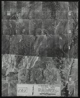
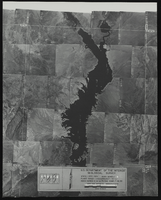
Aerial view of the Bonelli quadrant in Arizona-Nevada: photographic print
Date
1952
Archival Collection
Description
From the Army Mapping Service Aerial Photographs of Southern and Western Nevada (PH-00285). Aerial photographs, composites, and indices. High altitude aerial photographs, Quad. Bonelli 3, State: Arizona - Nevada. U.S. Geological Survey, Army Map Service. Flight Scale I-47200Project-GS-LJ. Index copied -8-26-50. Flying Comp. -7-26-50
Image
Aerial view of the Bonelli quadrant in Arizona-Nevada: photographic print
Date
1950
Archival Collection
Description
From the Army Mapping Service Aerial Photographs of Southern and Western Nevada (PH-00285). Aerial photographs, composites, and indices. High altitude aerial photographs, Quad. Bonelli, State: Arizona - Nevada. U.S. Geological Survey, Army Map Service. Flight Scale I-47200Project-GS-LJ. Index copied -8-26-50. Flying Comp. -7-26-50
Image