Search the Special Collections and Archives Portal
Search Results
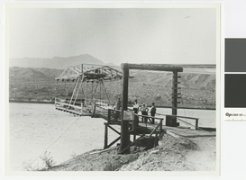
Photograph of Cottonwood Aerial Ferry, 1930-1935
Date
Archival Collection
Description
Cottonwood Aerial Ferry carried customers between Searchlight, Nevada and Chloride, Arizona. It is now under Lake Mohave. Sign with ferry rates: Car $2.00, Truck $2.50, Motorcycle $1.00, Horseman .50, Stock .50, Pedestrian .25
Transcribed Notes: Transcribed from photo sleeve: "Cottonwood Aerial Ferry, from about 1930-1935. This was the last and the most unusual of several ferries that crossed at Cottonwood between Searchlight, Nev. and Chloride, Ariz., these being the two major towns in the area before 1920. Most were conventional barge types similar to the Arivada Ferry shown in another picture. The aerial ferry was powered by an automobile engine mounted on the upper framework, with the operator up with the engine. It was located at the mouth of Painted Canyon, a short distance upriver from the Cottonwood Cove Resort. Courtesy Ella Kay."
Image
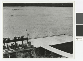
Photograph of Cottonwood Landing on the Colorado River, 1946
Date
Archival Collection
Description
Landing at Cottonwood on the Colorado River
Transcribed Notes: Transcribed from photo sleeve: "Cottonwood Landing, 1946. In 1946 the National Park Service gave a temporary permit to Hurl Emery, then operating the Eldorado Fishing Camp at Eldorado Canyon, to establish a landing at Cottonwood. The dock shown was put in, also a few tent cabins, one serving as a store. It operated under these conditions for several years until a permanent lease was issued by bid to a new operator. Not shown is 16 miles of rough dirt road. Courtesy Ella Kay."
Image
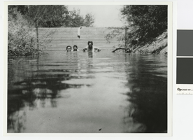
Photograph of Floyd Francis and Jake Beckley in the swimming hole on the Von Tobel and Beckley property, circa 1910
Date
Archival Collection
Description
Floyd Francis (center), Jake Beckley (right), and unidentified man in the "Old Swimming Hole" on the Von Tobel and Beckley property
Transcribed Notes: Transcribed from photo sleeve: "Floyd Francis (center), Jake Beckley (right), and unidentified man (on left) in an old swimming hole formed on the property of Von Tobel and Beckley."; Transcribed background history: "Early Las Vegas History by Florence Lee Jones, April 1969: Creating their own oasis in the Las Vegas Valley was the hobby of the late Ed Von Tobel, Sr., and his partner, the late Jake Beckley, when they came to Las Vegas in 1905 as gay young bachelors. At their ranch in Paradise Valley, where they owned the 120 acres now comprising the Sierra Vista Ranchos, exclusive residential area, they used the facilities at hand to form an 'old swimming hole.' From one of the three wells they drilled they diverted the free-flowing water into a nearby creek bed, built a cement dam to contain the water, and had their own pleasure resort. In this picture, from left, an unidentified man; Floyd Francis, early employee of the Von Tobel Lumber Company; and Jake Beckley, a partner in the fi
Image
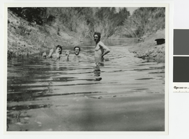
Photograph of Floyd Francis, Jake Beckley, and friend in the swimming hole on the Von Tobel and Beckley property, circa 1910
Date
Archival Collection
Description
Floyd Francis, an unidentified man, and Jake Beckley in the "old swimming hole" on the Von Tobel and Beckley property
Transcribed Notes: Transcribed from photo sleeve: "Another view of Floyd Francis, an unidentified man and Jake Beckley in the swimming hole on the property in Paradise Valley owned by Von Tobel and Beckley."; Transcribed from background history: "Early Las Vegas History by Florence Lee Jones, April 1969: In the years immediately after the auction of lots and the start of Las Vegas in 1905, a swimming pool was unknown in the area - but the late Ed Von Tobel, Sr., and his partner in the lumber business, Jake Beckley, solved that problem, as this picture shows. Von Tobel took this picture, showing from left Floyd Francis, who worked for more than 20 years at the Von Tobel Lumber Company; an unidentified man; and at right, Beckley. At their 120-acre ranch in Paradise Valley, which was a week-end retreat for the partners, they drilled three wells so they could irrigate their fruit orchard and truck garden. One of the wells had such a heavy flow that they dammed up a natural wash and created a swimming pool, a
Image
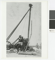
Photograph of a drill rig putting down the hole for the first well in the Las Vegas Heights District, circa 1907
Date
Archival Collection
Description
Drilling in the Las Vegas Heights District with Mr. Booth and Mr. Madison performing the work.
Transcribed Notes: Transcribed from front of photo: "1st well. Vegas Hts. About 1907. Booth & Madison, Drillers."; Transcribed from photo sleeve: "A drill rig which put down the hole for the first well in the Las Vegas Heights District in Las Vegas in 1907. The crew were Booth and Madison."
Image
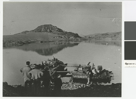
Photograph of Murl Emery work dock with Lake Mead rising in the background, 1935
Date
Archival Collection
Description
Murl Emery work dock, 1935, with Lake Mead rising
Transcribed Notes: Transcribed from back of photo: "Murl Emery work dock 1935 - Lake Rising"
Image
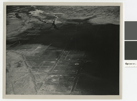
Aerial photograph of Saint Thomas, Nevada, being covered by Lake Mead, June 1938
Date
Archival Collection
Description
Aerial view of St. Thomas, Nevada, being covered by Lake Mead. Stamped on back of photo: Photograph by Bureau of Reclamation, Boulder Canyon Project, Boulder City, Nevada
Image

Photograph of a group of men releasing live rainbow trout into a pond, late 1950s
Date
Archival Collection
Description
Rainbow trout being released into a pond
Transcribed Notes: Transcribed from back of photo: "Dad & [Harold] unloading trout"
Image
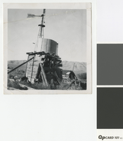
Photograph of water tank in the Nevada desert, pre-1950
Date
Archival Collection
Description
Water tank in the desert. Sign on windmill reads: Fairbanks-Morse Steel Eclipse.
Image
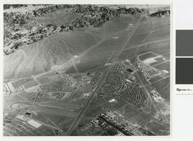
Aerial photograph of Downtown Henderson looking south towards Railroad Pass, circa 1963
Date
Archival Collection
Description
Aerial view of Henderson looking south towards Railroad Pass
Transcribed Notes: Transcribed from photo sleeve: "Aerial view of Downtown Henderson, NV"
Image
