Search Results


Topographic survey map of State Office Complex vicinity, September 25, 1970
Date
1970-09-25
Description
Blueline map, 74 x 110 cm. "Portion SE? SW? Section 27, Township 20 south, Range 61 east, M.D.M. & M., City of Las Vegas, Nev." "This survey was completed on September 25, 1970, at the instance of the state of Nevada Planning Board and correctly shows the elevation of all buildings and other structures." Shows City of Las Vegas Library, Dula Center, Nevada Highway Patrol building, YMCA. and State of Nevada Office Building. Library's copy is missing the lower right corner. Stamped in lower right-hand corner "Stephen F. Turner, Registered land surveyor - State of Nevada, No. 1803."
Image
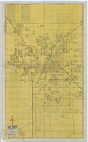
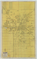
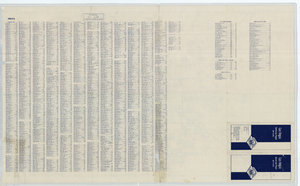
Street map of Las Vegas, North Las Vegas and vicinity, circa 1969
Date
1905-05-22
Description
Color; 100 x 58 cm., folded to 24 x 11 cm. "569." Indexes on verso. Library's copy has a small piece missing along the left-hand side of the map. Original publisher: California State Automobile Association.
Image
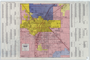
A general map of Las Vegas, 1969
Date
1905-05-22
Description
Color; 60 x 55 cm. on sheet 64 x 96 cm. At top left of map: Map of greater Las Vegas. Includes index.
Image
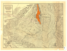
Map of Death Valley and surrounding areas in southern California, southern Nevada and Arizona, 1930
Date
1930
Archival Collection
Description
Col. ; 51 x 69 cm. Oblique perspective map. Relief shown by landform drawings and spot heights. North is toward upper-right corner. "1M--10-33--1846--A.P.Co." printed in lower left corner. Published by the Pacific Coast Borax Company, Los Angeles, California, 1930. Signed by Howard Burke near lower right corner.
Image
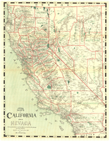
Map of California and Nevada, 1907
Date
1907
Description
Col. ; 57 x 43 cm., folded to 15 x 6 cm. Relief shown by hachures and spot heights. Published and copyrighted bu H.A. Candrian, 1907. "Mrs. H.A. Candrian, Dr'ng"--lower left corner.
Image

Plat of H.F.M & M addition to city of Las Vegas, Clark County, Nevada, comprising the west 1/2 of N.W. 1/4 Sec. 27, Twp. 20 S., R. 61 E., M.D.B & M, March 8, 1924
Date
1924-03-08
Description
Blue-line print ; 74 x 36 cm on sheet 79 x 61 cm. Survey was competed on March 8, 1924. Signed by the owners of the piece of property for the addition Roy W. Martin, Forest R. Mildren, William E. Ferron, and A. W. Ham, signed by the surveyor J.T. McWilliams, and notarized on March 31, 1924. Approved by the Board of City Commissioners and signed by the major W. C. German and by Florence S. Doherty, city clerk, on April 1, 1924. Recorded in Book 1 of plats, page 47. Includes township and range grid.
Image