Search the Special Collections and Archives Portal
Search Results
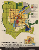
Map showing coordinated general plan for Las Vegas Valley, Planning Area A5, circa 1965-1968
Date
1963 to 1970
Description
Subtitle:'Including Las Vegas, North Las Vegas, Henderson, Boulder City, and the unincorporated areas.' 'Clark County Master Planning Program, Clark County, Nevada.' 'Eisner-Stewart and Associates, Planning Consultants, South Pasadena, California.' Includes inset of Boulder City. Text on verso about the general plan for the Las Vegas Valley, Clark County Master Planning Program Area. Published between 1965 and 1968? Scale [ca. 1:84,269. 1 inch to approximatley 1 1/3 miles].
Text
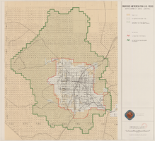
Map showing proposed metropolitan Las Vegas development area, June 24, 1997
Date
1997-06-24
Description
'Data sources: Advanced Planning Division, Clark County, Nevada.' 'Comprehensive Planning, Advanced Planning Division.' 'June 24, 1997.' Shows federal land, metropolitan Las Vegas development area, Las Vegas urban growth boundary and section lines. Scale [ca. 1:154,056. 1 inch to approx. 12,838 feet].
Image
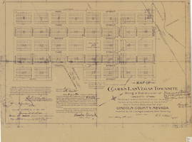
Map of Clark's Las Vegas Townsite, May 8, 1905
Date
1905-05-08
Archival Collection
Description
'Book 1, Page 37.' 'Dated: May 8th, 1905.' Subtitle: 'Being a sub-division of parts of the W.1/2 and the W.1/2 of the N.E.1/4 of Section 34 and the S.1/2 of the S.W.1/4 of Section 27 T.20 S.R. 61 E, Mount Diablo Base and Meridian, Lincoln County, Nevada. A Plat map. Blueline print. Scale [ca. 1:2,400]. 1 in. to 200 feet.
Text
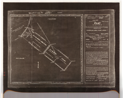
Plat of the Texas and Lone Star Lodes, May, 1905
Date
1905-05
Description
'Plat of the claim of the Rochester Goldfield Mining Company known as the Texas and Lone Star Lodes, in Goldfield Mining District, Nye County, Nevada containing an area of 36.121 acres. Scale of 300 feet to the inch. Variation 17° east. Surveyed May 6-18, 1905, by H. F. Bruce, U.S. Deputy Mineral Surveyor.' Certification signed by Matthew Kyle, U.S. General Surveyor's Office, Reno, Nevada, November 11, 1905. 'Claim located February 3, 1904; amended December 28, 1904.' 'Mineral Survey No. 2330.' At top of plat: 'Vol 459, P 133, No 45841.'
Text
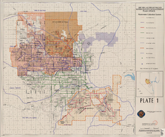
Map showing plan for water quality management update for wastewater collection systems in the Las Vegas Valley, February 20, 1997
Date
1997-02-20
Description
'Plate 1. Source: Clark County Geographic Information Systems Central Repository. Comprehensive Planning, Advanced Planning Division. Feburary 20, 1997.' Scale [ca. 1:95, 040. 1 in.=approx. 1.5 miles]. Shows sewers, force mains, service area boundaries, watershed boundaries, and lift stations. Includes inset location map. Includes township and range grid. Clark County, Nevada, Comprehensive Planning, Advanced Planning Division.
Image
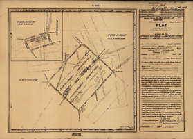
Plat of the claim of George Wingfield, June, 1907
Date
1907-06
Description
'Plat of the claim of George Wingfield, known as the Yankee Doodle and Desert Rose Lodes and Desert Rose Mill Site, in Goldfield Mining District, Esmeralda County, Nevada. Containing an area of 41.318 + 4.841 acres. Scale of 300 feet to the inch. Variation 17° east. Surveyed June 22-25, 1907.' 'Mineral Survey No. 3202 A and B.' 'Pat. # 132432, May 26, 1910.' Certification signed by Matthew Kyle, U.S. General Surveyor's Office, Reno, Nev., December 7, 1907.
Text

Map of Moapa Valley flood channel drainage program for 1940
Date
1940
Archival Collection
Description
Scale [ca. 1:63,360]. 1 in.=1 mile. Blueprint.
Image
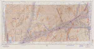
Elko sectional aeronautical chart, September 29, 1959
Date
1959-09-29
Description
52 x 110 cm. Relief shown by gradient tints, contours, and spot heights. Contour interval 1,000 feet. "Aeronautical data on this chart includes data received through Sept. 29, 1959." "Consult appropriate NOTAMS and Radio Facility Charts for supplemental data and current information." "Next edition is scheduled in approximately one year." "Base: Edition of May 1956. Revised Sept. 1958." "Lambert Conformal Conic Projection." "Standard Parallels 33° and 45°." "Elko compiled and printed at Washington, D. C. by the U. S. Coast and Geodetic Survey under authority of the Secretary of Commerce." "Principal sources: U. S. Geological Survey, U. S. Army Corps of Engineers, U. S. Air Force, U. S. Dept. of Agriculture, Civil Aeronautics Administration, and the U. S. Coast and Geodetic Survey." "Base: Edition of May 1956, revised Sept. 1958." "Detailed airport data and other useful information are printed on the back of this chart." Includes text, gradient tints scale and index to adjoining sheets. On verso: text, index map of sectional charts, inset maps of U.S. air defense identification zones and defense area, visual emergency signals, and charts. Original publisher: U.S. Coast and Geodetic Survey, Scale: 1:500,000.
Image
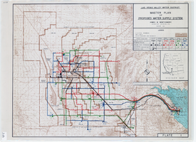
Topographic map of master plan for proposed water supply system for Las Vegas Valley Water District, August 1960
Date
1960-08
Description
Scale [ca. 1:63,360. 1 in. to approx. 1 mile]. Relief shown by contour lines. Includes inset location map of Water District. 'August 1960.' 'Plate 1.' Las Vegas Valley Water District
Image

Longitudinal section map, Montana Tonopah Mine, circa 1900s-1910s
Date
1900 to 1919
Description
'Longitudinal Section, Montana Tonopah Mine showing workings projected on east-west vertical plane.' In lower right corner: 'E.D. North E.M.' 'Photo-litho. Britton & Rey, S.F.'
Image
Pagination
Refine my results
Content Type
Creator or Contributor
Subject
Archival Collection
Digital Project
Resource Type
Material Type
Place
Language
