Search the Special Collections and Archives Portal
Search Results
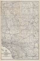
Map of a portion of southern California and southwestern Nevada embracing the arid region of Mojave & Colorado Deserts including Death Valley, circa 1937
Date
1937 (year approximate)
Description
79 x 52 cm. Panel title: Road map of the Mojave and Colorado Deserts including Death Valley National Monument. Index on verso. Relief shown by hachures and spot heights. In lower right-hand corner: Burke Douglas Pflum. "3712."--Lower left-hand corner of copy 1. "C13247."--Lower left-hand corner of copy 2. "1379."--Lower right-hand corner. Originally folded to 28 x 11 cm. On verso: Map showing roads and points of interest in Death Valley and vicinity. Original publisher: The Club.
Image
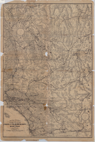
Map of a portion of southern California and southwestern Nevada embracing the arid region of Mojave & Colorado Deserts including Death Valley, circa 1936
Date
1934 to 1938
Description
78 x 52 cm. Relief shown by hachures and spot heights. Panel title: Road map of the Mojave and Colorado Deserts including Death Valley National Monument. In lower right-hand corner: 1379. In lower left-hand corner: Burke-Douglas. Indexes on verso to cities, towns, stations, junctions, resorts and natural features. On verso: Map showing roads and points of interest in Death Valley & vicinity. Originally folded to 27 x 11 cm. Original publisher: The Club.
Image
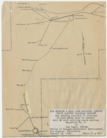
Map showing location of proposed 12-inch water main to connect Well #8 with settling basin serving Reservoir No. 2 at Las Vegas, Nevada, January 16, 1950
Date
1950-01-16
Archival Collection
Description
'Office of Manager-Industrial Development, Los Angeles, California.' Scale: 1" = 600'. 10 3/8 in. x 8 in.
Image
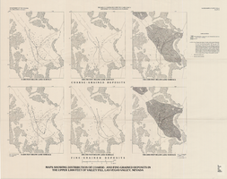
Maps showing distribution of coarse- and fine-grained deposits in the upper 1,000 feet of valley fill, Las Vegas Valley, Nevada, 1981 (Water-supply paper 2320-A, plate 3)
Date
1981
Description
'Department of Interior, U.S. Geological Survey. Water-supply paper 2320-A, plate 3.' 'Prepared in cooperation with the Clark County Department of Comprehensive Planning.' 'Base from U.S. Geological Survey, 1:250,000, Las Vegas and Kingman, 1969.' 'Geology from Malmberg (1965); Longwell and others (1965); and J. R. Harrill, 1976. Lithology by R.W. Plume, 1981.' Contents: Coarse-grained deposits: 0-200 feet below land surface; 200-700 feet below land surface; 700-1,000 feet below land surface -- Fine-grained deposits: 0-200 feet below land surface; 200-700 feet below land surface; 700-1,000 feet below land surface. Scale [ca. 1:316,800. 1 in.=approx. 5 miles]. Series: U.S. Geological Survey water-supply paper
2320-A. Originally published as plate 3 of Ground-water conditions in Las Vegas Valley, Clark County, Nevada. Part I. Hydrogeologic framework / by Russell W. Plume, published by the U.S. Geological Survey in 1989 as Water-supply paper 2320-A.United States Dept. of the Interior, Geological Survey.
2320-A. Originally published as plate 3 of Ground-water conditions in Las Vegas Valley, Clark County, Nevada. Part I. Hydrogeologic framework / by Russell W. Plume, published by the U.S. Geological Survey in 1989 as Water-supply paper 2320-A.United States Dept. of the Interior, Geological Survey.
Image
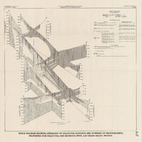
Fence diagram showing lithology of valley-fill deposits and summary of water-bearing properties for valley-fill and bedrock units, Las Vegas Valley, Nevada, 1981 (Water-supply paper 2320-A)
Date
1981
Description
'Department of the Interior, U.S. Geological Survey. Water-supply paper 2320-A, plate 2.' 'Prepared in cooperation with the Clark County Department of Comprehensive Planning.' 'Geology by R.W. Plume, 1981.' Scale [ca. 1:95,040. 1 in.=approx. 1.5 miles]. Series: U.S. Geological Survey water-supply paper
2320-A. Originally published as plate 2 of Ground-water conditions in Las Vegas Valley, Clark County, Nevada. Part I. Hydrogeologic framework / by Russell W. Plume, published by the U.S. Geological Survey in 1989 as Water-supply paper 2320-A. "Prepared in cooperation with the Clark County Department of Comprehensive Planning."
2320-A. Originally published as plate 2 of Ground-water conditions in Las Vegas Valley, Clark County, Nevada. Part I. Hydrogeologic framework / by Russell W. Plume, published by the U.S. Geological Survey in 1989 as Water-supply paper 2320-A. "Prepared in cooperation with the Clark County Department of Comprehensive Planning."
Text

Map of underground workings in Potosi and Central Lodes, May 1906
Date
1906-05
Description
'Scale 20 ft = 1 in.'
Image
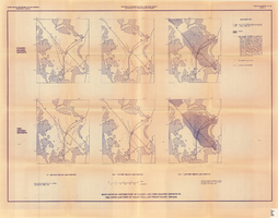
Maps showing distribution of coarse- and fine-grained deposits in the upper 1,000 feet of valley fill, Las Vegas Valley, Nevada, 1981 (Open-file report 84-130, plate 3)
Date
1981
Description
'United States Department of the Interior, Geological Survey. Open-file report 84-130, plate 3.' 'Prepared in cooperation with the Clark County Department of Comprehensive Planning.' 'Base from U.S. Geological Survey, 1:250,000, Las Vegas and Kingman, 1969.' 'Geology from Malmberg (1965); Longwell and others (1965); and J. R. Harrill, 1979. Lithology by R.W. Plume, 1981.' Contents: Coarse-grained deposits: 0-200 feet below land surface; 200-700 feet below land surface; 700-1,000 feet below land surface -- Fine-grained deposits: 0-200 feet below land surface; 200-700 feet below land surface; 700-1,000 feet below land surface. Scale [ca. 1:310,464. 1 in.=approx. 4.9 miles]. Series: Open-file report (Geological Survey (U.S.))
84-130 Originally published as plate 3 of Ground-water conditions in Las Vegas Valley, Clark County, Nevada. Part I. Hydrogeologic framework / by Russell W. Plume, published by the U.S. Geological Survey in 1984 as Open-file report 84-130.
84-130 Originally published as plate 3 of Ground-water conditions in Las Vegas Valley, Clark County, Nevada. Part I. Hydrogeologic framework / by Russell W. Plume, published by the U.S. Geological Survey in 1984 as Open-file report 84-130.
Image

Map of Moapa River Indian Reservation, TPS. 14 & 15 S., RS. 65 & 66 E., M.D.M., Nevada, 1902
Date
1902
Description
As surveyed by V. S. Barber, 1902. Scale = 15 chains to an inch. "H Doc 65 57 2" in lower right corner. Relief shown by hachures. Shows township and range grid.
Image
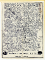
Map showing Tonopah & Tidewater Railroad Company line from Ludlow, California to Goldfield, Nevada, circa 1907
Date
1905 to 1909
Description
Scale not given. Relief shown by hachures and spot heights. Shows township and range grid. Shows mines, camps and ranches. Tonopah & Tidewater Railroad Company. Library's copy mounted on linen.
Image
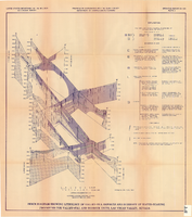
Fence diagram showing lithology of valley-fill deposits and summary of water-bearing properties for valley-fill and bedrock units, Las Vegas Valley, Nevada, 1981 (Open-file report 84-130)
Date
1981
Description
'United States Department of the Interior, Geological Survey. Open-file report 84-130, plate 2.' 'Prepared in cooperation with the Clark County Department of Comprehensive Planning.' 'Geology by R.W. Plume, 1981.' Scale [ca. 1:31,680. 1 in.=approx. .5 miles]. . Series: Open-file report (Geological Survey (U.S.))
84-130. Originally published as plate 2 of Ground-water conditions in Las Vegas .Valley, Clark County, Nevada. Part I. Hydrogeologic framework / by Russell W. Plume, published by the U.S. Geological Survey in 1984 as Open-file report 84-130. "Prepared in cooperation with the Clark County Department of Comprehensive Planning."
84-130. Originally published as plate 2 of Ground-water conditions in Las Vegas .Valley, Clark County, Nevada. Part I. Hydrogeologic framework / by Russell W. Plume, published by the U.S. Geological Survey in 1984 as Open-file report 84-130. "Prepared in cooperation with the Clark County Department of Comprehensive Planning."
Text
Pagination
Refine my results
Content Type
Creator or Contributor
Subject
Archival Collection
Digital Project
Resource Type
Material Type
Place
Language
