Search the Special Collections and Archives Portal
Search Results
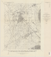
Map of part of Las Vegas Valley, Nevada, showing the approximate altitude of the water table in the near-surface reservoir in February 1956
Date
1965
Description
Genre/Form: Thematic maps. Scale 1:62,500 (W 115°15´--W 115°00´/N 36°15´--N 36°00´). 1 map ; 45 x 36 cm. Series: Water-supply paper (Washington, D.C.) ; 1780. Relief shown by contours. Originally published as plate 8 of Available water supply of the Las Vegas ground-water basin, Nevada, by Glenn T. Malmberg, published by the Geological Survey in 1965 as its Water-supply paper 1780. Includes township and range lines. Interior, Geological Survey
Image
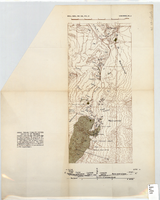
Topographic map of area near Virgin River south of St. Thomas, Nevada, 1936
Date
1936
Archival Collection
Description
Scale [ca. 1:110,880. 1 in. to approx. 1.75 miles]. 'Bull. Geol. Soc. Am., Vol. 47. Longwell Pl. 4.' Published as plate 4 of Longwell's Geology of the Boulder Reservoir floor, Arizona-Nevada. Geological Society of America
Image
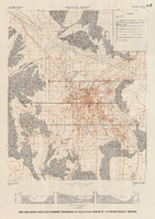
Map and basin profiles showing thickness of valley-fill deposits, Las Vegas Valley, Nevada, 1981 (color variation)
Date
1981
Description
At top of map: 'Department of the Interior. U.S. Geological Survey. Water supply paper2320-A, plate 5.' 'Prepared in cooperation with the Clark County Department of Comprehensive Planning.' At bottom of map: 'Base from U.S. Geological Survey, 1:100,000, Boulder City, Ariz.-Nev., Las Vegas, Nev.-Calif., Mesquite Lake, Nev.-Calif., 1978; Lake Mead, Nev.-Ariz., 1979.' 'Geology from Malmberg (1965); Longwell and others (1965); Haynes (1967); Bell and Smith (1980); Bell (1981) and J. R. Harrill, 1976. Thickness of valley-fill deposits by R.W. Plume, 1981.' Includes three profiles. Shows township and range lines. Scale 1:100.000 (W 115°30´--W 115°00´/N 36°30´--N 36°00´). Series: U.S. Geological Survey water-supply paper, 2320-A. Originally published as plate 5 of Ground-water conditions in Las Vegas Valley, Clark County, Nevada. Part I. Hydrogeologic framework / by Russell W. Plume, published by the U.S. Geological Survey in 1989 as Water-supply paper 2320-A.
Image
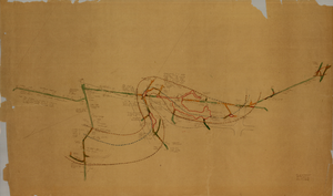
Map of the fourth level of the Clermont Mine, elevation 5228.8 feet, Goldfield, Nevada, circa 1902-1908
Date
1902 to 1908
Description
'Clermont, 4th level, el. 5228.8.' Hand-drawn, hand-colored and annotated map showing the fouth level of the Clermont Mine.
Image
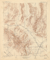
Topographic map of the Las Vegas Valley and surrounding northern and western mountain ranges, 1943
Date
1943
Description
'Edition of Mar. 1908, reprinted 1943.' 'E.M. Douglas, Geographer in charge. Topography and triangulation by R.H. Chapman, B.D. Stewart, J.E. Blackburn and D.F.C. Moor. Surveyed in 1906-1907.' Scale 1:250,000 ; polyconic proj. (W 116°00´--W 115°00´/N 37°00´--N 36°00´). Relief shown by contours and spot heights. 'Contour interval 100 feet.' 'Datum is mean sea level.' Includes township and range lines. Text and illustrations from the Topographic maps of the United States series on verso. Series: The topograhic maps of the United States. Map includes the Desert Range; Sheep Range; Pintwater Range; Las Vegas Range; Spring Mountains; Indian Springs Valley; Spotted Range. United States, Dept. of the Interior, Geological Survey
Text
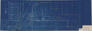
Map to accompany agreement with Willie T. Stewart covering lease of land at Las Vegas, Nevada, August 10, 1943
Date
1943-08-10
Archival Collection
Description
'Las Vegas Land and Water Company.' 'Office of Vice President, Los Angeles, California, August 10, 1943.' Relief shown by contours. Cadastral map. Scale [ca. 1:7,200]. 1 in.=600 feet..
Image
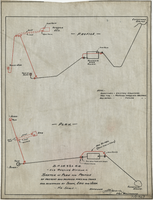
Sketch of plan and profile of present and proposed pipes and tanks and reservoirs at Sloan, Erie and Jean, Nevada, circa 1910s-1920s
Date
1910 to 1929
Archival Collection
Description
'No scale. Approved E.M. Jessup, Engr. Maintenance. 7-R-463.'
Image
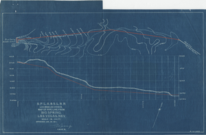
Blueprint map showing proposed water pipeline from Big Spring to Las Vegas, Nevada, January 24, 1911
Date
1911-01-24
Archival Collection
Description
'S.P.L.A.&S.L.R.R. Los Angeles Division. Map of pipe line from Big Spring. Las Vegas, Nev. Approved: Jan. 24, 1911. E.M. Jessup, E.M. of W.' In lower right corner: '4-U-323.' Scale [ca. 1:2,400] 1 in.=200 feet. Relief shown by contours. North is to upper right.
Image

Map showing location of proposed water lines serving Industrial Tract No. 1, Las Vegas Nevada, March 21, 1931
Date
1931-03-21
Archival Collection
Description
'Office of Ind'l. Engineer, Los Angeles, California.' 'Dwg. No. 568.' Scale: 1" = 100'.
Image
Pagination
Refine my results
Content Type
Creator or Contributor
Subject
Archival Collection
Digital Project
Resource Type
Material Type
Place
Language
