Search the Special Collections and Archives Portal
Search Results
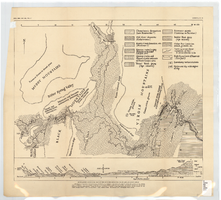
Generalized geological map of the Boulder Reservoir floor and adjacent areas, 1936
Date
1936
Archival Collection
Description
At top of map: 'Bull. Geol. Soc. Am., Vol. 47. Longwell, Pl. 21.' Scale [ca. 1:190,080. 1 in. to approx. 3 miles]. Published as plate 21 in Longwell's Geology of the Boulder Reservoir floor, Arizona-Nevada (1936). Includes a cross-section.
Image
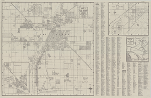
Map of Las Vegas and vicinity, including Henderson and Boulder City, Nevada, 1958
Date
1958
Description
53 x 52 cm. on sheet 56 x 87 cm. Includes inset maps of Boulder City, Henderson, Nellis Air Force Base and Las Vegas area. Map was probably published in 1958 because it shows the Stardust Hotel and Casino, which opened in 1958, but not the Convention Center, which opened in 1959. Includes index. Original publisher: Map Corporation of America.
Image
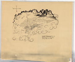
Hand-drawn map of Las Vegas, Nevada, circa 1855
Date
1850 to 1859
Description
Not drawn to scale. Relief shown pictorially. Facsimile of manuscript map. Oriented with north to left. Shows Las Vegas Mormon Fort, desert, mountains.
Image
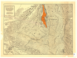
Map of Death Valley and surrounding areas in southern California, southern Nevada and Arizona, 1930
Date
1930
Archival Collection
Description
Col. ; 51 x 69 cm. Oblique perspective map. Relief shown by landform drawings and spot heights. North is toward upper-right corner. "1M--10-33--1846--A.P.Co." printed in lower left corner. Published by the Pacific Coast Borax Company, Los Angeles, California, 1930. Signed by Howard Burke near lower right corner.
Image
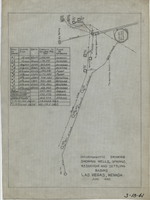
Diagrammatic drawing showing wells, springs, reservoir and settling basins, Las Vegas, Nevada, June 1942
Date
1942-06
Archival Collection
Description
Hand-drawn in pencil on tracing cloth. "June 1942." Also shows pipelines and power lines. Includes a hand-written table showing the number of the well or spring, casing size, depth, capacity in gallons per day, and whether it is pump or artesian. "3-18-41"--Written in black grease pencil in lower right corner of map.
Text

Map showing possible industrial users' connections to railroad pipelines in Las Vegas, Nevada, December 4, 1930
Date
1930-12-04
Archival Collection
Description
Stamped portion near lower right corner reads 'Union Pacific System, L.A. & S.L. R.R. Scale: 1" = 100'. Date: 12-4-30. Office Division, Eng'r. Los Angeles. Drg. No. 916.' 10 3/4 in. x 33 3/4 in. Scale: 1" = 100"..
Image

Map showing water connection for Moapa School District No. 17, Moapa, Nevada, August 1920
Date
1920-08
Archival Collection
Description
'Exhibit A.' 'L.A. & S.L. R.R. Co., Los Angeles Division.' 'August 1920.' 'Approved, [signed] C.F. Miller, Div. Engr.' '2-W-49' hand-printed in lower right corner.'Audit # 3309 12/31/24" hand-printed in lower left margin. Scale: 1 in. = 100 ft
Image
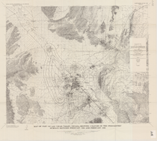
Map of part of Las Vegas Valley, Nevada, showing changes in the piezometric surface between February 1955 and February 1956
Date
1965
Description
Relief shown by contours. Includes township and range lines. Scale 1:96,000 (W 115°30´--W 114°45´/N 36°30´--N 36°00´). Series: Water-supply paper (Washington, D.C.)
1780. Originally published as plate 5 of Available water supply of the Las Vegas ground-water basin, Nevada, by Glenn T. Malmberg, published by the Geological Survey in 1965 as its Water-supply paper 1780.
1780. Originally published as plate 5 of Available water supply of the Las Vegas ground-water basin, Nevada, by Glenn T. Malmberg, published by the Geological Survey in 1965 as its Water-supply paper 1780.
Image
Pagination
Refine my results
Content Type
Creator or Contributor
Subject
Archival Collection
Digital Project
Resource Type
Material Type
Place
Language

