Search Results
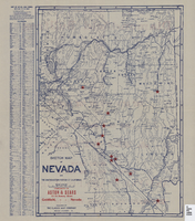
Sketch map of Nevada and the southeastern portion of California, 1906
Date
Description
Image
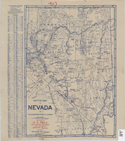
Sketch map of Nevada and the southeastern portion of California, 1906
Date
Description
Image

Geologic map of Las Vegas Valley, Nevada, 1982
Date
Description
2320-A. Originally published as plate 1 of Ground-water conditions in Las Vegas Valley, Clark County, Nevada. Part I. Hydrogeologic framework / by Russell W. Plume, published by the U.S. Geological Survey in 1989 as Water-supply paper 2320-A.
Image
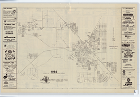
Street map of Henderson, Nevada, 1982
Date
Description
Image
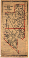
Map of Lincoln County, Nevada, 1908
Date
Description
'Map of Lincoln County, Nevada. Compiled by H.E. Freudenthal from official surveys. Copyright, 1908, by H.E. Freudenthal.' Relief shown by hachures and spot heights. Shows range and township grid. Shows towns, railroads, proposed railroads, wagon roads and springs. Scale [ca. 1:380,160]. 1 in. to approx. 6 miles (W 116°--W 114°/N 39°--N 35°).
Image
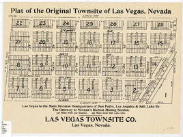
Plat of the original townsite of Las Vegas, Nevada, circa 1905
Date
Description
'Las Vegas is the main division headquarters of San Pedro, Los Angeles & Salt Lake Ry. The gateway to Nevada's richest mining section. 336 miles from Los Angeles. 444 miles from Salt Lake City.' Second copy available in the J.T. McWilliams manuscript collection.
Image
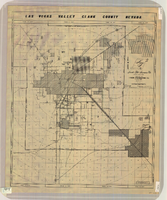
Map of Las Vegas Valley, Clark County, Nevada, circa 1950-1956
Date
Description
Image
General map of Las Vegas, Nevada, circa 1957
Date
Description
distributed by Las Vegas Nevada Chamber of Commerce . Scale (ca. 1:39,000. 1 in. to approx. 3,250 ft.].
Text

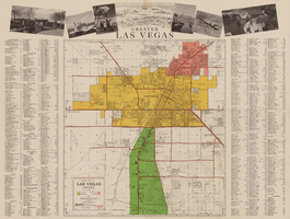
Map of metropolitan Las Vegas, Nevada area, circa 1957
Date
Description
Text
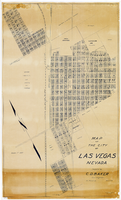
Map of the city of Las Vegas, Nevada, March 1, 1927
Date
Description
Image