Search the Special Collections and Archives Portal
Search Results
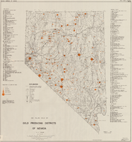
Map showing gold producing districts of Nevada, January 1967
Date
1967-01
Description
Scale 1:1,000,000. Series: Map (Nevada Bureau of Mines). 'January 1967.'
Text
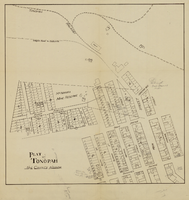
Plat of Tonopah, Nye County, Nevada, circa 1905
Date
1903 to 1907
Description
Plat of properties in downtown Tonopah, Nevada. Notes handwritten in pencil. Southern Nevada Mining Map Collection
Image
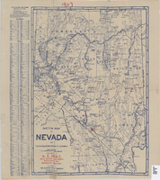
Sketch map of Nevada and the southeastern portion of California, 1906
Date
1906
Description
1907 written in red pencil at top of map. 41 x 29 cm. Relief shown by hachures. Copyright held by George S. Clason. Includes index. "Compliments of A.E. Holt, real estate and mines, Bullfrog Mining Dist., Rhyolite, Nevada." Red star indicates location of A.E. Holt company. Shows railroad routes. Library's copy has "1907" printed with brown crayon in upper margin and has four sets of two holes punched in a vertical line along the right third of the map. Original publisher: Clason Map Co..
Image
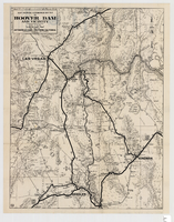
Map showing automobile routes to Hoover Dam and vicinity, circa 1934
Date
1930 to 1938
Description
'Prepared by the Automobile Club of Southern California.' 'burke' in lower right corner. '1352' in circle in lower left corner. Relief shown by hachures and spot heights. Shows mines, ranches, and springs. Scale [ca. 1:443,520] (W 115°30--W 114°--N 36°30/N 35°)
Image
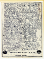
Map showing Tonopah & Tidewater Railroad Company line from Ludlow, California to Goldfield, Nevada, circa 1907
Date
1905 to 1909
Description
Scale not given. Relief shown by hachures and spot heights. Shows township and range grid. Shows mines, camps and ranches. Tonopah & Tidewater Railroad Company. Library's copy mounted on linen.
Image
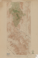
Topographic map of Goodsprings quadrangle, Nevada and California, 1919
Date
1919
Description
'R.B. Marshall, Chief Geographer; Geo. R. Davis, Geographer in charge; Topography by N.E. Ballmer and Roscoe Reeves; Control by J.E. Blackburn and L.F. Biggs. Surveyed in 1915-1916.' 'Edition of 1919.' Relief shown by hachures and spot heights. Title in lower right margin: Goodsprings. In center of top margin: Topography. Includes compilation diagram. Indicates location and density of cedar trees. Shows small portion of San Bernardino County, California. Published by U.S. Geological Survey. Scale 1:62,500 (W 115°35'00"--W 115°24'00"/N 36°02'30"--N 35°42'30"). 'Contour interval 50 feet. Datum is mean sea level.'
Text
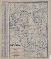
Sketch map of Nevada and the southeastern portion of California, 1906
Date
1906
Description
42 x 30 cm., fold. to 23 x 11 cm. Relief shown by hachures. Copyright: George S. Clason. "Compliments of D. Mackinzie & Company Incorporated, Mine Operators and Commission Brokers, Goldfield, Nevada." Company's locations in Goldfield and in Greenwater, California, are marked with red circles on the map. Includes index. Shows railroad routes. Original publisher: Clason Map Co..
Image
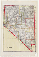
Map of Nevada, circa 1909
Date
1907 to 1911
Description
'Geo. F. Cram, engraver and publisher.' Scale [ca. 1:1,584,000. 1 in. to approx. 25 miles] (W 120°--W 114°/N 42°--N 35°). Relief shown by hachures and spot heights. Counties outlined in color. Shows railroads, forest reserves, mines, Indian reservations, and springs. Shows range and township grid. Indexes on verso to both Nevada and Utah maps. Atlas p. numbers in right margin: 124-125. G.F. Cram.
Text
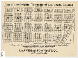
Plat of the original townsite of Las Vegas, Nevada, circa 1905
Date
1905 (year approximate)
Description
'Las Vegas is the main division headquarters of San Pedro, Los Angeles & Salt Lake Ry. The gateway to Nevada's richest mining section. 336 miles from Los Angeles. 444 miles from Salt Lake City.' Second copy available in the J.T. McWilliams manuscript collection.
Image
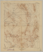
Map of Kawich Quadrangle, Nye County, Nevada, June 1908
Date
1908-06
Description
At upper left corner: 'Department of the Interior, U.S. Geological Survey.' 'E. M. Douglas, geographer; R. G. Chapman, in charge of section; triangulation and topography by R. H. Chapman and B. D. Stewart. Surveyed in 1905.' 'Engraved April 1906 by U.S.G.S.' 'Edition of June 1908, repritned 1929.' 'Polyconic projection. North American datum.' Guide to Topographic Maps of the United States series on map verso. UNLV Special Collections Southern Nevada Mining Map Collection
Text
Pagination
Refine my results
Content Type
Creator or Contributor
Subject
Digital Project
Resource Type
Year
Material Type
Place
Language
