Search the Special Collections and Archives Portal
Search Results
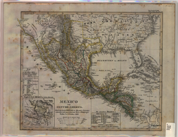
Map of Mexico and Central America, 1828
Date
1828
Description
Includes southwestern and southeastern United States and parts of the Caribbean islands. 'Nach den besten Hülfsmitteln in Mercators Projection entworfen und gezeichnet vom Pr.L. v. Stülpnagel. Gotha, bei J. Perthes, 1828.' Scale ca. 1:14,000,000 ; Mercator projection. Relief shown by hachures. Prime meridian: Washington, D.C. Inset: 'Umgeb d. Stadt Mexico in 4 fachen Maasstab [sic].' Hand colored. In upper right corner: 'Neue Ausgabe No. LVIII. Stielers Hand-Atlas (no.47b).' Includes index. Includes southern United States and part of West Indies. J. Perthes
Image
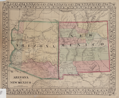
Map of Arizona and New Mexico, 1867
Date
1867
Description
26 x 32 cm. Relief shown by hachures. "Entered according to act of Congress in the year 1867 by S. Augustus Mitchell in the Clerks Office of the District Court for the Eastern District of Pennsylvania." Includes decorative border of grape vines. Shows Tucson as capital of Arizona; shows various trails including Cook's Wagon Route, Marcy's Route, and Kearney's Route. Written in pencil in lower right corner: 135. Original publisher: S.A. Mitchell.
Image
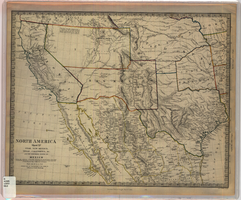
Map of Utah, New Mexico, Texas, California, Indian territory, and the northern states of Mexico, 1852
Date
1852-01-01
Description
At head of title: 'North America, sheet XV.' 'Published under the superintendence of the Society for Diffusion of Useful Knowledge.' At bottom center of map:'London, Charles Knight, Jany. 1st, 1852.' At bottom right of map: ' J. & C. Walker Sculpt.' Scale [1:7,500,000] 1 degree to 68.89 English miles (W 125°--W 92°/N 43°30?--N 22°30?). Relief shown by hachures. Atlas page number in lower margin: 144. Boundaries hand colored. Includes notes, locations of Indian tribes, population statistics. Charles Knight.
Image
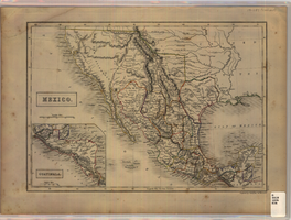
Map of Mexico, circa 1830s-1840s
Date
1830 to 1849
Description
'Engraved by S. Hall, Bury Strt., Bloomsby.' Inset map: Guatimala [sic] (including Honduras and Belize). Includes area of Southwestern states. Scale [ca. 1:12,400,000. 1 in. to approx. 200 miles] (W 125°-- W 85°/N 40°--N 15°). Relief shown by hachures. Prime meridian: Greenwich. Hand colored. 'XLIX'--outside of border at the lower right-hand. Published between 1836 and 1845?
Image
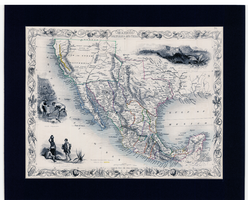
Map of Mexico, California and Texas, 1851
Date
1851
Description
'The map drawn and engraved by J. Rapkin.' Scale [ca. 1:14,256,000. 1 in. to approx. 225 miles] (W125°-- W80°/N 42°--N 15°). Relief shown by hachures. Prime meridian: Greenwich. Hand colored. Includes illustrations: Gold washing -- Mexican peasantry --Ruins at Uxmal, Yucatan. Includes decorative border. Library's copy is matted. Originally published as Map 70 of The Illustrated Atlas And Modern History Of The World, Geographical, Political, Commercial & Statistical, edited by R. Montgomery Martin, Esq., London & New York, J. & F. Tallis, 1851. Illustrated atlas and modern history of the world, geographical, political, commercial & statistical
Image
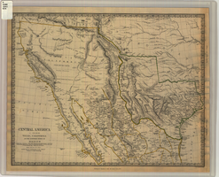
Map of Texas, California, New Mexico and the northern states of Mexico, October 15, 1842
Date
1842-10-15
Description
'Published under the superintendence of the Society for Diffusion of Useful Knowledge.' 'Published by Chapman & Hall, 186 Strand, 15 Oct. 1842.' 'J. & C. Walker, Sculpt.' Scale [ca. 1:7,600,000]. 1 in. to ca. 120 miles (W 125°--W 91°/N 43°--N 23° 30?). 1 map ; 31 x 39 cm. Relief indicated by hachures and spot heights. Shows elevations in yards. Includes notes on exploring expeditions, etc. Borders hand colored. Chapman & Hall.
Image
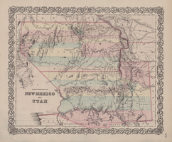
Map of territories of New Mexico and Utah, 1855
Date
1855
Description
29 x 36 cm. Shows natural features, and populated places, wagon route, proposed railroad routes and explorers' routes. Relief shown by hachures. Prime meridians: Greenwich and Washington. "Entered according to act of Congress in the year 1855 by J.H. Colton & Co in the Clerk's Office of the District Court of the U.S. for the Southern District of New York." Hand colored. Atlas p. number in lower-right margin: 51. Decorative border. The geographic region of Southwest is referred to as the New Southwest. Original publisher: J.H. Colton .
Image
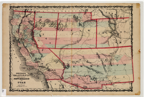
Map of California and territories of New Mexico and Utah, circa 1861
Date
1859 to 1862
Description
'Compiled, drawn, and engraved under the supervision of J.H. Colton and A.J. Johnson.' Relief shown by hachures and spot heights. Scale [ca. 1:3,041,280]. 1 in. to approx. 48 miles (W 124°--W 103°/N 42°--N 31°). Hand colored
Prime meridians: Greenwich and Washington
Plates 54 & 55 removed from Johnson's New illustrated family atlas of the world, with descriptions geographical, statistical and historical ... New York, 1862
Title page of atlas.
Prime meridians: Greenwich and Washington
Plates 54 & 55 removed from Johnson's New illustrated family atlas of the world, with descriptions geographical, statistical and historical ... New York, 1862
Title page of atlas.
Image
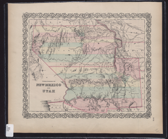
Map showing the territories of New Mexico and Utah, 1855
Date
1855
Description
'Entered according to Act of Congress in the year 1855 by J.H. Colton & Co. in the Clerk's Office of the Dist. Court of the U.S. for the South'n. Dist. of New York.' Scale [ca. 1:4,752,000. 1 in. to approx. 75 miles] (W 120°--W 102°/N 43°--N 32°). Shows natural features, and populated places, wagon route, proposed railroad routes and explorers' routes. Relief shown by hachures. Prime meridians: Greenwich and Washington.Hand colored. Atlas p. number in lower-right margin: 51. Decorative border. J.H. Colton & Co.
Image
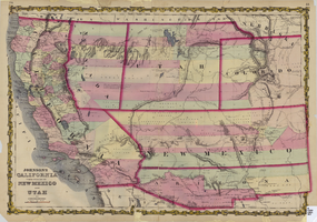
Map of California and territories of New Mexico and Utah, circa 1861
Date
1856 to 1866
Description
40 x 60 cm. Relief shown by hachures and spot heights. Prime meridians: Greenwich and Washington. Atlas plate numbers 54 and 55 in the upper corners. Shows forts, trails, exploration routes, drainage, mail steamship routes, physical features, Indian tribes, and historic sites. The geographic region of Southwest is referred to as the New Southwest. Original publisher: Johnson .
Image
Pagination
Refine my results
Content Type
Creator or Contributor
Subject
Archival Collection
Digital Project
Resource Type
Material Type
Place
Language
