Search the Special Collections and Archives Portal

Search Results
Display    Results Per Page
Displaying results 91 - 100 of 123

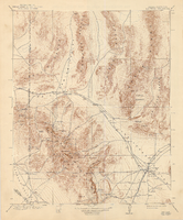
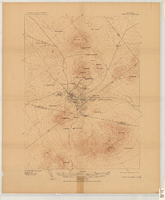
Tonopah, Nevada mining map, March 1904

Date

1904-03

Description

'U.S. Geological Survey, George Otis Smith, Director.' 'R.U. Goode, Geographer in charge. Triangulation by U.S. Coast and Geodetic Survey. Topography by W.J. Peters. Surveyed in 1902-1903.' 'Edition of Mar. 1904, reprinted Apr. 1910.' Oriented with north toward the upper left. Relief shown by contours and hachures. Scale 1:12,000 (W 117°14´--W 117°12´/N 38°05´--N 38°03´)

Text

Topographic map of the Las Vegas Valley and surrounding northern and western mountain ranges, 1943

Date

1943

Description

'Edition of Mar. 1908, reprinted 1943.' 'E.M. Douglas, Geographer in charge. Topography and triangulation by R.H. Chapman, B.D. Stewart, J.E. Blackburn and D.F.C. Moor. Surveyed in 1906-1907.' Scale 1:250,000 ; polyconic proj. (W 116°00´--W 115°00´/N 37°00´--N 36°00´). Relief shown by contours and spot heights. 'Contour interval 100 feet.' 'Datum is mean sea level.' Includes township and range lines. Text and illustrations from the Topographic maps of the United States series on verso. Series: The topograhic maps of the United States. Map includes the Desert Range; Sheep Range; Pintwater Range; Las Vegas Range; Spring Mountains; Indian Springs Valley; Spotted Range. United States, Dept. of the Interior, Geological Survey

Text

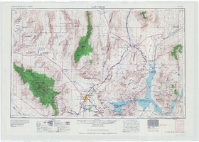
Topographic map of the Las Vegas Valley area, 1959

Date

1959

Description

Scale 1:250,000 ; Transverse Mercator proj. (W 116°--W 114°/N 37°--N 36°) ; 1 map : col. ; 45 x 72 cm ; Relief shown by contours and spot heights. Contour interval 200 feet ; Margin title ; "Compiled in 1955 by photogrammetric methods by U.S. Coast and Geodetic Survey and from Nevada 1:48,000 and 1:62,500, USGS, 1952-54, and Nevada 1:50,000, CE, 1952. Planimetric detail revised by photo-planimetric methods. Horizontal and vertical control by USGS, USC& GS, and CE. Photography field annotated 1954. Road data 1954." ; Shows townships and ranges ; Gives 1955 declination from true north ; Includes location diagram, reliability diagram, and sectionalized township map ; Filing title: Las Vegas, Nevada; Arizona; California ; Interior--Geological Survey

Image

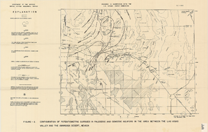
Map showing configuration of potentiometric surfaces in Paleozoic and Cenozoic aquifers in the area between the Las Vegas Valley and the Amargosa Desert, Nevada, 1963

Date

1963

Description

'Department of the Interior, United States Geological Survey. TEI-840.' 'Prepared in cooperation with the U.S. Atomic Energy Commission.' 'Contours in northwest Las Vegas Valley from Malmberg, 1961.' Relief shown by contours. Shows township and range lines. Scale [ca. 1:253,440. 1 in.=aprrox. 4 miles] (W 114°00´--W 115°00´--N 37°00´/N 36°00´). Originally published in A summary of the ground-water hydrology of the area between the Las Vegas Valley and the Amargosa Desert, Nevada : with special reference to the effects of possible new withdrawals of ground water / by Isaac J. Winograd, published by the U.S. Geological Survey in 1963 as number 840 of the Trace elements investigations report.

Image

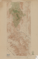
Topographic map of Goodsprings quadrangle, Nevada and California, 1919

Date

1919

Description

'R.B. Marshall, Chief Geographer; Geo. R. Davis, Geographer in charge; Topography by N.E. Ballmer and Roscoe Reeves; Control by J.E. Blackburn and L.F. Biggs. Surveyed in 1915-1916.' 'Edition of 1919.' Relief shown by hachures and spot heights. Title in lower right margin: Goodsprings. In center of top margin: Topography. Includes compilation diagram. Indicates location and density of cedar trees. Shows small portion of San Bernardino County, California. Published by U.S. Geological Survey. Scale 1:62,500 (W 115°35'00"--W 115°24'00"/N 36°02'30"--N 35°42'30"). 'Contour interval 50 feet. Datum is mean sea level.'

Text

Topographic map of Nevada-California, Las Vegas quadrangle, March 1908

Date

1908-03

Description

'Edition of Mar. 1908.' 'E.M. Douglas, geographer in charge; Topography and triangulation by R.H. Chapman, B.D. Stewart, J.E. Blackburn, and D.F.C. Moor. Surveyed in 1906-1907.' Scale 1:250,000 (W 116°00--W 115°00/N 37°00--N 36°00). Relief shown by contours and spot heights. Title in lower-right corner: Las Vegas. Contour interval 100 feet. Datum is mean sea level. "Topography"--Center of top margin. Text about the Topographic Maps of the United States series and symbols used on map on verso. U.S. Geological Survey

Text

Map of Lincoln County, Nevada and Mohave County, Arizona area, 1892

Date

1892

Description

'Henry Gannett, chief geographer ; A.H. Thompson, geographer in charge ; triangulation by H.M. Wilson ; topography by H.M. Wilson and Powell survey.' 'Edition of Mar. 1892, reprinted 1929.' Handwritten legend on right-side margin of map. Original publisher: Dept. of the Interior, U.S. Geological Survey. Scale 1:250,000
polyconic proj. (W 115°--W 114°/N 37°--N 35°).

Image
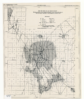
Map of part of Las Vegas Valley showing contours of the composite piezometric surface during the spring of 1944, and specific capacities of wells tapping the confined water

Date

1948

Description

Relief shown by contours. Includes range and township grid. Shows springs and wells. Scale [ca. 1:67,162. 1 in. to approx. 1.06 miles]. Series: Water resources bulletin (Carson City, Nev.)
no. 5. Originally published as plate 8 in Geology and water resources of Las Vegas, Pahrump, and Indian Spring Valleys, Clark and Nye Counties, Nevada by George B. Maxey and C.H. Jameson, which is number 5 of the Water resources bulletin published by the Nevada Office of the State Engineer.

Image
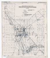
Map of part of Las Vegas Valley showing the piezometric surface of the "near-surface" water during the spring of 1946 by contours, and areas of discharge by evaporation and transpiration

Date

1946

Description

Relief shown by contours. Includes range and township grid. Shows springs, wells and areas of discharge. Scale [ca. 1:67,162. 1 in. to approx. 1.06 miles]. Series: Water resources bulletin (Carson City, Nev.)
no. 5. Originally published as plate 7 in Geology and water resources of Las Vegas, Pahrump, and Indian Spring Valleys, Clark and Nye Counties, Nevada by George B. Maxey and C.H. Jameson, which is number 5 of the Water resources bulletin published by the Nevada Office of the State Engineer.

Image

Topographic map of Nevada-California, Las Vegas quadrangle, 1951

Date

1951

Description

'Edition of Mar. 1908, reprinted 1951.' 'E.M. Douglas, geographer in charge; Topography and triangulation by R.H. Chapman, B.D. Stewart, J.E. Blackburn, and D.F.C. Moor. Surveyed in 1906-1907.' Scale 1:250,000 ; polyconic proj. (W 116°00--W 115°00/N 37°00--N 36°00). Relief shown by contours and spot heights. Title in lower-right corner: Nev.-Calif., Las Vegas. Contour interval 100 feet. Datum is mean sea level. U.S. Geological Survey

Image