Search Results
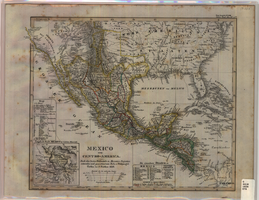
Map of Mexico and Central America, 1828
Date
Description
Includes southwestern and southeastern United States and parts of the Caribbean islands. 'Nach den besten Hülfsmitteln in Mercators Projection entworfen und gezeichnet vom Pr.L. v. Stülpnagel. Gotha, bei J. Perthes, 1828.' Scale ca. 1:14,000,000 ; Mercator projection. Relief shown by hachures. Prime meridian: Washington, D.C. Inset: 'Umgeb d. Stadt Mexico in 4 fachen Maasstab [sic].' Hand colored. In upper right corner: 'Neue Ausgabe No. LVIII. Stielers Hand-Atlas (no.47b).' Includes index. Includes southern United States and part of West Indies. J. Perthes
Image

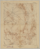
Topographic map of the Las Vegas Valley area, 1959
Date
Description
Image

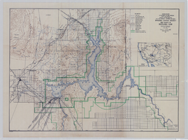
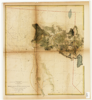
Map showing U.S. Bureau of Reclamation Region 3 projects in Arizona, California, Nevada, New Mexico and Utah, September 1967
Date
Description
Image

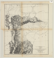
Maps of explorations and surveys for a railroad route from the Mississippi River to the Pacific Ocean, 1855
Date
Description
Image
Map of Kawich Quadrangle, Nye County, Nevada, June 1908
Date
Description
Text
Topographic map of Boulder Canyon Project, Boulder Dam area, 1940
Date
Description
Image
From the valley of Green River to the Great Salt Lake
Date
Description
Image
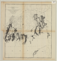
From the Great Salt Lake to the Humboldt Mountains
Date
Description
Image
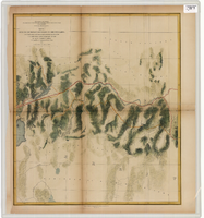
From the Humboldt Mountains to the Mud Lakes
Date
Description
Image
From the valley of the Mud Lakes to the Pacific Ocean
Date
Description
Image