Search Results
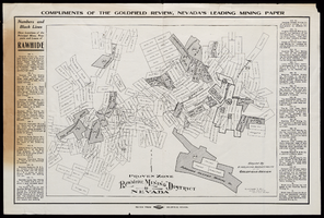
Map of Rawhide Mining District, Nevada, circa 1908
Date
1905 to 1911
Description
'Numbers and black lines show locations of the principal mines, prospects and leases of Rawhide.' 'Compiled by Engraving Department of the Goldfield Review. Olmstead and Rich, Mining Engineers, Goldfield, Nevada.' At top of map: 'Compliments of the Goldfield Review, Nevada's leading mining paper.' Includes index. Published by Goldfield Review Press.
Text

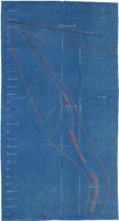
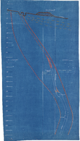
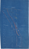
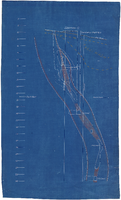
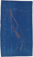
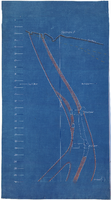
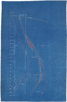
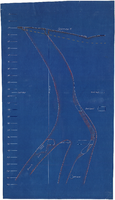
Cross-section maps of Combination and Florence Mines, Goldfield, Nevada, circa 1902-1908
Date
1902 to 1908
Description
Maps of Combination and Florence Mines, Goldfield, Nevada.
Image