Search Results

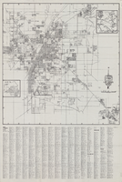
Map of the Livingston Ranches near Overton, Clark County, Nevada, March 27, 1920
Date
1920-03-27
Description
Cadastral map. "Las Vegas Plat Book 1, page 42 --Lower left hand corner. "Survey completed March 27th, 1920, J. T. McWilliams, O. E." "Inset plat showing fractional areas adjacent to section corner sections = 12-13 Tp16S.R.67E, 7-18 Tp16S.R68E." Signed by the surveyor on March 28, 1920, and notarized. Includes an inset plat showing fractional area adjacent to section corner, sections 12-13 Tp. 16 S. R. 76 E., 7-18 Tp. 16 S. R. 6 8 E. Includes table of areas of tracts and table of reference ties to scribe marked objects. Recorded in Book 1, page 42 in the County Recorder of Deed's office. Includes township and range grid. Original publisher: Clark County, State of Nevada : D.H. Livingston, 1920, Scale: 600, blue, 82 x 68 cm.
Image

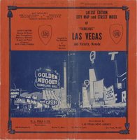
Official Arrow city map, Las Vegas & vicinity, Nevada, circa 1957-1961
Date
1957 to 1961
Description
71 x 68 cm. on sheet 106 x 71 cm., folded in cover 25 x 12 cm. Cover title: Latest edition, city map and street index of "fabulous" Las Vegas and vicinity, Nevada. Publisher from cover. "H-654-32." Includes indexes. Inside of cover includes information on Las Vegas. Includes inset maps of Boulder City, Nevada, and Las Vegas's location. Original publisher: R. L. Polk.
Image

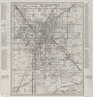
Map of Las Vegas and vicinity, Nevada, circa 1957-1961
Date
1957 to 1961
Description
70 x 68 cm. on sheet 106 x 71 cm. Includes indexes. Includes Nellis Air Force Base, Henderson, and inset maps of Boulder City, Nevada, and Las Vegas's geographical location in the Southwest. "H-654-32" on the lower right-hand corner. Page 2 contains a photograph of the Fremont Street in Downtown Las Vegas, featuring the Golden Nugget Gambling Hall and the Horseshoe Casino. Page 3 outlines local and regional attractions, as well as population information. Original publisher: R. L. Polk.
Image


Street map of greater Las Vegas, 1963
Date
1963
Description
55 x 44 cm. Panel title: Front Boy's official 1963-1964 edition street map : detailed guide of North Las Vegas, Las Vegas, Paradise Valley and vicinity. Relief shown by spot heights. Originally folded to: 29 x 12 cm. "Note, revised and recorded 1st - 1961, 2nd - 1962, 3rd 1963, 4th - 1963."On verso: "MAR 1964" stamped in red ink on upper right hand corner. Includes notes and quotations. Includes indexes. Original publisher: Front.
Image

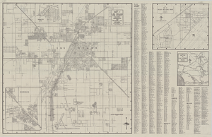
Map of Las Vegas and vicinity, including Henderson and Boulder City, Nevada, 1958
Date
1958
Description
53 x 52 cm. on sheet 56 x 87 cm. Includes inset maps of Boulder City, Henderson, Nellis Air Force Base and Las Vegas area. Map was probably published in 1958 because it shows the Stardust Hotel and Casino, which opened in 1958, but not the Convention Center, which opened in 1959. Includes index. Original publisher: Map Corporation of America.
Image