Search Results
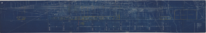
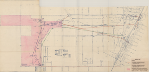
Map showing possible industrial users' connections to railroad pipelines in Las Vegas Nevada, circa 1930-1931
Date
Archival Collection
Description
Map showing industrial users' connections to railroad pipelines in Las Vegas, Nevada.
Image
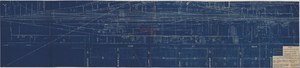
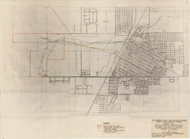
Map showing location of proposed water lines serving Industrial Tract No. 1, Las Vegas Nevada, March 21, 1931
Date
Archival Collection
Description
Image
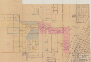
Map to accompany joint letter dated April 20th, 1931 to Mr. Gray concerning construction of proposed water main to serve lessees in Industrial Unit No. 1, Las Vegas, Nevada, April 20, 1931
Date
Archival Collection
Description
Image
Map showing location of proposed water mains to serve Hyde Park Subdivision No. 2 at Las Vegas, Nevada, April 21, 1953
Date
Archival Collection
Description
Image
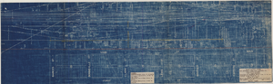
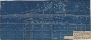
Map showing location of proposed water line to be installed along Los Angeles & Salt Lake Railroad Co. Track No. 8, Las Vegas, Nevada, May 1, 1931
Date
Archival Collection
Description
Label in lower right coner: 'Union Pacific System. Los Angeles & Salt Lake Railroad Co. Form 30, No. 6-4002. Las Vegas, Nevada. Location of proposed water line to be installed along Track No. 8. Scale 1" = 100'. Chief Engineer's Office, L.A. & S.L.R.R. Co., Los Angeles, Caif. May 1, 1931. Dwg. No. 36103.' Handwritten in red pencil on label: 'W.O. 9798.' Accompanies: Work Order Authority for Extensions and Additions to Exisiting Property, Los Angeles & Salt Lake Railroad Co., May 1, 1931. (Box 25 Folder 80-12).
Image
Map of Las Vegas Valley Water District, April 16, 1953
Date
Archival Collection
Description
Image
Map to accompany agreement with Las Vegas Land and Water Company covering furnishing of water by UPRRCo. to LVL&WCo. at Las Vegas, Nevada, October 4, 1950
Date
Archival Collection
Description
Image
Map to accompany Appraisal of water lands of Los Angeles & Salt Lake Railroad Company, Las Vegas, Nevada, August 19, 1952
Date
Archival Collection
Description
Image
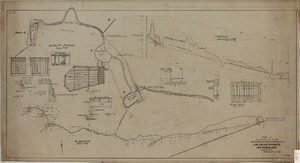
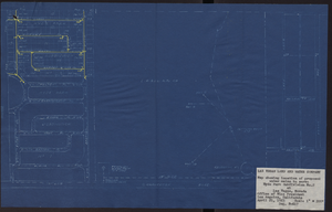
Map showing proposed improvement of Las Vegas Springs, Las Vegas, Nevada, September 21, 1916
Date
Description
'Exhibit A'. 'Approved Sept. 21, 1916.' 'W.E.J.'"--Lower left corner. 'L-44-50 to 61. T-75 - 17 & 46'--Upper left corner. Includes discharge figures and plans for improvements to springs Scale [ca. 1:240]. 1 in. to 20 feet. -- Scale [ca. 1:2,400]. 1 in. to 200 ft. Vertical scale [ca. 1:48]. 1 in. to 4 feet. -- Scale [ca. 1:4,800]. 1 in. to 100 feet. Library's copy has "Proposed layout" written on it in pencil near lower center and other markings in red. Contents: Detail at springs -- Profile -- Alignment.
Image
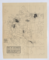
Map of Goldfield, circa 1904-1908
Date
Description
Image