Search Results
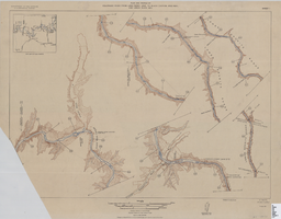

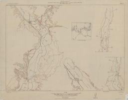
Topographic map showing proposed reservoir for the Las Vegas Rancho, August 4, 1931
Date
1931-08-04
Archival Collection
Description
'Chief Engineers Office, Los Angeles, Calif. August 4, 1931. Scale: 1"=100'. Drawn by L.P.D. 1"=10'.' Accompanies: Letter from R. L. Adamson to F. H. Knickerbocker, August 18, 1931 (Folder 6B: 18-1-9).
Image
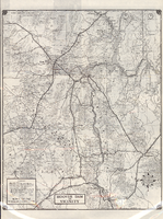
Road map of Hoover Dam and vicinity, circa 1949
Date
1947 to 1951
Description
'Cartography by W. C. Kainsinger, W.T. Taylor. Field mapping by K. R. Reed, G. Boyd. Typography by W. R. Williams.' 'Copyright by Automobile Club of Southern California. C-21351.' 'C-1352'--Panel. Index on verso. In lower right corner: 'Map number 1959.' Scale 1:415,210 (W 116°--W 114°/N 37°--N 35°). Relief shown by hachures and spot heights. Shows mines, ranches and springs. Not the same as the 1948 edition of this map. Cartographers', field mappers', typographers' names are different, and 2 out of 3 numbers on maps are different. Probably after 1947 as Boulder Dam has been changed to Hoover Dam, but before 1950 as Las Vegas Bombing and Gunnery Range has not been changed to Nellis Air Force Base. Automobile Club of Southern California.
Text

City of Las Vegas map, 1952
Date
1952
Description
General information on Las Vegas and index on verso ; Copyright held by Redwood Publishing Co. ; Includes inset map of the Strip (U.S. 91 or Los Angeles Highway) ; Redwood Publishing Company
Text
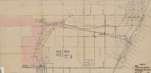
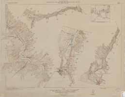
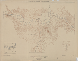
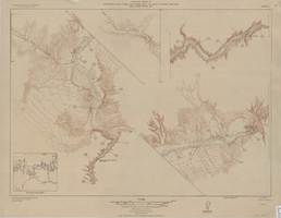
Map showing locations of water bearing lands to be sold to the Las Vegas Valley Water District and boundaries of lands owned by the Union Pacific Railroad not to be sold to the District, April 29,1953
Date
1953-04-29
Description
'Exhibit A. Location of water bearing lands to be sold to the District. Boundary of lands owned by Union Pacific which are not to be sold to the District. April 29, 1953. I-128'
Image