Search Results
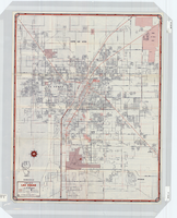
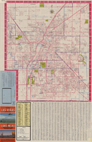
Street map of Las Vegas, 1966
Date
1966
Description
1966 ed. Color; 56 x 43 cm., folded to 23 x 10 cm. Panel title: Street map of Las Vegas and vicinity. On bottom of panel: Humble Oil & Refining Company. Index, photographs of Las Vegas scenes and nearby tourist attractions and map titled Lake Mead National Recreation Area, lower basin section on verso. Original publisher: H. M. Gousha Company.
Image
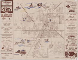
Map of the city of Las Vegas, North Las Vegas, and the "Strip", 1956
Date
1956
Description
40 x 37 cm., folded to 28 x 15 cm. Copyright held by Robert E. Barringer. Panel title: Welcome map, greater Las Vegas area and scenic routes to and from there. Includes inset map of Boulder City. Map of California from San Francisco to Los Angeles to Las Vegas by Beth Bergh on verso. Includes notes. Index on verso. Includes advertisements for Las Vegas and California businesses. Original publisher: Redwood Publishing Co..
Image
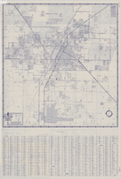
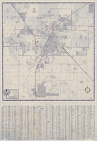
Street map of Las Vegas and vicinity, 1962
Date
1962
Description
43 x 40 cm., folded to 18 x 9 cm. Panel title: Las Vegas and vicinity. "Richfield" below title." Includes index. Text with facts about Las Vegas, photographs of Las Vegas and nearby tourist attractions and maps of Henderson, Boulder City and downtown Las Vegas on verso. Original publisher: Thomas Bros. Maps, Scale: One inch equals approximately 0.68 mile.
Image
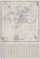
Street map of Las Vegas and vicinity, 1960
Date
1960
Description
43 x 40 cm., folded to 18 x 9 cm. Panel title: Las Vegas and vicinity map. Includes index. Text with facts about Las Vegas, photographs of Las Vegas and nearby tourist attractions and maps of Henderson, Boulder City and downtown Las Vegas on verso. Library's copy 2 has notes handwritten in black ink. Original publisher: Thomas Bros. Maps.
Image
Street map of Las Vegas and vicinity, 1961
Date
1961
Description
43 x 40 cm., folded to 18 x 9 cm. Panel title: Las Vegas and vicinity map. Includes index. Text with facts about Las Vegas, photographs of Las Vegas and nearby tourist attractions and maps of Henderson, Boulder City and downtown Las Vegas on verso. Library's copy 2 has notes handwritten in black ink. Original publisher: Thomas Bros. Maps, Scale: One inch equals approximately 0.68 mile.
Image

Street map of the Las Vegas area, circa 1960
Date
1959 to 1960
Description
53 x 65 cm., folded to 22 x 9 cm. Panel title: Welcome map & established guide to the greater Las Vegas area and scenic routes to and from there. Includes index and advertisements for local businesses. Las Vegas Motel Association map on verso along with advertisements, information on the Las Vegas Convention Center, and sightseeing information. Map was probably distributed by the Las Vegas Chamber of Commerce. Library's copy has freeway, service road, and streets connecting to the freeway marked with different colors of crayon and includes notes. 1960 ed. Map is irregularly shaped. Original publisher: Las Vegas Motel Association.
Image
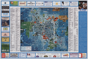
Aerial map of the Las Vegas Valley, with map of Las Vegas, 1992
Date
1992
Description
2 maps on 1 sheet : both sides, col. ; 47 x 51 cm. and 54 x 71 cm. on sheet 61 x 91 cm. Photomap. Includes text about Las Vegas, list of businesses with coordinates for map on verso, and advertisements. On verso: Bird's-eye view map of a section of unincorporated Las Vegas east of the Strip between Charleston and Sunset oriented with north to left and drawn by Jack Tavenner in 1992. Shows locations of schools, lists Boulder City merchants, and includes advertisements. Original Publisher: Landiscor Aerial Photo
Image

City map of Las Vegas, 1973
Date
1905-05-26
Description
Color; 55 x 45 cm., on sheet 95 x 47 cm., folded to 24 x 10 cm. Panel title: Las Vegas city map. Copyright held by Cardinal Publishing Company. Relief shown by hachures. Includes illustrations and advertisements. Index, text, illustrations, advertisements, and map of "Lake Mead National Recreation Area, lower basin section" on verso. Original publisher: Cardinal Publishing Company.
Image
Las Vegas street map and Lake Mead Recreation Area pictorial map, 1979
Date
1979
Description
'Covering Las Vegas, North Las Vegas, Sunrise Manor, Winchester, Paradise and East Las Vegas from Craig Road on the north to Sunset Road on the south and Nellis Boulevard on the east to Jones Boulevard on the west' -- front panel. 'This tourist map has been published by CreaTours, Inc. in co-operation with the North Las Vegas Chamber of Commerce." 3rd ed. Scale [ca. 1:31,680. 1 in. to approx. 0.5 miles]. Includes indexes. Pictorial map of Lake Mead National Recreation Area on verso, by Cliff Segerblom. 'Lithographed by Creel Printing Company, Las Vegas, Nev.' Second edition, copyright 1977. 'Map not to scale due to artistic license.' Advertisements on map verso.
Text
Satellite image map of the Las Vegas Valley, 1981
Date
1981
Description
'1981. Experimental edition 36114-A1-SI-250.' Scale 1:250,000 ; Transverse Mercator proj. (W 116°--W 114°/N 37°--N 36°). Series: Western United States 1:250,000. Western United States 1:250,000 ; NJ 11-12. Filing title: Las Vegas, Nev.; Ariz.; Calif. 'Imagery recorded with Multispectral Scanner (MSS) on NASA Landsat-3.' Includes image coverage diagram. Separate map on verso: Las Vegas / prepared by the U.S. Army Topographic Command ; revised by the U.S. Geological Survey 1969. Ed. 5. Washington, D.C. : Geological Survey, 1976, NJ 11-12 in the series Western United States 1:250,000. United States Geological Survey
Image