Search Results
Single family homes north of East Sahara Avenue and west of Tree Line Drive, looking east, Las Vegas, Nevada: digital photograph
Date
2017-09-28
Archival Collection
Description
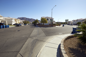
Single family homes line Peach orchard Road as it splits with Allspice Court in a neighborhood north of East Sahara Avenue and west of Tree Line Drive.
Image

Utility boxes and apartments off East Sahara Avenue west of Tree Line Drive, looking south, Las Vegas, Nevada: digital photograph
Date
2017-09-28
Archival Collection
Description
Utility boxes line Orchard Valley Drive in front of the Villas at Sunrise Mountain Apartments off East Sahara Avenue west of Tree Line Drive.
Image
Landscaping along East Sahara Avenue west of Tree Line Drive, looking west, Las Vegas, Nevada: digital photograph
Date
2017-09-28
Archival Collection
Description
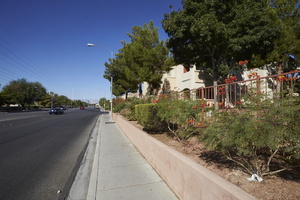
Landscaping next to East Sahara Avenue west of Tree Line Drive in front of the Villas at Sunrise Mountain Apartments.
Image

Power pole turns away from East Sahara Avenue west of Tree Line Drive, looking southwest, Las Vegas, Nevada: digital photograph
Date
2017-09-28
Archival Collection
Description
A major power line makes a ninety-degree turn away from East Sahara Avenue west of Tree Line Drive. Sahara Avenue is a major power transmission line route for most of its 18 mile stretch.
Image
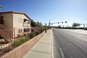
Landscaping and sidewalks along East Sahara Avenue west of Tree Line Drive, looking east, Las Vegas, Nevada: digital photograph
Date
2017-09-28
Archival Collection
Description
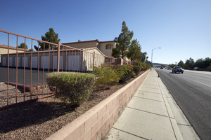
Landscaping and sidewalks along East Sahara Avenue west of Tree Line Drive in front of the Villas at Sunrise Mountain Apartments.
Image
Car on East Sahara Avenue west of Tree Line Drive, looking west, Las Vegas, Nevada: digital photograph
Date
2017-09-28
Archival Collection
Description
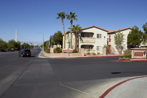
A car turns from an entrance to the Villas at Sunrise Mountain onto East Sahara Avenue west of Tree Line Drive.
Image
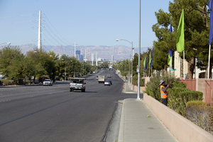
Traffic and worker on East Sahara Avenue west of Tree Line Drive, looking west, Las Vegas, Nevada: digital photograph
Date
2017-09-28
Archival Collection
Description
Traffic flows along East Sahara Avenue west of Tree Line Drive as a worker prunes landscaping for the Villas at Sunrise Mountain Apartment Complex.
Image
Apartments on East Sahara Avenue west of Tree Line Drive, looking east, Las Vegas, Nevada: digital photograph
Date
2017-09-28
Archival Collection
Description
A unit in the Villas at Sunrise Mountain Apartment complex is seen along East Sahara Avenue west of Tree Line Drive.
Image
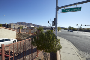
East Sahara Avenue west of Tree Line Drive intersection, looking east, Las Vegas, Nevada: digital photograph
Date
2017-09-28
Archival Collection
Description
The intersection of East Sahara Avenue west of Tree Line Drive is home to Las Vegas High School.
Image
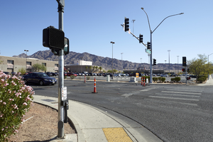
Las Vegas High School from intersection of East Sahara Avenue and Tree Line Drive, looking northeast, Las Vegas, Nevada: digital photograph
Date
2017-09-28
Archival Collection
Description
Las Vegas High School is seen from the intersection of East Sahara Avenue and Tree Line Drive.
Image