Search the Special Collections and Archives Portal
Search Results
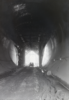
Film transparency of Hoover Dam construction, circa 1931-1933
Date
1931 to 1933
Archival Collection
Description
An image showing a view down a Hoover Dam tunnel during construction; an unidentified man is sitting on a truck on the far end. Note: Boulder Dam was officially renamed Hoover Dam in 1947.
Image
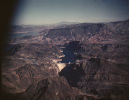
Film transparency of Hoover Dam, circa 1940s-1950s
Date
1940 to 1959
Archival Collection
Description
An image showing an aerial view of Hoover Dam and Lake Mead. Note: Boulder Dam was officially renamed Hoover Dam in 1947.
Image
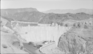
Film transparency of Hoover Dam, circa mid 1930s-1950s
Date
1935 to 1959
Archival Collection
Description
A grayscale image showing the downstream face of Hoover Dam and cars parked at a lookout point. Note: Boulder Dam was officially renamed Hoover Dam in 1947.
Image
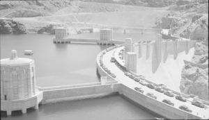
Film transparency of Hoover Dam, circa 1935-1936
Date
1935 to 1936
Archival Collection
Description
An image of the upstream face of Hoover Dam. Note: Boulder Dam was officially renamed Hoover Dam in 1947.
Image
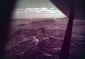
Film transparency of Hoover Dam, circa mid 1950s
Date
1953 to 1956
Archival Collection
Description
An image showing an aerial view of Hoover Dam and Lake Mead. Note: Boulder Dam was officially renamed Hoover Dam in 1947.
Image
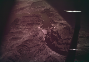
Film transparency of Hoover Dam, circa 1940s-1950s
Date
1940 to 1959
Archival Collection
Description
An image showing an aerial view of the downstream face of Hoover Dam. Note: Boulder Dam was officially renamed Hoover Dam in 1947. The photograph is damaged with long, white cuts on its right side.
Image

Film transparency of Hoover Dam, circa 1940s-1950s
Date
1940 to 1959
Archival Collection
Description
An image showing the upstream face of Hoover Dam; intake towers can be seen in Lake Mead. Note: Boulder Dam was officially renamed Hoover Dam in 1947.
Image
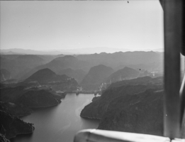
Film transparency of Hoover Dam, circa mid 1930s
Date
1935 to 1936
Archival Collection
Description
An image of the upstream face of Hoover Dam. Note: Boulder Dam was officially renamed Hoover Dam in 1947.
Image
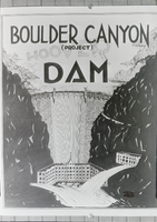
Film transparency of a Boulder Canyon/Hoover Dam project poster, circa 1931-1936
Date
1931 to 1936
Archival Collection
Description
An image of a project poster depicting the Hoover Dam when it was first planned to be built in Boulder Canyon. Later constructed in Black Canyon where less rock faults were found, Hoover Dam was built in the 1930s on the Colorado River between Arizona and Nevada. Note: Boulder Dam was officially renamed Hoover Dam in 1947.
Image
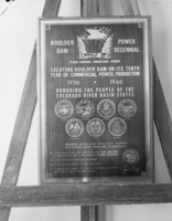
Film transparency of the Boulder Dam Power Decennial plaque, October 25, 1946
Date
1946-10-25
Archival Collection
Description
An image of the Boulder Dam Power Decennial plaque, which was made for the ten year anniversary of Boulder Dam, renamed Hoover Dam in 1947. Depicted on the sign is an outline of the downstream face of the Hoover Dam, along with outlines of the state seals of Arizona, California, Colorado, Nevada, New Mexico, Utah, and Wyoming. Transcribed from text across the sign: "Boulder Dam, Power Decennial. Flood Control - Irrigation - Power. Saluting Boulder Dam On Its Tenth Year Of Commercial Power Production. 1936-1946. Honoring The People Of The Colorado River Basin States. Whose initiative brought forth Boulder Dam, making possible: The maximum utilization of the water resources of this great river system; The prevention of floods; The conservation of water; The availability of hydroelectric energy to a wide area."
Image
Pagination
Refine my results
Content Type
Creator or Contributor
Subject
Archival Collection
Digital Project
Resource Type
Year
Material Type
Place
Language
Records Classification
