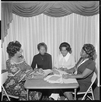
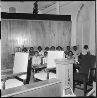
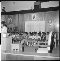
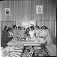
Search the Special Collections and Archives Portal

Search Results

Display    Results Per Page
Displaying results 59761 - 59770 of 830606

Audio recording clip of interview with Joseph Behne by Joan Leavitt, July 22, 2004

Date

2004-07-22

Description

Narrator affiliation: Test Director, Lawrence Livermore National Laboratory

Sound

Interview with Bruce Walter Church, April 27, 2004

Date

2004-04-27

Description

Narrator affiliation: Assistant Manager for Environment, Safety, Security & Health, Department of Energy
Access note: May not quote in any form without written permission from interviewee

Text

Audio recording clip of interview with Bruce Church by Jeffrey Richardson, April 27, 2004

Date

2004-04-27

Description

Narrator affiliation: Assistant Manager for Environment, Safety, Security & Health, Department of Energy

Sound

Interview with Harold David Cunningham, March 11, 2004

Date

2004-03-11

Description

Narrator affiliation: General Manager, Reynolds Electrical and Engineering Company (REECo)

Text

Audio recording clip of interview with Harold Cunningham by Mary Palevsky, March 11, 2004

Date

2004-03-11

Description

Narrator affiliation: General Manager, Reynolds Electrical and Engineering Company (REECo)

Sound

Interview with Ann G. Dye, November 1, 2004

Date

2004-11-01

Description

Narrator affiliation: Program Manager, ReeCO in support of Department of Defense, Los Alamos National Laboratory & Sandia Programs

Text

Audio recording clip of interview with Ann Dye by Shannon Applegate, November 1, 2004

Date

2004-11-01

Description

Narrator affiliation: Program Manager, ReeCO in support of Department of Defense, Los Alamos National Laboratory & Sandia Programs

Sound

Interview with Julia Occhiogrosso, June 17, 2004

Date

2004-06-17

Description

Narrator affiliation: Protester, Loyal Dissenter

Text

Map of Mexico, California and Texas, 1851

Date

1851

Description

'The map drawn and engraved by J. Rapkin.' Scale [ca. 1:14,256,000. 1 in. to approx. 225 miles] (W125°-- W80°/N 42°--N 15°). Relief shown by hachures. Prime meridian: Greenwich. Hand colored. Includes illustrations: Gold washing -- Mexican peasantry --Ruins at Uxmal, Yucatan. Includes decorative border. Library's copy is matted. Originally published as Map 70 of The Illustrated Atlas And Modern History Of The World, Geographical, Political, Commercial & Statistical, edited by R. Montgomery Martin, Esq., London & New York, J. & F. Tallis, 1851. Illustrated atlas and modern history of the world, geographical, political, commercial & statistical

Image

Map of Nevada, circa 1909

Date

1907 to 1911

Description

'Geo. F. Cram, engraver and publisher.' Scale [ca. 1:1,584,000. 1 in. to approx. 25 miles] (W 120°--W 114°/N 42°--N 35°). Relief shown by hachures and spot heights. Counties outlined in color. Shows railroads, forest reserves, mines, Indian reservations, and springs. Shows range and township grid. Indexes on verso to both Nevada and Utah maps. Atlas p. numbers in right margin: 124-125. G.F. Cram.

Text