Search Results
Film transparency of the Beaver Dam area near Carp, Nevada, November, 1954
Date
1954-11
Archival Collection
Description
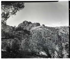
Beaver Dam area east of Carp, Nevada. Carp, Nevada is an unincorporated community in Lincoln County, Nevada, United States located 35 miles (56 km) south of Caliente. It sits on the Meadow Valley Wash, which empties into Lake Mead. Carp was originally a small railroad station for the Union Pacific Railroad. The post office started under the name of "Carpsdale" on June 29, 1918, but was rescinded. It then officially opened under the name of "Cliffdale" June 7, 1921 and changed yet again to "Carp" December 1, 1925. The Carp post office remained open to serve rural ranches until July 1, 1974, when it closed permanently. Little remains of Carp today except a railroad siding usually occupied by idling trains, and the remains of the watering reservoir.
Image
Film transparency of the Beaver Dam area near Carp, Nevada, November, 1954
Date
1954-11
Archival Collection
Description
Beaver Dam area east of Carp, Nevada. Carp, Nevada is an unincorporated community in Lincoln County, Nevada, United States located 35 miles (56 km) south of Caliente. It sits on the Meadow Valley Wash, which empties into Lake Mead. Carp was originally a small railroad station for the Union Pacific Railroad. The post office started under the name of "Carpsdale" on June 29, 1918, but was rescinded. It then officially opened under the name of "Cliffdale" June 7, 1921 and changed yet again to "Carp" December 1, 1925. The Carp post office remained open to serve rural ranches until July 1, 1974, when it closed permanently. Little remains of Carp today except a railroad siding usually occupied by idling trains, and the remains of the watering reservoir.
Image
Film transparency of the Ruby Mountain Range, Elko County, Nevada, October, 1955
Date
1955-10
Archival Collection
Description
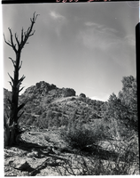
The Ruby Mountain Range in Elko County, Nevada, as seen through a stand of trees.
Image
Film transparency of a western sheep drive in Northern Nevada, circa 1940s-1950s
Date
1940 to 1959
Archival Collection
Description
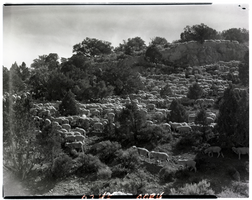
A herd of sheep being driven over a mountain in Northern Nevada.
Image

Film transparency of a duck hunter in a blind, Overton, Nevada, January, 1956
Date
1956-01
Archival Collection
Description
A duck hunter hides in a blind near a row of decoy ducks in the water along the Overton Arm of Lake Mead, Nevada. Overton is an Unincorporated Town located in Clark County, Nevada in Moapa Valley 65 mi (105 km) northeast of Las Vegas, Nevada, on the north end of Lake Mead. The town is home to Perkins Field airport and Echo Bay Airport.
Image
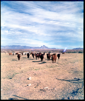
Film transparency of a herd of cattle near Warm Springs, Nevada, December, 1954
Date
1954-12
Archival Collection
Description
A herd of cattle in the desert near Warm Springs, Nevada.
Image
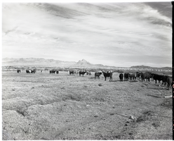
Film transparency of cattle, Warm Springs, 1954
Date
1954
Archival Collection
Description
A herd of cattle in the desert near Warm Springs, Nevada.
Image
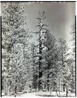
Film transparency of pine trees on Mount Charleston, Nevada, circa 1940s-1950s
Date
1940 to 1959
Archival Collection
Description
Pine trees on Mount Charleston, Nevada at 8,700 feet elevation. Mount Charleston is part of the Spring Mountains.
Image
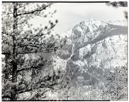
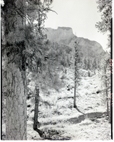
Film transparency of pine trees on Mount Charleston, Nevada, circa 1940s-1950s
Date
1940 to 1959
Archival Collection
Description
Charleston Peak, Mount Charleston, Nevada. Charleston Peak is 11,900 feet in elevation, the valley where the photo was taken is 8,700 feet in elevation. Mount Charleston is part of the Spring Mountains.
Image