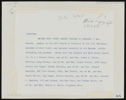
Search Results
"The Million Dollar Gambler from the West" by Al Plantadosi and Murray Bloom, 1913
Level of Description
Archival Collection
Collection Name: UNLV Libraries Collection of Gambling Related Sheet Music
Box/Folder: Oversized Box 02
Archival Component

Film negative of Fremont Street looking west (Las Vegas), circa 1932
Date
Archival Collection
Description
Fremont Street from the roof of the Sal Segav in the early 1930s.
Site Name: Fremont Street
Address: Fremont street, Las Vegas, NV
Image
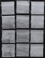
Sahara, Nevada CC facing West, Las Vegas, NV: contact sheet
Date
Archival Collection
Description
Image
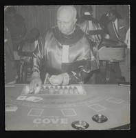
Man dealing blackjack at the Cove Hotel in West Las Vegas: photographic print
Date
Archival Collection
Description
Image
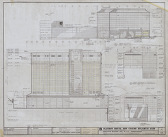
Architectural drawing of the Playboy Hotel and Casino (Atlantic City), north and west elevations, April 5, 1979
Date
Archival Collection
Description
North and west elevations for the construction of the Playboy Hotel and Casino. Includes revision dates. Original material: mylar. Drawn by: R.R.L. and Jerry C. Job Captain: Bobby C.
Site Name: Playboy Hotel and Casino (Atlantic City)
Address: Florida Ave & Boardwalk, Atlantic City, NJ
Image

Architectural drawing of Harrah's Tahoe (Stateline, Nev.), exterior elevations, north and west, December 1, 1971
Date
Archival Collection
Description
North and west elevations for the construction of the Harrah's Lake Tahoe. Includes revision dates and key plan. Drawn by Tony. Original material: mylar. Berton Charles Severson, architect; Brian Walter Webb, architect.
Site Name: Harrah's Tahoe
Address: 15 Highway 50
Image

Sidewalk on Westwind Road south of West Sahara Road, looking south, Las Vegas, Nevada: digital photograph
Date
Archival Collection
Description
Image
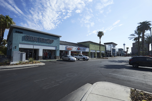
Businesses in strip mall north of West Sahara Avenue looking northeast, Las Vegas, Nevada: digital photograph
Date
Archival Collection
Description
Image