Search Results
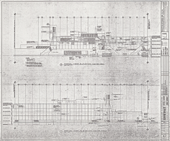
Architectural drawing of the Showboat Hotel and Casino (Atlantic City), east and west center elevations, 1985
Date
Archival Collection
Description
East and west center elevations for the construction of the Showboat Hotel and Casino in Atlantic city. Includes revision dates. Parchment copy.
Site Name: Showboat Hotel and Casino (Atlantic City)
Address: 801 Boardwalk, Atlantic City, NJ
Image
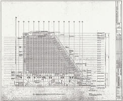
Architectural drawing of the Showboat Hotel and Casino (Atlantic City), partial west tower elevation, 1985
Date
Archival Collection
Description
West tower area elevation for the construction of the Showboat Hotel and Casino in Atlantic city. Includes revision dates. Parchment copy.
Site Name: Showboat Hotel and Casino (Atlantic City)
Address: 801 Boardwalk, Atlantic City, NJ
Image
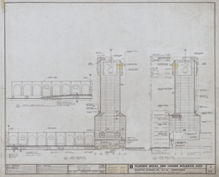
Architectural drawing of the Playboy Hotel and Casino (Atlantic City), east and west elevations, April 5, 1979
Date
Archival Collection
Description
East and west elevations for the construction of the Playboy Hotel and Casino. Includes revision dates. Original material: mylar.
Site Name: Playboy Hotel and Casino (Atlantic City)
Address: Florida Ave & Boardwalk, Atlantic City, NJ
Image

Certificates for members of the Jewish Genealogy Society of Southern Nevada West, 1999
Date
Archival Collection
Description
Two certificates given by the Jewish Genealogy Society of Nevada to members in 1999.
Text
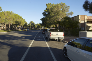
Grand Canyon Drive south of West Sahara Avenue, looking north, Las Vegas, Nevada: digital photograph
Date
Archival Collection
Description
Image
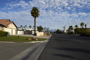
Home on Tenaya Way south of West Sahara Avenue, looking north, Las Vegas, Nevada: digital photograph
Date
Archival Collection
Description
Image
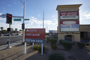
Commercial property on West Sahara Avenue and Buffalo Drive, looking east, Las Vegas, Nevada: digital photograph
Date
Archival Collection
Description
Image
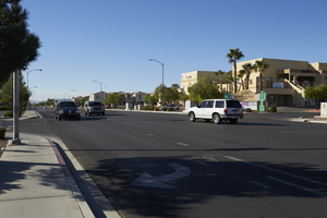
Traffic on Cimarron Road south of West Sahara Avenue, looking southwest, Las Vegas, Nevada: digital photograph
Date
Archival Collection
Description
Image
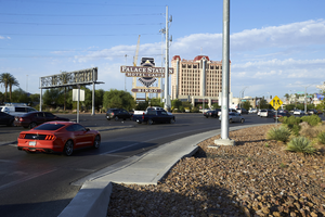
Businesses on East Sahara Avenue near Burnham Avenue looking west, Las Vegas, Nevada: digital photograph
Date
Archival Collection
Description
Image
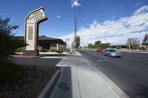
Traffic exiting I-15 to West Sahara Avenue near Rancho Drive, Las Vegas, Nevada: digital photograph
Date
Archival Collection
Description
Image