Search Results
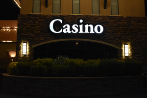
Gold Dust West wall mounted casino sign, Reno, Nevada
Date
2016 (year approximate) to 2020 (year approximate)
Archival Collection
Description
The Gold Dust West's Casino sign with lit neon.
444 Vine St, Reno, NV 89503
Image
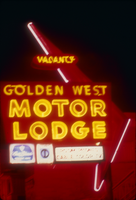
Slide of the neon sign for the Golden West Motor Lodge, Reno, Nevada, 1986
Date
1986
Archival Collection
Description
A color image of the neon sign for the Golden West Motor Lodge, lit up at night. Site Name: Golden West Motor Lodge (Reno, Nev.)
Image
Liquor stores, West Las Vegas, Nevada, 1979
Level of Description
File
Archival Collection
Lloyd Gill Photograph Collection
To request this item in person:
Collection Number: PH-00083
Collection Name: Lloyd Gill Photograph Collection
Box/Folder: N/A
Collection Name: Lloyd Gill Photograph Collection
Box/Folder: N/A
Archival Component
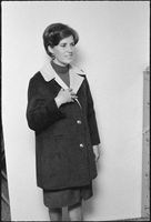
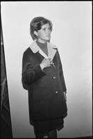
West Las Vegas, Nevada community members, 1979
Level of Description
File
Archival Collection
Lloyd Gill Photograph Collection
To request this item in person:
Collection Number: PH-00083
Collection Name: Lloyd Gill Photograph Collection
Box/Folder: N/A
Collection Name: Lloyd Gill Photograph Collection
Box/Folder: N/A
Archival Component