Search Results
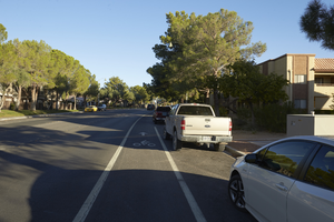
Grand Canyon Drive south of West Sahara Avenue, looking north, Las Vegas, Nevada: digital photograph
Date
Archival Collection
Description
Image
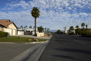
Home on Tenaya Way south of West Sahara Avenue, looking north, Las Vegas, Nevada: digital photograph
Date
Archival Collection
Description
Image
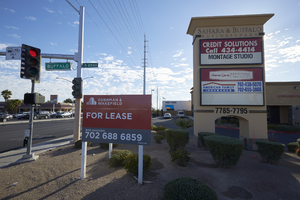
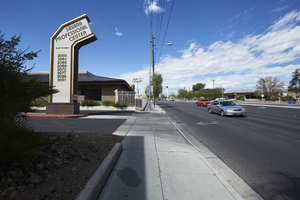
Commercial property on West Sahara Avenue and Buffalo Drive, looking east, Las Vegas, Nevada: digital photograph
Date
Archival Collection
Description
Image
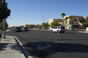
Traffic on Cimarron Road south of West Sahara Avenue, looking southwest, Las Vegas, Nevada: digital photograph
Date
Archival Collection
Description
Image
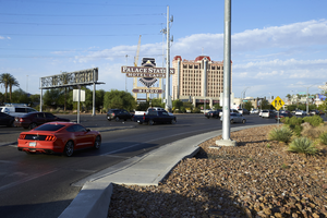
Businesses on East Sahara Avenue near Burnham Avenue looking west, Las Vegas, Nevada: digital photograph
Date
Archival Collection
Description
Image
Traffic exiting I-15 to West Sahara Avenue near Rancho Drive, Las Vegas, Nevada: digital photograph
Date
Archival Collection
Description
Image
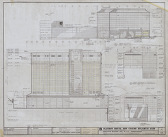
Architectural drawing of the Playboy Hotel and Casino (Atlantic City), north and west elevations, April 5, 1979
Date
Archival Collection
Description
North and west elevations for the construction of the Playboy Hotel and Casino. Includes revision dates. Original material: mylar. Drawn by: R.R.L. and Jerry C. Job Captain: Bobby C.
Site Name: Playboy Hotel and Casino (Atlantic City)
Address: Florida Ave & Boardwalk, Atlantic City, NJ
Image

Architectural drawing of Harrah's Tahoe (Stateline, Nev.), exterior elevations, north and west, December 1, 1971
Date
Archival Collection
Description
North and west elevations for the construction of the Harrah's Lake Tahoe. Includes revision dates and key plan. Drawn by Tony. Original material: mylar. Berton Charles Severson, architect; Brian Walter Webb, architect.
Site Name: Harrah's Tahoe
Address: 15 Highway 50
Image
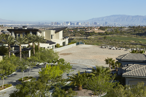
Custom homes surround an undeveloped lot as seen from Sun City Anthem Drive west of Eastern Avenue with Las Vegas skyline in background, looking west in Henderson, Nevada: digital photograph
Date
Archival Collection
Description
From the UNLV University Libraries Photographs of the Development of the Las Vegas Valley, Nevada (PH-00394). Part of the collection documents the entire 19 mile length of the north/south Eastern Avenue / Civic Center Drive alignment. This photograph was captured in the section of Eastern Avenue between Grand Hills and Sun City Anthem Drives.
Image

Aerial photograph of the Sands Hotel looking West (Las Vegas), early 1960s
Date
Archival Collection
Description
Aerial view of the Sands Hotel and adjacent property in the 1960s.
Site Name: Sands Hotel
Address: 3355 Las Vegas Boulevard South
Image