Search Results
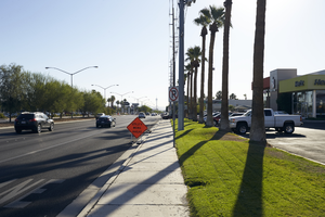
Traffic, sidewalks, and landscaping on West Sahara Avenue, looking east, Las Vegas, Nevada: digital photograph
Date
Archival Collection
Description
Image

Pedestrians walk on sidewalk on East Sahara Avenue looking west, Las Vegas, Nevada: digital photograph
Date
Archival Collection
Description
Image
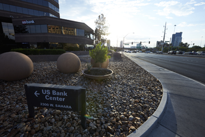
US Bank Center on West Sahara Avenue at Rancho Drive, Las Vegas, Nevada: digital photograph
Date
Archival Collection
Description
Image
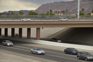
I-215 The Beltway flows beneath West Sahara Avenue overpass, Las Vegas, Nevada: digital photograph
Date
Archival Collection
Description
Image
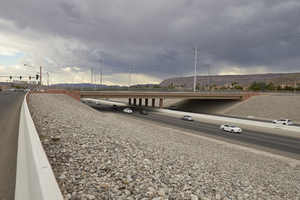
I-215 The Beltway flows beneath West Sahara Avenue overpass, Las Vegas, Nevada: digital photograph
Date
Archival Collection
Description
Image
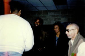
Photograph of Debbie Conway (center) at the First West Las Vegas Job Fair, circa 1996
Date
Archival Collection
Description
Debbie Conway is pictured with Les Brown and Ramon Savoy. The First West Las Vegas Job Fair was held on the grounds of the Vons' Shopping Center now known as the Edmond Center.
Image
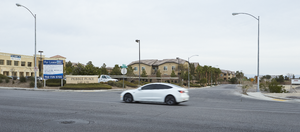
A car travels on Pebble Road passing Jefferys Street west of Eastern Avenue with commercial and multi-family development, looking north-west in Las Vegas, Nevada: digital photograph
Date
Archival Collection
Description
From the UNLV University Libraries Photographs of the Development of the Las Vegas Valley, Nevada (PH-00394). Part of the collection documents the entire 19 mile length of the north/south Eastern Avenue / Civic Center Drive alignment. This photograph was captured in the section of Eastern Avenue between Pebble Road and Silverado Ranch Boulevard.
Image
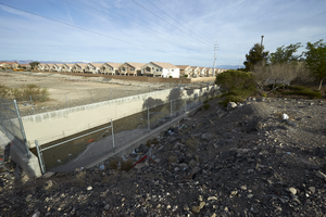
A flood control channel near an undeveloped lot on the north side of St. Rose Parkway west of Eastern Avenue, looking north-west in Las Vegas, Nevada: digital photograph
Date
Archival Collection
Description
From the UNLV University Libraries Photographs of the Development of the Las Vegas Valley, Nevada (PH-00394). Part of the collection documents the entire 19 mile length of the north/south Eastern Avenue / Civic Center Drive alignment. This photograph was captured in the section of Eastern Avenue between Silverado Ranch Boulevard and Coronado Center Drive.
Image
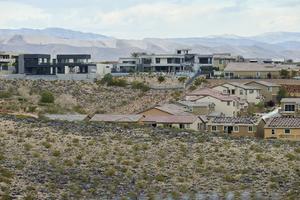
Custom and track homes with undeveloped land off Pecos Ridge Parkway west of Eastern Avenue with custom homes above, looking west-southwest in Henderson, Nevada: digital photograph
Date
Archival Collection
Description
From the UNLV University Libraries Photographs of the Development of the Las Vegas Valley, Nevada (PH-00394). Part of the collection documents the entire 19 mile length of the north/south Eastern Avenue / Civic Center Drive alignment. This photograph was captured in the section of Eastern Avenue between Sunridge Heights Parkway and Grand Hills Drive.
Image
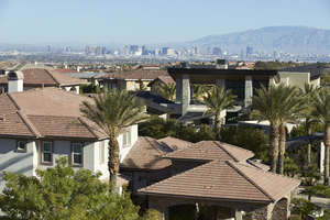
Custom homes with Las Vegas skyline in background as seen from Sun City Anthem Drive west of Eastern Avenue, looking north-west in Henderson, Nevada: digital photograph
Date
Archival Collection
Description
From the UNLV University Libraries Photographs of the Development of the Las Vegas Valley, Nevada (PH-00394). Part of the collection documents the entire 19 mile length of the north/south Eastern Avenue / Civic Center Drive alignment. This photograph was captured in the section of Eastern Avenue between Grand Hills and Sun City Anthem Drives.
Image