Search the Special Collections and Archives Portal
Search Results

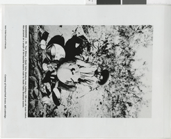
Photograph of Tom Wilson with a water basket, early 1900s
Date
1900 to 1920
Archival Collection
Description
Transcribed from photograph, "Shoshone - 10. Tom Wilson, a Death Valley Shoshone man, holding a 100 year old water basket. Also pictured are a sample of the beautiful baskets made by Death Valley Shoshone women. Inter-Tribal Council of Nevada. Courtesy of National Park Service, Bill Lethbridge."
Image
Las Vegas, Nevada - Water Service, North 60ft Lot "H" - Park Place Addition water service, 1944
Level of Description
File
Archival Collection
Union Pacific Railroad Collection
To request this item in person:
Collection Number: MS-00397
Collection Name: Union Pacific Railroad Collection
Box/Folder: Box 43
Collection Name: Union Pacific Railroad Collection
Box/Folder: Box 43
Archival Component
State of Nevada Division of Water Resources 1996; Las Vegas Valley Water Usage Report by Coache, Robert, P. E., 1996
Level of Description
File
Archival Collection
Clark County Planning Commission Research Library Collection
To request this item in person:
Collection Number: MS-01027
Collection Name: Clark County Planning Commission Research Library Collection
Box/Folder: Box 14
Collection Name: Clark County Planning Commission Research Library Collection
Box/Folder: Box 14
Archival Component

Chart, revised charges to the Las Vegas Land and Water Company, September 22, 1942
Date
1942-09-22
Archival Collection
Description
Chart showing revised charges to the Las Vegas Land and Water Company from the Union Pacific Railroad Company for the years 1939-1941 and the first nine months of 1942 based on projected and actual water consumption in Las Vegas.
Transcribed Notes: Auditor of Disbursements' Office, Omaha, Nebraska - September 22, 1942.
Text

Report, Outline of water supply system at Basic Magnesium, Incorporated, Henderson, Nevada, September 22, 1944
Date
1944-09-22
Archival Collection
Description
Detailed report with drawings and maps of the water system at Basic Magnesium, Incorporated.
Text
Documentation for Las Vegas Region Water Supply - Monthly Planning Model by Water Resources Management, Inc., 1991 January
Level of Description
File
Archival Collection
Clark County Planning Commission Research Library Collection
To request this item in person:
Collection Number: MS-01027
Collection Name: Clark County Planning Commission Research Library Collection
Box/Folder: Box 18
Collection Name: Clark County Planning Commission Research Library Collection
Box/Folder: Box 18
Archival Component

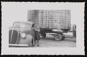
Photograph of Dorothy Casner in front of a water tank, (Nev.), 1930s
Date
1930 to 1939
Archival Collection
Description
Dorothy Casner leans on a truck. There is a water tank on the back of the truck ready for relocation.
Image

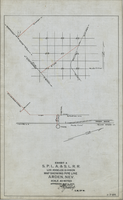
Map showing water pipeline in Arden, Nevada, May 4, 1913
Date
1913-05-04
Archival Collection
Description
'Exhibit A. S.P.L.A. & S.L.R.R. Los Angeles Division.' 'Approved May 4, 1913 [signed] E.M. Jessup, E.M. of W.' 'I-T-54.'
Image
Clean Water Coalition Citizens Advisory Committee
Level of Description
File
Archival Collection
Jeff Van Ee Papers
To request this item in person:
Collection Number: MS-00470
Collection Name: Jeff Van Ee Papers
Box/Folder: N/A
Collection Name: Jeff Van Ee Papers
Box/Folder: N/A
Archival Component
Metcalf, Lynn, "Ground water - surface water interactions in the lower Virgin River area, Arizona and Nevada", 1995 Summer
Level of Description
Item
Archival Collection
University of Nevada, Las Vegas Theses, Dissertations, and Honors Papers
To request this item in person:
Collection Number: UA-00082
Collection Name: University of Nevada, Las Vegas Theses, Dissertations, and Honors Papers
Box/Folder: Box 120
Collection Name: University of Nevada, Las Vegas Theses, Dissertations, and Honors Papers
Box/Folder: Box 120
Archival Component
Pagination
Refine my results
Content Type
Creator or Contributor
Subject
Archival Collection
Digital Project
Resource Type
Year
Material Type
Place
Language
Records Classification
